STATISTICS

Start Year: 1995
Current Year: 2006

Month: January

2 Weeks is 1 Month
Next Month: 09/02/2025

OUR STAFF

Administration Team

Administrators are in-charge of the forums overall, ensuring it remains updated, fresh and constantly growing.

Administrator: Jamie
Administrator: Hollie

Community Support

Moderators support the Administration Team, assisting with a variety of tasks whilst remaining a liason, a link between Roleplayers and the Staff Team.

Moderator: Connor
Moderator: Odinson
Moderator: ManBear


Have a Question?
Open a Support Ticket

AFFILIATIONS

RPG-D

[Australia]: Australian Region Tropical Cyclone Warning Centre

Owen

Commonwealth of Australia
GA Member
Jul 2, 2018
3,151
Overview
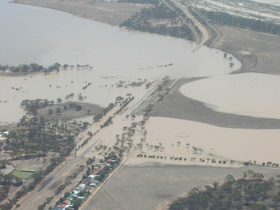
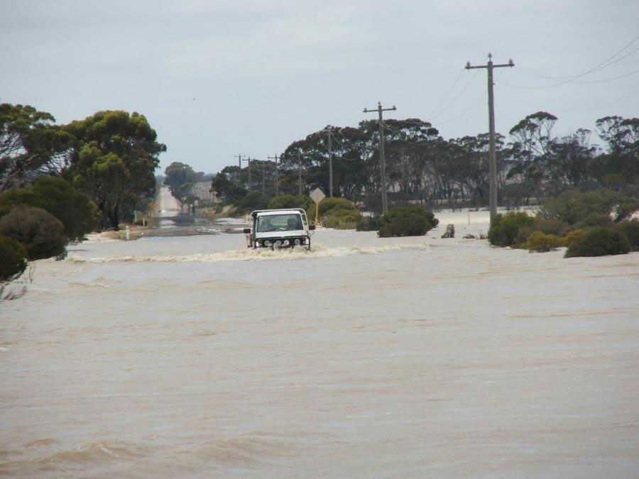
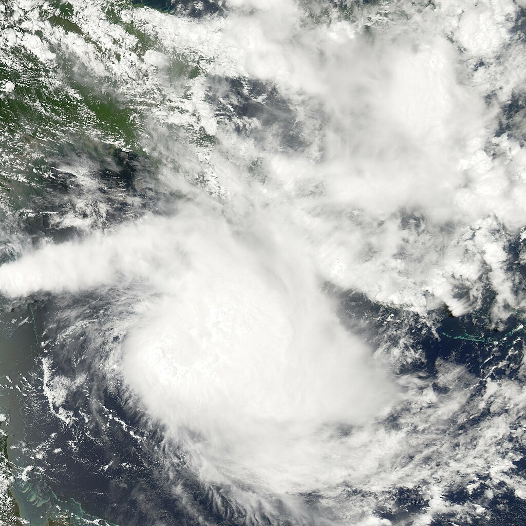
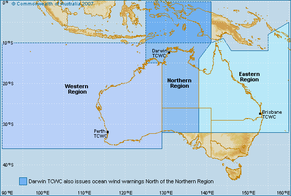
Tropical cyclones are violent, spiralling wind and rain systems that threaten lives and property at sea and on land. They can cause disruption, damage and destruction far beyond the coast, including extensive flooding. These powerful storms are one of our climate influences. Australia's most cyclone-prone area is the north-west coast between Broome and Exmouth. Tropical cyclones cross this coast more often than anywhere else around the continent. Other areas such as north Queensland and the Top End also get a high number of tropical cyclones.

Australia's tropical cyclone season runs from 1 November to 30 April. They can happen at other times in our region but this is rare. To help keep coastal communities safe, we:

  • Keep a 24-hour watch on developing cyclones in our region
  • Provide a tropical cyclones forecast for the 7 days ahead
  • Deliver seasonal outlooks for Australia and the South Pacific
  • Issue watches and warnings when a cyclone is expected to affect Australia's coast or territories
Tropical cyclones in the Australian region are monitored by four Tropical Cyclone Warning Centres (TCWCs) in Perth, Darwin, Brisbane and Port Moresby in Papua New Guinea.

Cyclone warnings will be issued in certain colour-coded messages in accordance to their severity:

  • Tropical Low
  • Category 1
  • Category 2
  • Category 3
  • Category 4
  • Category 5
 

Owen

Commonwealth of Australia
GA Member
Jul 2, 2018
3,151
Severe Tropical Cyclone Bertie
A weak tropical low persisted on 17 November at a low latitude about 740 km (460 mi) west-southwest of the Indonesia island of Sumatra. Early on 18 November, the TCWC Perth issued a gale warning on the system; at the time, the system consisted of cycling convection in association with several small circulations. The circulations organized into a well-defined center of circulation, and at 0000 UTC on 19 November it was classified as Tropical Cyclone Bertie about 835 km (519 mi) northwest of the Cocos Islands. The storm tracked southwestward around the western periphery of a mid-level ridge between Australia and Indonesia. Environmental conditions generally favored further strengthening, with good outflow though moderate wind shear, and late on 19 November the TCWC Perth initiated advisories on Bertie.

Tropical Cyclone Bertie gradually strengthened and became a Severe Tropical Cyclone on 21 November. The next day, TCWC Perth issued its last advisory on the cyclone, as it was expected to cross 90ºE, which separates the TCWC Perth and the Météo-France areas of responsibility. However, Bertie turned due southward and the cyclone remained just east of 90ºE, during which the TCWC Perth estimated Bertie attained peak winds of 185 km/h (115 mph). Early on 23 November, the JTWC assessed the cyclone as reaching winds of 210 km/h (130 mph), which is the equivalent to a marginal Category 4 on the Saffir-Simpson hurricane scale. On 24 November, the cyclone crossed into the area of responsibility of the Météo-France La Réunion (Alexander).


=========================================================================
HIGH SEAS WEATHER WARNING FOR METAREA 10 ISSUED BY THE
AUSTRALIAN BUREAU OF METEOROLOGY TROPICAL CYCLONE WARNING
CENTRE PERTH AT 1828UTC 21 NOVEMBER 2005

HURRICANE WARNING FOR THE WESTERN AREA

Please be aware, wind gusts can be a further 40 percent stronger than the
averages given here, and maximum waves may be up to twice the height.

SITUATION
At 1800UTC Severe Tropical Cyclone Bertie located within 20 nautical miles of
Latitude ten decimal three south [10.3S]
Longitude ninety one decimal seven east [91.7]
Recent movement south southwest at 4 knots.
Maximum winds 75 knots.
Central pressure 960 hPa.

AREA AFFECTED
Within 100 nautical miles of the centre, extending to 120 nautical miles in
western quadrants.

FORECAST
Within 25 nautical miles of the centre, winds to 80 knots decreasing below 64
knots by 22/1800UTC. Very high seas and heavy swell.
Within 40 nautical miles winds above 48 knots with very rough to high seas and
heavy swell.
Within 100 nautical miles of the centre extending to 120 nautical miles in
western quadrants, winds above 34 knots with rough to very rough seas and
moderate to heavy swell.

At 0600UTC 22 November: 11.4 south 91.3 east
965 hPa. Winds to 70 knots near centre.
At 1800UTC 22 November: 12.7 south 90.6 east
975 hPa. Winds to 60 knots near centre.

Next warning issued by 0100 UTC 22 November 2005.

=========================================================================
HIGH SEAS WEATHER WARNING FOR METAREA 10 ISSUED BY THE
AUSTRALIAN BUREAU OF METEOROLOGY TROPICAL CYCLONE WARNING
CENTRE PERTH AT 0041UTC 22 NOVEMBER 2005

HURRICANE WARNING FOR THE WESTERN AREA

Please be aware, wind gusts can be a further 40 percent stronger than the
averages given here, and maximum waves may be up to twice the height.

SITUATION
At 0000UTC Severe Tropical Cyclone Bertie located within 20 nautical miles of
latitude ten decimal nine degrees South [10.9 S]
longitude ninety decimal nine degrees East [90.9 E]
Recent movement southwest at 7 knots.
Maximum winds 70 knots.
Central pressure 965 hPa.

AREA AFFECTED
Within 90 nautical miles of the centre, extending to 120 nautical miles in
western quadrants.

FORECAST
Sustained winds to 70 knots near centre decreasing to below 64 knots by
22/1200UTC.
Within 25 nautical miles of centre winds above 64 knots with very high seas and
heavy swell.
Within 40 nautical miles of centre winds above 48 knots with very rough to high
seas and heavy swell.
Within 90 nautical miles of centre, extending to within 120 nautical miles in
western quadrants, winds above 34 knots with rough to very rough seas and
moderate to heavy swell.

At 1200UTC 22 November: 12.4 south 90.1 east
970 hPa. Winds to 60 knots near centre.
At 0000UTC 23 November: 13.5 south 89.5 east
980 hPa. Winds to 55 knots near centre.

Next warning issued by 0700 UTC 22 November 2005.

=========================================================================
HIGH SEAS WEATHER WARNING FOR METAREA 10 ISSUED BY THE
AUSTRALIAN BUREAU OF METEOROLOGY TROPICAL CYCLONE WARNING
CENTRE PERTH AT 0639UTC 22 NOVEMBER 2005

HURRICANE WARNING FOR THE WESTERN AREA

Please be aware, wind gusts can be a further 40 percent stronger than the
averages given here, and maximum waves may be up to twice the height.

SITUATION
At 0600UTC Severe Tropical Cyclone Bertie located within 20 nautical miles of
latitude eleven decimal eight degrees South [11.8 S]
longitude ninety decimal five degrees East [90.5 E]
Recent movement southwest at 10 knots.
Maximum winds 80 knots.
Central pressure 955 hPa.

AREA AFFECTED
Within 90 nautical miles of the centre.

FORECAST
Sustained winds to 80 knots near centre decreasing to below 64 knots by
23/0600UTC.
Within 25 nautical miles of centre winds above 64 knots with very high seas and
heavy swell.
Within 40 nautical miles of centre winds above 48 knots with very rough to high
seas and heavy swell.
Within 90 nautical miles of centre, winds above 34 knots with rough to very
rough seas and moderate to heavy swell.

At 1800UTC 22 November: 13.0 south 89.5 east
960 hPa. Winds to 75 knots near centre.
At 0600UTC 23 November: 14.2 south 88.8 east
970 hPa. Winds to 60 knots near centre.

Next warning issued by 1300 UTC 22 November 2005.

=========================================================================
HIGH SEAS WEATHER WARNING FOR METAREA 10 ISSUED BY THE
AUSTRALIAN BUREAU OF METEOROLOGY TROPICAL CYCLONE WARNING
CENTRE PERTH AT 1249UTC 22 NOVEMBER 2005

HURRICANE WARNING FOR THE WESTERN AREA

Please be aware, wind gusts can be a further 40 percent stronger than the
averages given here, and maximum waves may be up to twice the height.

SITUATION
At 1200UTC Severe Tropical Cyclone Bertie located within 15 nautical miles of
latitude eleven decimal nine degrees South [11.9 S]
longitude ninety decimal four degrees East [90.4 E]
Recent movement south southwest at 7 knots.
Maximum winds 85 knots.
Central pressure 945 hPa.

AREA AFFECTED
Within 120 nautical miles of the centre.

FORECAST
Sustained winds to 90 knots near centre.
Within 25 nautical miles of centre winds above 64 knots with very high seas and
heavy swell.
Within 40 nautical miles of centre winds above 48 knots with very rough to high
seas and heavy swell.
Within 120 nautical miles of centre, winds above 34 knots with rough to very
rough seas and moderate to heavy swell.

At 0000UTC 23 November: 13.1 south 89.5 east
940 hPa. Winds to 90 knots near centre.
At 1200UTC 23 November: 14.2 south 89.1 east
940 hPa. Winds to 90 knots near centre.

The next warning will be issued by La Reunion Meteorological Service.
 
Last edited:

Owen

Commonwealth of Australia
GA Member
Jul 2, 2018
3,151
Tropical Low 04S
A tropical low persisted on 19 December just west of 90ºE and the Cocos (Keeling) Islands, which is just outside the area of responsibility of TCWC Perth. The system initially consisted of pulsating convection in association with an elongated and partially exposed low-level circulation. TCWC Perth began issuing gale warnings on the system on 22 December as the low tracked southeastward towards the Cocos (Keeling) Islands. Moderate wind shear persisted over the system, preventing immediate development. The low turned southwestward passing south of the British Indian Ocean Territory (Jamie), and on 23 December it entered the area of responsibility of Météo-France in Réunion (Alexander).

date/time lat long hPa kts
2005-12-17 00 9.0 83.7 1006 15
2005-12-17 06 8.5 84.3 1004 20
2005-12-17 12 8.2 85.1 1002 25
2005-12-17 18 8.0 85.9 1002 25
2005-12-18 00 7.9 86.6 1002 25
2005-12-18 06 8.1 86.9 1002 25
2005-12-18 12 8.5 87.1 1002 25
2005-12-18 18 8.9 87.2 1002 25
2005-12-19 00 9.0 87.5 1002 25
2005-12-19 06 8.9 87.8 1002 25
2005-12-19 12 8.7 88.0 1002 25
2005-12-19 18 8.5 88.2 1002 25
2005-12-20 00 8.3 88.6 1002 25
2005-12-20 06 8.1 89.0 1002 25
2005-12-20 12 7.9 89.7 1002 25
2005-12-20 18 8.0 90.5 1002 25
2005-12-21 00 8.2 91.2 1002 25
2005-12-21 06 8.7 91.7 1002 25
2005-12-21 12 8.9 91.8 1002 25
2005-12-21 18 9.1 91.8 1002 25
2005-12-22 00 9.4 91.8 1002 25
2005-12-22 06 9.6 91.6 1002 25
2005-12-22 12 9.8 91.3 1002 25
2005-12-22 18 10.0 90.6 1002 25
2005-12-23 00 10.1 89.8 1002 25
2005-12-23 06 10.4 88.7 1002 25
2005-12-23 12 10.7 87.9 1002 25

2005-12-23 18 11.1 87.1 1000 30
 

Owen

Commonwealth of Australia
GA Member
Jul 2, 2018
3,151
Severe Tropical Cyclone Clare
On 4 January 2006, a weak area of low pressure was situated in the Arafura Sea. It moved westward, and by 6 January, it was located in the Timor Sea. That same day, the Australian Bureau of Meteorology identified the system as a tropical disturbance. On 7 January, the low began to show signs of strengthening. Continuing to organise, the BoM designated it as Tropical Cyclone Clare shortly thereafter. At the time, it was centred approximately 426km to the north of Broome and moving west-southwestward.

By early on 8 January, the storm had begun to steadily gain power. Later that day, Clare achieved severe tropical cyclone status while located around 270km north of Port Hedland. Tracking southwestward, the storm continued to mature. On 9 January, TCWC Perth estimated the storm to have peaked in intensity with maximum sustained 1-minute winds of 140 km/h and a minimum barometric pressure of 964 millibars. This made Clare a Category 3 on the Australian tropical cyclone scale.

Clare maintained roughly the same intensity as its track became more southerly. At 1600 UTC on 9 January the storm made landfall at the Pilbara to the west of Dampier. Heading ashore, the storm began to quickly deteriorate, and the BoM declared it dissipated on 10 January as it continued southward.

In advance of the storm's landfall, officials issued a "red alert" for several locations. Offshore, oil rigs were shut down and ports were closed. At least 2,000 residents were evacuated from their homes in potentially susceptible areas of the Karratha region. In areas between Broome and Port Hedland, people were urged to tidy debris and organise disaster supplies to prepare for the storm.

Upon moving ashore, the storm produced winds of 131km/h at Legendre Island and a gust of 142 km/h at Karratha. Heavy precipitation, often exceeding 200mm, was recorded along the central Pilbara coast. Rainfall at Wickham totalled 215mm, with 212mm at Karratha and more moderate amounts elsewhere. Since storm surge from the cyclone peaked during low tide, it was not severe and caused no known damage.

Clare produced extensive flooding that forced the closure of numerous roads, including part of the North West Coastal Highway. It also triggered torrential rains and flooding in southern areas of Western Australia, including Gascoyne and the South-West Land Division. There, 224mm of rain fell in 24 hours. Additionally, the Greenough River surpassed its banks; a sandbagging effort prevented the resultant floods from inundating the town of Walkaway. The storm cut off power and left tens of thousands of residents without telephone service. Property damage was generally minor, and no casualties or significant injuries from the storm were reported. The name Clare was retired following its usage in this event.

On 13 January 2006, the town of Lake Grace in the south of the state was flooded by ex-Cyclone Clare, receiving 230mm of rainfall. It was declared a disaster zone by the State Government.

Overall, damage was estimated to be at least $5 million, and Clare was responsible for no deaths.


Cyclone Clare impacting Karratha


Cyclone Clare impacting Karratha


Flooding in Lake Grace


Flooding in Lake Grace

=========================================================================
HIGH SEAS WEATHER WARNING FOR METAREA 10 ISSUED BY THE
AUSTRALIAN BUREAU OF METEOROLOGY TROPICAL CYCLONE WARNING
CENTRE PERTH AT 0700UTC 7 JANUARY 2006

GALE WARNING FOR THE WESTERN AREA

Please be aware, wind gusts can be a further 40 percent stronger than the
averages given here, and maximum waves may be up to twice the height.

SITUATION
At 0600UTC tropical low located within 25 nautical miles of
Latitude 13.3 south
Longitude 124.3 east
Recent movement west southwest at 13 knots.
Maximum winds 30 knots.
Central pressure 1002 hPa.

AREA AFFECTED
Within 90 nautical miles of the centre.

FORECAST
Low may develop into a tropical cyclone in the next 18 to 24 hours causing
clockwise winds 30/45 knots, rough to very rough seas and moderate swell.

At 1800UTC 07 January: Within 50 nautical miles of 14.3 south 122.5 east
Central pressure 1000 hPa.
Winds to 30 knots near centre.
At 0600UTC 08 January: Within 75 nautical miles of 15.9 south 120.8 east
Central pressure 995 hPa.
Winds to 35 knots near centre.

Next warning issued by 1300 UTC 07 January 2006.

=========================================================================
HIGH SEAS WEATHER WARNING FOR METAREA 10 ISSUED BY THE
AUSTRALIAN BUREAU OF METEOROLOGY TROPICAL CYCLONE WARNING
CENTRE PERTH AT 1305UTC 7 JANUARY 2006

STORM WARNING FOR THE WESTERN AREA

Please be aware, wind gusts can be a further 40 percent stronger than the
averages given here, and maximum waves may be up to twice the height.

SITUATION
At 1200UTC tropical cyclone CLARE located within 25 nautical miles of
Latitude 14.2 south
Longitude 123.0 east
Recent movement: west southwest at 13 knots.
Maximum winds: 40 knots.
Central pressure: 994 hPa.

AREA AFFECTED
Within 30 nautical miles of the centre extending to within 90 nautical miles of
the centre by 08/0000UTC.

FORECAST
Sustained winds to 40 knots near centre increasing to 50 knots by 08/1200UTC.
Within 45 nautical miles of centre by 08/1200UTC winds 45/50 knots with very
rough to high seas and moderate to heavy swell.
Within 45 nautical miles of centre extending to within 90nm of centre after
08/0000UTC winds above 34 knots with rough to very rough seas and moderate
swell.
At 0000UTC 08 January: 15.3 south 121.1 east
990 hPa. Winds to 45 knots near centre.
At 1200UTC 08 January: 16.6 south 119.9 east
985 hPa. Winds to 50 knots near centre.

Next warning issued by 1800 UTC 07 January 2006.

=========================================================================
HIGH SEAS WEATHER WARNING FOR METAREA 10 ISSUED BY THE
AUSTRALIAN BUREAU OF METEOROLOGY TROPICAL CYCLONE WARNING
CENTRE PERTH AT 1858UTC 7 JANUARY 2006

STORM WARNING FOR THE WESTERN AREA

Please be aware, wind gusts can be a further 40 percent stronger than the
averages given here, and maximum waves may be up to twice the height.

SITUATION
At 1800UTC tropical cyclone CLARE located within 20 nautical miles of
Latitude 14.9 south
Longitude 122.0 east
Recent movement: west southwest at 13 knots.
Maximum winds: 40 knots.
Central pressure: 992 hPa.

AREA AFFECTED
Within 40 nautical miles of the centre extending to within 90 nautical miles of
the centre by 08/0600UTC.

FORECAST
Sustained winds to 40 knots near centre increasing to 55 knots by 08/1200UTC.
Within 40 nautical miles of centre by 08/1200UTC winds 45/55 knots with very
rough to high seas and moderate to heavy swell.
Within 40 nautical miles of centre extending to within 90 nautical miles of
centre after 08/0600UTC winds above 34 knots with rough to very rough seas and
moderate swell.
At 0600UTC 08 January: 16.5 south 120.3 east
985 hPa. Winds to 50 knots near centre.
At 1800UTC 08 January: 17.9 south 118.6 east
980 hPa. Winds to 55 knots near centre.

Next warning issued by 0100 UTC 08 January 2006.

=========================================================================
HIGH SEAS WEATHER WARNING FOR METAREA 10 ISSUED BY THE
AUSTRALIAN BUREAU OF METEOROLOGY TROPICAL CYCLONE WARNING
CENTRE PERTH AT 0054UTC 8 JANUARY 2006

HURRICANE WARNING FOR THE WESTERN AREA

Please be aware, wind gusts can be a further 40 percent stronger than the
averages given here, and maximum waves may be up to twice the height.

SITUATION
At 0000UTC Tropical Cyclone CLARE located within 25 nautical miles of
Latitude 15.7 south
Longitude 120.8 east
Recent movement: west southwest at 14 knots.
Maximum winds: 50 knots.
Central pressure: 985 hPa.

AREA AFFECTED
Within 70 nautical miles of the centre extending to within 90 nautical miles of
the centre by 08/1200UTC.

FORECAST
Within 15 nautical miles of the centre: Sustained winds to 50 knots increasing
to 70 knots by 09/0000UTC, with very rough to high seas and moderate to heavy
swell.
Within 25 nautical miles of centre, extending to within 45 nautical miles by
09/0000UTC: 45/60 knot winds with very rough to high seas and moderate to heavy
swell.
Within 70 nautical miles of centre extending to within 90 nautical miles of
centre by 09/000UTC winds above 34 knots with rough to very rough seas and
moderate to heavy swell.

At 1200UTC 08 January: Within 50 nautical miles of 17.3 south 119.1 east
Central pressure 975 hPa.
Winds to 60 knots near centre.
At 0000UTC 09 January: Within 80 nautical miles of 18.5 south 117.6 east
Central pressure 965 hPa.
Winds to 70 knots near centre.

Next warning issued by 0700 UTC 08 January 2006.

=========================================================================
HIGH SEAS WEATHER WARNING FOR METAREA 10 ISSUED BY THE
AUSTRALIAN BUREAU OF METEOROLOGY TROPICAL CYCLONE WARNING
CENTRE PERTH AT 0629UTC 8 JANUARY 2006

HURRICANE WARNING FOR THE WESTERN AREA

Please be aware, wind gusts can be a further 40 percent stronger than the
averages given here, and maximum waves may be up to twice the height.

SITUATION
At 0600UTC Tropical Cyclone CLARE located within 25 nautical miles of
Latitude 16.5 south
Longitude 120.0 east
Recent movement: southwest at 12 knots.
Maximum winds: 55 knots.
Central pressure: 980 hPa.

AREA AFFECTED
Within 90 nautical miles of the centre.

FORECAST
Within 15 nautical miles of the centre: Sustained winds to 55 knots increasing
to 75 knots by 09/0600UTC, with very rough to high seas and moderate to heavy
swell.
Within 30 nautical miles of centre, extending to within 45 nautical miles by
09/0000UTC: 45/60 knot winds with very rough to high seas and moderate to heavy
swell.
Within 75 nautical miles of centre extending to within 90 nautical miles of
centre by 09/000UTC winds above 34 knots with rough to very rough seas and
moderate to heavy swell.

At 1800UTC 08 January: Within 45 nautical miles of 18.0 south 118.4 east
Central pressure 970 hPa.
Winds to 65 knots near centre.
At 0600UTC 09 January: Within 80 nautical miles of 19.3 south 117.1 east
Central pressure 960 hPa.
Winds to 75 knots near centre.

Next warning issued by 1300 UTC 08 January 2006.

=========================================================================
HIGH SEAS WEATHER WARNING FOR METAREA 10 ISSUED BY THE
AUSTRALIAN BUREAU OF METEOROLOGY TROPICAL CYCLONE WARNING
CENTRE PERTH AT 1232UTC 8 JANUARY 2006

HURRICANE WARNING FOR THE WESTERN AREA

Please be aware, wind gusts can be a further 40 percent stronger than the
averages given here, and maximum waves may be up to twice the height.

SITUATION
At 1200UTC Tropical Cyclone CLARE located within 25 nautical miles of
Latitude 17.2 south
Longitude 119.2 east
Recent movement: southwest at 11 knots.
Maximum winds: 60 knots.
Central pressure: 970 hPa.

AREA AFFECTED
Within 90 nautical miles of the centre.

FORECAST
Within 15 nautical miles of the centre: Sustained winds to 60 knots increasing
to 70 knots by 08/1800UTC and 100 knots by 09/1200UTC, with very high seas
increasing to phenomenal with a heavy swell.
Within 35 nautical miles of centre, extending to within 40 nautical miles by
09/0600UTC: 45/60 knot winds with high to very high seas and moderate to heavy
swell.
Within 80 nautical miles of centre extending to within 90 nautical miles of
centre by 09/0600UTC winds above 34 knots with rough to very rough seas and
moderate to heavy swell.

At 0000UTC 09 January: Within 45 nautical miles of 18.7 south 117.9 east
Central pressure 955 hPa.
Winds to 80 knots near centre.
At 1200UTC 09 January: Within 80 nautical miles of 20.5 south 116.9 east
Central pressure 930 hPa.
Winds to 100 knots near centre.

Next warning issued by 1800 UTC 08 January 2006.

=========================================================================
HIGH SEAS WEATHER WARNING FOR METAREA 10 ISSUED BY THE
AUSTRALIAN BUREAU OF METEOROLOGY TROPICAL CYCLONE WARNING
CENTRE PERTH AT 1901UTC 8 JANUARY 2006

HURRICANE WARNING FOR THE WESTERN AREA

Please be aware, wind gusts can be a further 40 percent stronger than the
averages given here, and maximum waves may be up to twice the height.

SITUATION
At 1800UTC Severe Tropical Cyclone CLARE located within 20 nautical miles of
Latitude 18.2 south
Longitude 118.4 east
Recent movement: southwest at 11 knots.
Maximum winds: 65 knots.
Central pressure: 965 hPa.

AREA AFFECTED
Within 100 nautical miles of the centre.

FORECAST
Within 15 nautical miles of the centre: Sustained winds to 65 knots increasing
to 95 knots by 09/1200UTC, with very high seas increasing to phenomenal with a
heavy swell.
Within 30 nautical miles of centre, extending to within 40 nautical miles by
09/1200UTC: 45/60 knot winds with high to very high seas and moderate to heavy
swell.
Within 100 nautical miles of centre: winds above 34 knots with rough to very
rough seas and moderate to heavy swell.

At 0600UTC 09 January: Within 40 nautical miles of 19.7 south 117.0 east
Central pressure 950 hPa.
Winds to 80 knots near centre.
At 1800UTC 09 January: Within 60 nautical miles of 21.3 south 116.2 east
[over land]
Central pressure 940 hPa.
Winds to 90 knots near centre.

Next warning issued by 0000 UTC 09 January 2006.

=========================================================================
HIGH SEAS WEATHER WARNING FOR METAREA 10 ISSUED BY THE
AUSTRALIAN BUREAU OF METEOROLOGY TROPICAL CYCLONE WARNING
CENTRE PERTH AT 0037UTC 9 JANUARY 2006

HURRICANE WARNING FOR THE WESTERN AREA

Please be aware, wind gusts can be a further 40 percent stronger than the
averages given here, and maximum waves may be up to twice the height.

SITUATION
At 0000UTC Severe Tropical Cyclone CLARE located within 15 nautical miles of
Latitude 18.8 south
Longitude 117.7 east
Recent movement: southwest at 8 knots.
Maximum winds: 75 knots.
Central pressure: 960 hPa.

AREA AFFECTED
Within 100 nautical miles of the centre.

FORECAST
Within 15 nautical miles of the centre: Sustained clockwise winds to 75 knots
increasing to 90 knots within 25 nautical miles by 09/1200UTC, with very high
seas increasing to phenomenal with a heavy swell.
Within 30 nautical miles of centre, extending to within 40 nautical miles by
09/1200UTC: 45/60 knot clockwise winds with high to very high seas and moderate
to heavy swell.
Within 100 nautical miles of centre: clockwise winds above 34 knots with rough
to very rough seas and moderate to heavy swell.

At 1200UTC 09 January: Within 40 nautical miles of 20.7 south 116.3 east
Central pressure 940 hPa.
Winds to 90 knots near centre.
At 0000UTC 10 January: Within 60 nautical miles of 22.0 south 115.6 east
[over land]
Central pressure 970 hPa.
Winds to 60 knots near centre.

Next warning issued by 0700 UTC 09 January 2006.

=========================================================================
HIGH SEAS WEATHER WARNING FOR METAREA 10 ISSUED BY THE
AUSTRALIAN BUREAU OF METEOROLOGY TROPICAL CYCLONE WARNING
CENTRE PERTH AT 0707UTC 9 JANUARY 2006

HURRICANE WARNING FOR THE WESTERN AREA

Please be aware, wind gusts can be a further 40 percent stronger than the
averages given here, and maximum waves may be up to twice the height.

SITUATION
At 0700UTC Severe Tropical Cyclone CLARE located within 15 nautical miles of
Latitude 19.7 south
Longitude 116.9 east
Recent movement: southwest at 9 knots.
Maximum winds: 75 knots.
Central pressure: 960 hPa.

AREA AFFECTED
Within 100 nautical miles of the centre.

FORECAST
Within 20 nautical miles of the centre: Sustained clockwise winds to 75 knots
increasing to 80 knots by 09/1200UTC, with very high seas increasing to
phenomenal with a heavy swell.
Within 40 nautical miles of centre: 45/60 knot clockwise winds with high to very
high seas and moderate to heavy swell.
Within 100 nautical miles of centre: clockwise winds above 34 knots with rough
to very rough seas and moderate to heavy swell.

At 1900UTC 09 January: Within 40 nautical miles of 21.4 south 115.8 east
Central pressure 960 hPa.
Winds to 75 knots near centre.
At 0700UTC 10 January: Within 60 nautical miles of 22.6 south 115.1 east
[over land]
Central pressure 985 hPa.
Winds to 50 knots near centre.

Next warning issued by 1300 UTC 09 January 2006.

=========================================================================
HIGH SEAS WEATHER WARNING FOR METAREA 10 ISSUED BY THE
AUSTRALIAN BUREAU OF METEOROLOGY TROPICAL CYCLONE WARNING
CENTRE PERTH AT 1301UTC 9 JANUARY 2006

HURRICANE WARNING FOR THE WESTERN AREA

Please be aware, wind gusts can be a further 40 percent stronger than the
averages given here, and maximum waves may be up to twice the height.

SITUATION
At 1200UTC Severe Tropical Cyclone CLARE located within 15 nautical miles of
Latitude 20.4 south
Longitude 116.5 east
Recent movement: south southwest at 9 knots.
Maximum winds: 75 knots.
Central pressure: 960 hPa.

AREA AFFECTED
Within 100 nautical miles of the centre.

FORECAST
Within 20 nautical miles of the centre: Sustained clockwise winds to 75 knots
with very high to phenomenal with a heavy swell. Winds easing to below 65 knots
during early Tuesday.
Within 40 nautical miles of centre: 45/60 knot clockwise winds with high to very
high seas and moderate to heavy swell. Winds easing to below 45 knots later on
Tuesday.
Within 100 nautical miles of centre: clockwise winds above 34 knots with rough
to very rough seas and moderate to heavy swell.

At 0000UTC 10 January: Within 40 nautical miles of 22.0 south 115.9 east
Central pressure 980 hPa.
Winds to 50 knots near centre.
At 1200UTC 10 January: Within 60 nautical miles of 23.7 south 115.5 east
[over land]
Central pressure 990 hPa.
Winds to 40 knots near centre.

Next warning issued by 1900 UTC 09 January 2006.

=========================================================================
HIGH SEAS WEATHER WARNING FOR METAREA 10 ISSUED BY THE
AUSTRALIAN BUREAU OF METEOROLOGY TROPICAL CYCLONE WARNING
CENTRE PERTH AT 1838UTC 9 JANUARY 2006

HURRICANE WARNING FOR THE WESTERN AREA

Please be aware, wind gusts can be a further 40 percent stronger than the
averages given here, and maximum waves may be up to twice the height.

SITUATION
At 1800UTC Severe Tropical Cyclone CLARE located over land within 15 nautical
miles of
Latitude 21.0 south
Longitude 116.4 east
Recent movement: south southwest at 5 knots.
Maximum winds: 75 knots.
Central pressure: 960 hPa.

AREA AFFECTED
Within 100 nautical miles of the centre.

FORECAST
Within 20 nautical miles of the centre: Sustained clockwise winds to 75 knots
with very high to phenomenal with a heavy swell. Winds easing to below 60 knots
next 6 hours.
Within 40 nautical miles of centre: 45/60 knot clockwise winds with high to very
high seas and moderate to heavy swell. Winds easing to below 45 knots by
100300UTC.
Within 100 nautical miles of centre: Clockwise winds above 34 knots with rough
to very rough seas and moderate to heavy swell, Winds easing below 34 knots by
101200UTC.

At 0600UTC 10 January: Within 40 nautical miles of 22.1 south 115.8 east
[over land]
Central pressure 980 hPa.
Winds to 50 knots near centre.

Next warning issued by 0100 UTC 10 January 2006.

=========================================================================
HIGH SEAS WEATHER WARNING FOR METAREA 10 ISSUED BY THE
AUSTRALIAN BUREAU OF METEOROLOGY TROPICAL CYCLONE WARNING
CENTRE PERTH AT 0011UTC 10 JANUARY 2006
CANCELLATION OF
HURRICANE WARNING FOR THE WESTERN AREA

Please be aware, wind gusts can be a further 40 percent stronger than the
averages given here, and maximum waves may be up to twice the height.

SITUATION
At 0100UTC Tropical Cyclone CLARE located over land within 15 nautical miles of
Latitude 21.8 south
Longitude 116.1 east
Recent movement: south southwest at 8 knots.
Maximum winds: 55 knots.
Central pressure: 980 hPa.


AREA AFFECTED
Within 100 nautical miles of the centre. Gales are no longer expected over
maritime areas.


FORECAST
Southwest to northwest winds 23/33 knots. Rough seas, moderate swell.
Gales are no longer expected over maritime areas.

At 1200UTC 10 January: Within 40 nautical miles of 23.1 south 115.3 east
[over land]
Central pressure 995 hPa.

No further warnings will be issued for this system.
 

Owen

Commonwealth of Australia
GA Member
Jul 2, 2018
3,151
Tropical Cyclone Daryl
On 17 January, TCWC Perth started issuing tropical cyclone advisories for a tropical low overland. The low tracked into Kuri Bay next day and developed into Tropical Cyclone Daryl. It continued to strengthen, and on 21 January briefly became a Severe Tropical Cyclone operationally but was downgraded to a 55kt Tropical Cyclone following the end of season analysis. Over the next two days, Daryl tracked parallel to the West Australian coast, mostly as a Category 2 system. Daryl continued tracking in a south-westerly direction before being downgraded to a low-pressure system on 23 January. The cyclone did not cross the coast.

=========================================================================
HIGH SEAS WEATHER WARNING FOR METAREA 10 ISSUED BY THE
AUSTRALIAN BUREAU OF METEOROLOGY TROPICAL CYCLONE WARNING
CENTRE PERTH AT 1318UTC 18 JANUARY 2006

STORM WARNING FOR THE WESTERN AREA

Please be aware, wind gusts can be a further 40 percent stronger than the
averages given here, and maximum waves may be up to twice the height.

SITUATION
At 1200UTC Tropical Cyclone Daryl was located within 30 nautical miles of
Latitude 16.2 south
Longitude 123.0 east
Recent movement: west southwest 5 knots.
Maximum winds: 35 knots.
Central pressure: 990 hPa.


AREA AFFECTED
Within 90 nautical miles of the centre.


FORECAST
Within 40 nautical miles of the centre: winds increasing to 50 knots by 1200UTC
19 January with very rough to high seas and moderate to heavy swell.

Within 60 nautical miles of the centre extending to 90 nautical miles by 0000UTC
19 January: Clockwise winds above 34 knots with rough to very rough seas,
moderate swell.

At 0000UTC 19 January: Within 60 nautical miles of 16.5 south 122.1 east
Central pressure 980 hPa.
Winds to 45 knots near centre.
At 1200UTC 19 January: Within 80 nautical miles of 17.1 south 121.0 east
Central pressure 975 hPa.
Winds to 50 knots near centre.

Next warning issued by 1900UTC 18 January 2006.

WEATHER PERTH
=========================================================================
HIGH SEAS WEATHER WARNING FOR METAREA 10 ISSUED BY THE
AUSTRALIAN BUREAU OF METEOROLOGY TROPICAL CYCLONE WARNING
CENTRE PERTH AT 1555UTC 18 JANUARY 2006

STORM WARNING FOR THE WESTERN AREA

Please be aware, wind gusts can be a further 40 percent stronger than the
averages given here, and maximum waves may be up to twice the height.

SITUATION
At 1500UTC Tropical Cyclone Daryl was located within 30 nautical miles of
Latitude 16.1 south
Longitude 122.9 east
Recent movement: west 5 knots.
Maximum winds: 40 knots.
Central pressure: 984 hPa.


AREA AFFECTED
Within 90 nautical miles of the centre.


FORECAST
Within 40 nautical miles of the centre: winds increasing to 50 knots by 0000UTC
19 January with very rough to high seas and moderate to heavy swell.

Within 60 nautical miles of the centre extending to 90 nautical miles by 0000UTC
19 January: Clockwise winds above 34 knots with rough to very rough seas,
moderate swell.

At 0000UTC 19 January: Within 60 nautical miles of 16.5 south 122.1 east
Central pressure 980 hPa.
Winds to 50 knots near centre.
At 1200UTC 19 January: Within 80 nautical miles of 17.1 south 121.0 east
Central pressure 975 hPa.
Winds to 55 knots near centre.

Next warning issued by 1900UTC 18 January 2006.

WEATHER PERTH
=========================================================================
HIGH SEAS WEATHER WARNING FOR METAREA 10 ISSUED BY THE
AUSTRALIAN BUREAU OF METEOROLOGY TROPICAL CYCLONE WARNING
CENTRE PERTH AT 1923UTC 18 JANUARY 2006

STORM WARNING FOR THE WESTERN AREA

Please be aware, wind gusts can be a further 40 percent stronger than the
averages given here, and maximum waves may be up to twice the height.

SITUATION
At 1800UTC Tropical Cyclone Daryl was located within 30 nautical miles of
Latitude 15.8 south
Longitude 122.8 east
Recent movement: west southwest 3 knots.
Maximum winds: 40 knots.
Central pressure: 984 hPa.


AREA AFFECTED
Within 80 nautical miles of the centre.


FORECAST
Within 30 nautical miles of the centre: winds increasing to 50 knots by 0600UTC
19 January with very rough to high seas and moderate to heavy swell.

Within 50 nautical miles of the centre extending to 80 nautical miles in
northern quadrants: Clockwise winds above 34 knots with rough to very rough
seas, moderate swell.

At 0600UTC 19 January: Within 45 nautical miles of 16.4 south 121.9 east
Central pressure 980 hPa.
Winds to 50 knots near centre.
At 1800UTC 19 January: Within 60 nautical miles of 16.9 south 120.7 east
Central pressure 975 hPa.
Winds to 55 knots near centre.

Next warning issued by 0100UTC 19 January 2006.

WEATHER PERTH
=========================================================================
HIGH SEAS WEATHER WARNING FOR METAREA 10 ISSUED BY THE
AUSTRALIAN BUREAU OF METEOROLOGY TROPICAL CYCLONE WARNING
CENTRE PERTH AT 0031UTC 19 JANUARY 2006

HURRICANE WARNING FOR THE WESTERN AREA

Please be aware, wind gusts can be a further 40 percent stronger than the
averages given here, and maximum waves may be up to twice the height.

SITUATION
At 0000UTC Tropical Cyclone Daryl was located within 30 nautical miles of
Latitude 16.1 south
Longitude 122.6 east
Recent movement: southwest 4 knots.
Maximum winds: 50 knots.
Central pressure: 980 hPa.


AREA AFFECTED
Within 60 nautical miles of the centre extending to 120 nautical miles in
northern quadrants.


FORECAST
Within 40 nautical miles of the centre: winds increasing to 60 knots by 1200UTC
19 January and to 70 knots by 0000UTC 20 January with very rough to very high
seas and heavy swell.

Within 60 nautical miles of the centre extending to 120 nautical miles in
northern quadrants: Clockwise winds above 34 knots with rough to very rough
seas, moderate to heavy swell.

At 1200UTC 19 January: Within 45 nautical miles of 17.0 south 121.4 east
Central pressure 970 hPa.
Winds to 60 knots near centre.
At 0000UTC 20 January: Within 90 nautical miles of 17.9 south 120.4 east
Central pressure 960 hPa.
Winds to 70 knots near centre.

Next warning issued by 0700UTC 19 January 2006.

WEATHER PERTH
=========================================================================
HIGH SEAS WEATHER WARNING FOR METAREA 10 ISSUED BY THE
AUSTRALIAN BUREAU OF METEOROLOGY TROPICAL CYCLONE WARNING
CENTRE PERTH AT 0646UTC 19 JANUARY 2006

HURRICANE WARNING FOR THE WESTERN AREA

Please be aware, wind gusts can be a further 40 percent stronger than the
averages given here, and maximum waves may be up to twice the height.

SITUATION
At 0600UTC Tropical Cyclone Daryl was located within 20 nautical miles of
Latitude 16.5 south
Longitude 121.8 east
Recent movement: southwest 6 knots.
Maximum winds: 50 knots.
Central pressure: 976 hPa.


AREA AFFECTED
Within 60 nautical miles of the centre extending to 120 nautical miles in
northern quadrants.


FORECAST
Within 20 nautical miles of the centre: winds increasing to 65 knots by 1800UTC
19 January and to 75 knots by 0600UTC 20 January with very high to phenomenal
seas and heavy swell.
Within 40 nautical miles of the centre: 48/63 knot winds with high to very high
seas and heavy swell.
Within 60 nautical miles of the centre extending to 120 nautical miles in
northern quadrants: Clockwise winds above 34 knots with rough to very rough
seas, moderate to heavy swell.

At 1800UTC 19 January: Within 50 nautical miles of 17.2 south 120.7 east
Central pressure 965 hPa.
Winds to 65 knots near centre.
At 0600UTC 20 January: Within 70 nautical miles of 18.3 south 119.6 east
Central pressure 955 hPa.
Winds to 75 knots near centre.

Next warning issued by 1300UTC 19 January 2006.

WEATHER PERTH
=========================================================================
HIGH SEAS WEATHER WARNING FOR METAREA 10 ISSUED BY THE
AUSTRALIAN BUREAU OF METEOROLOGY TROPICAL CYCLONE WARNING
CENTRE PERTH AT 1253UTC 19 JANUARY 2006

HURRICANE WARNING FOR THE WESTERN AREA

Please be aware, wind gusts can be a further 40 percent stronger than the
averages given here, and maximum waves may be up to twice the height.

SITUATION
At 1200UTC Tropical Cyclone Daryl was located within 20 nautical miles of
Latitude 16.8 south
Longitude 121.9 east
Recent movement: west southwest 7 knots.
Maximum winds: 50 knots.
Central pressure: 976 hPa.


AREA AFFECTED
Within 60 nautical miles of the centre extending to 120 nautical miles in
northern quadrants.


FORECAST
Within 20 nautical miles of the centre: winds increasing to 65 knots by 0600UTC
20 January and to 70 knots by 1200UTC 20 January with very high to phenomenal
seas and heavy swell.
Within 40 nautical miles of the centre: 48/63 knot winds with high to very high
seas and heavy swell.
Within 60 nautical miles of the centre extending to 120 nautical miles in
northern quadrants: Clockwise winds above 34 knots with rough to very rough
seas, moderate to heavy swell.

At 0000UTC 20 January: Within 40 nautical miles of 17.8 south 120.8 east
Central pressure 970 hPa.
Winds to 55 knots near centre.
At 1200UTC 20 January: Within 70 nautical miles of 19.0 south 119.5 east
Central pressure 960 hPa.
Winds to 70 knots near centre.

Next warning issued by 1900UTC 19 January 2006.

WEATHER PERTH
=========================================================================
HIGH SEAS WEATHER WARNING FOR METAREA 10 ISSUED BY THE
AUSTRALIAN BUREAU OF METEOROLOGY TROPICAL CYCLONE WARNING
CENTRE PERTH AT 1900UTC 19 JANUARY 2006

HURRICANE WARNING FOR THE WESTERN AREA

Please be aware, wind gusts can be a further 40 percent stronger than the
averages given here, and maximum waves may be up to twice the height.

SITUATION
At 1800UTC Tropical Cyclone Daryl was located within 20 nautical miles of
Latitude 16.8 south
Longitude 121.5 east
Recent movement: west 4 knots.
Maximum winds: 50 knots.
Central pressure: 975 hPa.


AREA AFFECTED
Within 60 nautical miles of the centre extending to 120 nautical miles in
northern quadrants.


FORECAST
Within 20 nautical miles of the centre: winds increasing to 65 knots by 1800UTC
20 January with very high to phenomenal seas and heavy swell.
Within 40 nautical miles of the centre: 48/63 knot winds with high to very high
seas and heavy swell.
Within 60 nautical miles of the centre extending to 120 nautical miles in
northern quadrants: Clockwise winds above 34 knots with rough to very rough
seas, moderate to heavy swell.

At 0600UTC 20 January: Within 40 nautical miles of 17.7 south 120.7 east
Central pressure 970 hPa.
Winds to 55 knots near centre.
At 1800UTC 20 January: Within 60 nautical miles of 19.1 south 119.1 east
Central pressure 960 hPa.
Winds to 65 knots near centre.

Next warning issued by 0100UTC 20 January 2006.

WEATHER PERTH
=========================================================================
HIGH SEAS WEATHER WARNING FOR METAREA 10 ISSUED BY THE
AUSTRALIAN BUREAU OF METEOROLOGY TROPICAL CYCLONE WARNING
CENTRE PERTH AT 0052UTC 20 JANUARY 2006

HURRICANE WARNING FOR THE WESTERN AREA

Please be aware, wind gusts can be a further 40 percent stronger than the
averages given here, and maximum waves may be up to twice the height.

SITUATION
At 0000UTC Tropical Cyclone Daryl was located within 25 nautical miles of
Latitude 17.4 south
Longitude 120.7 east
Recent movement: southwest 6 knots.
Maximum winds: 60 knots.
Central pressure: 970 hPa.


AREA AFFECTED
Within 60 nautical miles of the centre extending to 120 nautical miles in
northern quadrants.


FORECAST
Within 20 nautical miles of the centre: winds increasing to 70 knots by 0000UTC
21 January with very high to phenomenal seas and heavy swell.
Within 35 nautical miles of the centre: 48/63 knot winds with high to very high
seas and heavy swell.
Within 60 nautical miles of the centre extending to 120 nautical miles in
northern quadrants: Clockwise winds above 33 knots with rough to very rough
seas, moderate to heavy swell.

At 1200UTC 20 January: Within 45 nautical miles of 19.0 south 119.6 east
Central pressure 968 hPa.
Winds to 60 knots near centre.
At 0000UTC 21 January: Within 65 nautical miles of 20.3 south 117.4 east
Central pressure 960 hPa.
Winds to 70 knots near centre.

Next warning issued by 0700UTC 20 January 2006.

WEATHER PERTH
=========================================================================
HIGH SEAS WEATHER WARNING FOR METAREA 10 ISSUED BY THE
AUSTRALIAN BUREAU OF METEOROLOGY TROPICAL CYCLONE WARNING
CENTRE PERTH AT 0655UTC 20 JANUARY 2006

STORM WARNING FOR THE WESTERN AREA

Please be aware, wind gusts can be a further 40 percent stronger than the
averages given here, and maximum waves may be up to twice the height.

SITUATION
At 0600UTC Tropical Cyclone Daryl was located within 30 nautical miles of
Latitude 18.1 south
Longitude 120.5 east
Recent movement: southwest 8 knots.
Maximum winds: 50 knots.
Central pressure: 975 hPa.


AREA AFFECTED
Within 30 nautical miles to the SE of the centre extending to 100 nautical miles
in the northwest quadrants.


FORECAST
Within 20 nautical miles of the centre: 48/58 knot winds with high to very high
seas and heavy swell.
Within 30 nautical miles to the SE of the centre extending to 100 nautical miles
in the northwest quadrants: Clockwise winds above 33 knots with very rough seas,
moderate to heavy swell.

At 1800UTC 20 January: Within 45 nautical miles of 19.2 south 119.0 east
Central pressure 975 hPa.
Winds to 50 knots near centre.
At 0600UTC 21 January: Within 65 nautical miles of 20.6 south 117.6 east
Central pressure 970 hPa.
Winds to 55 knots near centre.

Next warning issued by 1300UTC 20 January 2006.

WEATHER PERTH
=========================================================================
HIGH SEAS WEATHER WARNING FOR METAREA 10 ISSUED BY THE
AUSTRALIAN BUREAU OF METEOROLOGY TROPICAL CYCLONE WARNING
CENTRE PERTH AT 1246UTC 20 JANUARY 2006

STORM WARNING FOR THE WESTERN AREA

Please be aware, wind gusts can be a further 40 percent stronger than the
averages given here, and maximum waves may be up to twice the height.

SITUATION
At 1200UTC Tropical Cyclone Daryl was located within 30 nautical miles of
Latitude 18.5 south
Longitude 119.9 east
Recent movement: southwest 8 knots.
Maximum winds: 50 knots.
Central pressure: 975 hPa.


AREA AFFECTED
Within 55 nautical miles northeast of the centre, extending to within 90
nautical miles in the southwest quadrants.


FORECAST
Within 20 nautical miles of the centre: 45/55 knot clockwise winds with high to
very high seas and heavy swell.
Within 55 nautical miles northeast of the centre extending to 90 nautical miles
in the southwest quadrants: Clockwise winds above 33 knots with very rough seas,
moderate to heavy swell.

At 0000UTC 21 January: Within 60 nautical miles of 19.9 south 118.4 east
Central pressure 970 hPa.
Winds to 55 knots near centre.
At 1200UTC 21 January: Within 90 nautical miles of 20.7 south 117.4 east
Central pressure 970 hPa.
Winds to 55 knots near centre.

Next warning issued by 1900UTC 20 January 2006.

WEATHER PERTH
=========================================================================
HIGH SEAS WEATHER WARNING FOR METAREA 10 ISSUED BY THE
AUSTRALIAN BUREAU OF METEOROLOGY TROPICAL CYCLONE WARNING
CENTRE PERTH AT 1625UTC 20 JANUARY 2006

STORM WARNING FOR THE WESTERN AREA

Please be aware, wind gusts can be a further 40 percent stronger than the
averages given here, and maximum waves may be up to twice the height.

SITUATION
At 1500UTC Tropical Cyclone Daryl was relocated within 30 nautical miles of
Latitude 18.7 south
Longitude 118.3 east
Recent movement: west southwest 12 knots.
Maximum winds: 60 knots.
Central pressure: 970 hPa.


AREA AFFECTED
Within 55 nautical miles northeast of the centre, extending to within 90
nautical miles in the southwest quadrants.


FORECAST
Within 40 nautical miles of the centre: 45/60 knot clockwise winds with high to
very high seas and heavy swell.
Within 55 nautical miles northeast of the centre extending to 90 nautical miles
in the southwest quadrants: Clockwise winds above 33 knots with very rough seas,
moderate to heavy swell.

At 0300UTC 21 January: Within 60 nautical miles of 19.6 south 117.0 east
Central pressure 970 hPa.
Winds to 60 knots near centre.
At 1500UTC 21 January: Within 90 nautical miles of 20.7 south 115.7 east
Central pressure 970 hPa.
Winds to 60 knots near centre.

Next warning issued by 1900UTC 20 January 2006.

WEATHER PERTH
=========================================================================
HIGH SEAS WEATHER WARNING FOR METAREA 10 ISSUED BY THE
AUSTRALIAN BUREAU OF METEOROLOGY TROPICAL CYCLONE WARNING
CENTRE PERTH AT 1905UTC 20 JANUARY 2006

HURRICANE WARNING FOR THE WESTERN AREA

Please be aware, wind gusts can be a further 40 percent stronger than the
averages given here, and maximum waves may be up to twice the height.

SITUATION
At 1800UTC Severe Tropical Cyclone Daryl was located within 15 nautical miles of
Latitude nineteen decimal zero south [19.0S]
Longitude one hundred and seventeen decimal seven east [117.7E]
Recent movement: west southwest 13 knots.
Maximum winds: 65 knots.
Central pressure: 965 hPa.


AREA AFFECTED
Within 90 nautical miles of the centre.


FORECAST
Within 20 nautical miles of the centre: 64/70 knot clockwise winds with very
high to phenomenal seas and heavy swell.
Within 40 nautical miles of the centre: 45/63 knot clockwise winds with high to
very high seas and heavy swell.
Within 90 nautical miles of the centre: Clockwise winds above 34 knots with very
rough seas, moderate to heavy swell.

At 0600UTC 21 January: Within 60 nautical miles of 20.4 south 115.9 east
Central pressure 960 hPa.
Winds to 70 knots near centre.
At 1800UTC 21 January: Within 90 nautical miles of 20.8 south 114.5 east
Central pressure 970 hPa.
Winds to 70 knots near centre.

Next warning issued by 0100UTC 21 January 2006.

WEATHER PERTH
=========================================================================
HIGH SEAS WEATHER WARNING FOR METAREA 10 ISSUED BY THE
AUSTRALIAN BUREAU OF METEOROLOGY TROPICAL CYCLONE WARNING
CENTRE PERTH AT 0043UTC 21 JANUARY 2006

HURRICANE WARNING FOR THE WESTERN AREA

Please be aware, wind gusts can be a further 40 percent stronger than the
averages given here, and maximum waves may be up to twice the height.

SITUATION
At 0000UTC Severe Tropical Cyclone Daryl was located within 15 nautical miles of
Latitude nineteen decimal five south [19.5S]
Longitude one hundred and sixteen decimal six east [116.6E]
Recent movement: west southwest 12 knots.
Maximum winds: 65 knots.
Central pressure: 965 hPa.


AREA AFFECTED
Within 65 nautical miles of the centre in southern quadrants extending to within
95 nautical miles in northern quadrants.


FORECAST
Within 20 nautical miles of the centre: 64/70 knot clockwise winds with very
high to phenomenal seas and heavy swell.
Within 25 nautical miles of the centre in southern quadrants, extending to
within 35 nautical miles of the centre in northern quadrants: 45/63 knot
clockwise winds with high to very high seas and heavy swell.
Within 65 nautical miles of the centre in southern quadrants extending to within
95 nautical miles in northern quadrants: Clockwise winds above 34 knots with
very rough seas, moderate to heavy swell.

At 1200UTC 21 January: Within 50 nautical miles of 20.4 south 115.4 east
Central pressure 965 hPa.
Winds to 65 knots near centre.
At 0000UTC 22 January: Within 90 nautical miles of 20.8 south 114.4 east
Central pressure 965 hPa.
Winds to 65 knots near centre.

Next warning issued by 0700UTC 21 January 2006.

WEATHER PERTH
=========================================================================
HIGH SEAS WEATHER WARNING FOR METAREA 10 ISSUED BY THE
AUSTRALIAN BUREAU OF METEOROLOGY TROPICAL CYCLONE WARNING
CENTRE PERTH AT 0643UTC 21 JANUARY 2006

HURRICANE WARNING FOR THE WESTERN AREA

Please be aware, wind gusts can be a further 40 percent stronger than the
averages given here, and maximum waves may be up to twice the height.

SITUATION
At 0600UTC Tropical Cyclone Daryl was located within 25 nautical miles of
Latitude nineteen decimal five south [19.5S]
Longitude one hundred and sixteen decimal two east [116.2E]
Recent movement: west southwest 6 knots.
Maximum winds: 55 knots.
Central pressure: 975 hPa.


AREA AFFECTED
Within 60 nautical miles of the centre in southern quadrants extending to within
90 nautical miles in northern quadrants.


FORECAST
Within 30 nautical miles of the centre: 45/63 knot clockwise winds with high to
very high seas and heavy swell. Winds reaching 65 knots near the centre by
0600UTC 22 January with very high to phenomenal seas and heavy swell.
Within 60 nautical miles of the centre in southern quadrants extending to within
90 nautical miles in northern quadrants: Clockwise winds above 34 knots with
very rough seas, moderate to heavy swell.

At 1800UTC 21 January: Within 45 nautical miles of 20.0 south 115.0 east
Central pressure 970 hPa.
Winds to 60 knots near centre.
At 0600UTC 22 January: Within 60 nautical miles of 20.6 south 113.9 east
Central pressure 960 hPa.
Winds to 65 knots near centre.

Next warning issued by 1300UTC 21 January 2006.

WEATHER PERTH
=========================================================================
HIGH SEAS WEATHER WARNING FOR METAREA 10 ISSUED BY THE
AUSTRALIAN BUREAU OF METEOROLOGY TROPICAL CYCLONE WARNING
CENTRE PERTH AT 1258UTC 21 JANUARY 2006

STORM WARNING FOR THE WESTERN AREA

Please be aware, wind gusts can be a further 40 percent stronger than the
averages given here, and maximum waves may be up to twice the height.

SITUATION
At 1200UTC Tropical Cyclone Daryl was located within 25 nautical miles of
Latitude nineteen decimal nine south [19.9S]
Longitude one hundred and fifteen decimal nine east [115.9E]
Recent movement: west southwest 6 knots.
Maximum winds: 50 knots.
Central pressure: 978 hPa.


AREA AFFECTED
Within 65 nautical miles of the centre.


FORECAST
Within 20 nautical miles of the centre: 40/50 knot clockwise winds with high to
very high seas and heavy swell.

Within 65 nautical miles of the centre: Clockwise winds above 34 knots with very
rough seas, moderate to heavy swell.

At 0000UTC 22 January: Within 45 nautical miles of 20.5 south 114.9 east
Central pressure 978 hPa.
Winds to 50 knots near centre.
At 1200UTC 22 January: Within 70 nautical miles of 21.4 south 113.9 east
Central pressure 978 hPa.
Winds to 50 knots near centre.

Next warning issued by 1900UTC 21 January 2006.

WEATHER PERTH
=========================================================================
HIGH SEAS WEATHER WARNING FOR METAREA 10 ISSUED BY THE
AUSTRALIAN BUREAU OF METEOROLOGY TROPICAL CYCLONE WARNING
CENTRE PERTH AT 1859UTC 21 JANUARY 2006

STORM WARNING FOR THE WESTERN AREA

Please be aware, wind gusts can be a further 40 percent stronger than the
averages given here, and maximum waves may be up to twice the height.

SITUATION
At 1800UTC Tropical Cyclone Daryl was located within 25 nautical miles of
Latitude twenty decimal one south [20.1S]
Longitude one hundred and fifteen decimal four east [115.4E]
Recent movement: west southwest 5 knots.
Maximum winds: 50 knots.
Central pressure: 980 hPa.


AREA AFFECTED
Within 65 nautical miles of the centre.


FORECAST
Within 20 nautical miles of the centre: 40/50 knot clockwise winds with high to
very high seas and heavy swell easing below 48 knots by 22/0100UTC.

Within 65 nautical miles of the centre: Clockwise winds above 34 knots with very
rough seas, moderate to heavy swell.

At 0600UTC 22 January: Within 40 nautical miles of 20.6 south 114.1 east
Central pressure 985 hPa.
Winds to 45 knots near centre.
At 1800UTC 22 January: Within 55 nautical miles of 21.1 south 113.2 east
Central pressure 988 hPa.
Winds to 35 knots near centre.

Next warning issued by 0100UTC 22 January 2006.

WEATHER PERTH
=========================================================================
HIGH SEAS WEATHER WARNING FOR METAREA 10 ISSUED BY THE
AUSTRALIAN BUREAU OF METEOROLOGY TROPICAL CYCLONE WARNING
CENTRE PERTH AT 0018UTC 22 JANUARY 2006

STORM WARNING FOR THE WESTERN AREA

Please be aware, wind gusts can be a further 40 percent stronger than the
averages given here, and maximum waves may be up to twice the height.

SITUATION
At 0000UTC Tropical Cyclone Daryl was located within 30 nautical miles of
Latitude twenty decimal three south [20.3S]
Longitude one hundred and fourteen decimal seven east [114.7E]
Recent movement: west 7 knots.
Maximum winds: 50 knots.
Central pressure: 984 hPa.


AREA AFFECTED
Within 60 nautical miles of the centre.


FORECAST
Within 20 nautical miles of the centre: 40/50 knot clockwise winds with very
rough to high seas and heavy swell easing below 48 knots by 22/0400UTC.

Within 60 nautical miles of the centre: Clockwise winds above 34 knots with very
rough seas, moderate to heavy swell.

At 1200UTC 22 January: Within 40 nautical miles of 20.4 south 113.3 east
Central pressure 986 hPa.
Winds to 45 knots near centre.
At 0000UTC 23 January: Within 55 nautical miles of 21.2 south 111.8 east
Central pressure 988 hPa.
Winds to 40 knots near centre.

Next warning issued by 0700UTC 22 January 2006.

WEATHER PERTH
=========================================================================
HIGH SEAS WEATHER WARNING FOR METAREA 10 ISSUED BY THE
AUSTRALIAN BUREAU OF METEOROLOGY TROPICAL CYCLONE WARNING
CENTRE PERTH AT 0630UTC 22 JANUARY 2006

GALE WARNING FOR THE WESTERN AREA

Please be aware, wind gusts can be a further 40 percent stronger than the
averages given here, and maximum waves may be up to twice the height.

SITUATION
At 0600UTC Tropical Cyclone Daryl was located within 30 nautical miles of
Latitude twenty decimal four south [20.4S]
Longitude one hundred and fourteen decimal one east [114.1E]
Recent movement: west southwest 7 knots.
Maximum winds: 45 knots.
Central pressure: 986 hPa.


AREA AFFECTED
Within 65 nautical miles of the centre.


FORECAST
Within 65 nautical miles of the centre: Clockwise winds above 34 knots with very
rough seas, moderate to heavy swell.

At 1800UTC 22 January: Within 40 nautical miles of 21.1 south 112.5 east
Central pressure 988 hPa.
Winds to 40 knots near centre.
At 0600UTC 23 January: Within 55 nautical miles of 22.2 south 110.6 east
Central pressure 990 hPa.
Winds to 35 knots near centre.

Next warning issued by 1300UTC 22 January 2006.

WEATHER PERTH
=========================================================================
HIGH SEAS WEATHER WARNING FOR METAREA 10 ISSUED BY THE
AUSTRALIAN BUREAU OF METEOROLOGY TROPICAL CYCLONE WARNING
CENTRE PERTH AT 1254UTC 22 JANUARY 2006

GALE WARNING FOR THE WESTERN AREA

Please be aware, wind gusts can be a further 40 percent stronger than the
averages given here, and maximum waves may be up to twice the height.

SITUATION
At 1200UTC Tropical Cyclone Daryl was located within 30 nautical miles of
Latitude twenty decimal seven south [20.7S]
Longitude one hundred and thirteen decimal two east [113.2E]
Recent movement: west southwest 9 knots.
Maximum winds: 40 knots.
Central pressure: 988 hPa.


AREA AFFECTED
Within 60 nautical miles of the centre.


FORECAST
Within 60 nautical miles of the centre: Clockwise winds 34/40 knots with very
rough seas, moderate to heavy swell. Winds easing below 34 knots by 1200UTC 23
January.

At 0000UTC 23 January: Within 50 nautical miles of 21.7 south 111.2 east
Central pressure 988 hPa.
Winds to 40 knots near centre.
At 1200UTC 23 January: Within 90 nautical miles of 22.7 south 109.4 east
Central pressure 994 hPa.
Winds to 30 knots near centre.

Next warning issued by 1900UTC 22 January 2006.

WEATHER PERTH
=========================================================================
HIGH SEAS WEATHER WARNING FOR METAREA 10 ISSUED BY THE
AUSTRALIAN BUREAU OF METEOROLOGY TROPICAL CYCLONE WARNING
CENTRE PERTH AT 1849UTC 22 JANUARY 2006

GALE WARNING FOR THE WESTERN AREA

Please be aware, wind gusts can be a further 40 percent stronger than the
averages given here, and maximum waves may be up to twice the height.

SITUATION
At 1800UTC Tropical Cyclone Daryl was located within 30 nautical miles of
Latitude twenty decimal nine south [20.9S]
Longitude one hundred and twelve decimal four east [112.4E]
Recent movement: west southwest 9 knots.
Maximum winds: 40 knots.
Central pressure: 988 hPa.


AREA AFFECTED
Within 60 nautical miles of the centre.


FORECAST
Within 60 nautical miles of the centre: Clockwise winds 34/40 knots with very
rough seas, moderate to heavy swell. Winds easing below 34 knots by 1200UTC 23
January.

At 0600UTC 23 January: Within 50 nautical miles of 22.2 south 110.3 east
Central pressure 991 hPa.
Winds to 40 knots near centre.
At 1800UTC 23 January: Within 90 nautical miles of 23.4 south 108.3 east
Central pressure 994 hPa.
Winds to 30 knots near centre.

Next warning issued by 0100UTC 23 January 2006.

WEATHER PERTH
=========================================================================
HIGH SEAS WEATHER WARNING FOR METAREA 10 ISSUED BY THE
AUSTRALIAN BUREAU OF METEOROLOGY TROPICAL CYCLONE WARNING
CENTRE PERTH AT 0052UTC 23 JANUARY 2006

GALE WARNING FOR THE WESTERN AREA

Please be aware, wind gusts can be a further 40 percent stronger than the
averages given here, and maximum waves may be up to twice the height.

SITUATION
At 0000UTC Tropical Cyclone Daryl was located within 30 nautical miles of
Latitude twenty one decimal nine south [21.9S]
Longitude one hundred and eleven decimal seven east [111.7E]
Recent movement: southwest 10 knots.
Maximum winds: 40 knots.
Central pressure: 988 hPa.


AREA AFFECTED
Within 200 nautical miles of the centre in western quadrants.


FORECAST
SE to SW winds 30/40 knots with rough to very rough seas, moderate swell. Winds
easing below 34 knots by 1200UTC 23 January.

At 1200UTC 23 January: Within 50 nautical miles of 23.1 south 109.7 east
Central pressure 994 hPa.
Winds to 30 knots near centre.
At 0000UTC 24 January: Within 90 nautical miles of 24.5 south 108.1 east
Central pressure 998 hPa.
Winds to 25 knots near centre.

Next warning issued by 0700UTC 23 January 2006.

WEATHER PERTH
=========================================================================
HIGH SEAS WEATHER WARNING FOR METAREA 10 ISSUED BY THE
AUSTRALIAN BUREAU OF METEOROLOGY TROPICAL CYCLONE WARNING
CENTRE PERTH AT 0607UTC 23 JANUARY 2006
CANCELLATION OF
GALE WARNING FOR THE WESTERN AREA

Please be aware, wind gusts can be a further 40 percent stronger than the
averages given here, and maximum waves may be up to twice the height.

SITUATION
At 0600UTC Ex-Tropical Cyclone Daryl was located within 15 nautical miles of
Latitude twenty three decimal two south [23.2S]
Longitude one hundred and ten decimal two east [110.2E]
Recent movement: southwest 15 knots.
Maximum winds: 30 knots.
Central pressure: 990 hPa.


AREA AFFECTED
Within 200 nautical miles of the centre in western quadrants.


FORECAST
Winds associated with ex-TC Daryl have eased below 34 knots.

No further warnings will be issued for this system.

=========================================================================
 
Top