

- Jul 2, 2018
- 3,680
Headquarters |
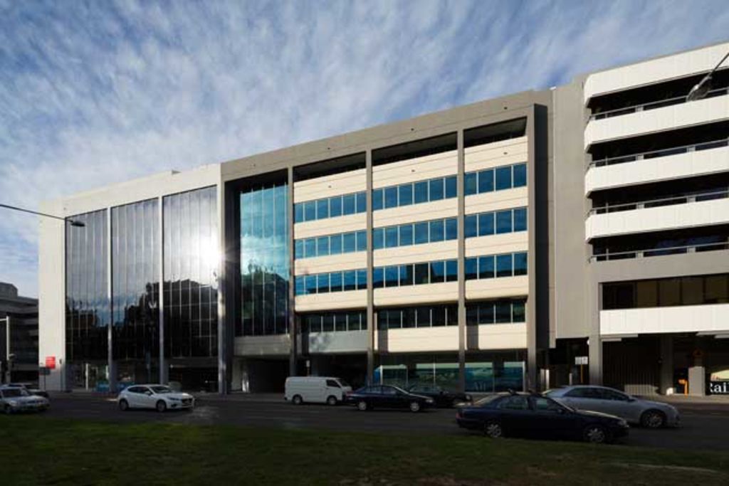 |
62 Northbourne Avenue, Civic, Australian Capital Territory |
Ministers |
| Office: | Officeholder: | Image: |
|---|---|---|
| Minister for Infrastructure and Transport | The Honourable Anthony Albanese, MP | |
| Minister for Shipping and Aviation | The Honourable Kelvin Thomson, MP |  |
| Minister for Population, Cities and Urban Infrastructure | The Honourable Senator Nick Sherry | |
| Assistant Minister for Infrastructure and Transport | The Honourable Catherine King, MP | |
| Secretary of the Department of Infrastructure and Transport | Mike Mrdak, AO |  |
 |
| Project Name: | Project Code: | Transport Mode: | Funding Program: | Start Date: | End Date: | Cost: | Collaborations (incl. division of cost): | Location (LGA and state): | Project Status: | Description: |
|---|---|---|---|---|---|---|---|---|---|---|
| APY Lands Main Access Road Upgrade and Sealing Project | 060001-09SA-RTR | Road | Army Aboriginal Community Assistance Program | January 2009 | December 2009 | $200 million | Australian Army (labour) Government of South Australia (20%) | Aṉangu Pitjantjatjara Yankunytjatjara, South Australia | Ongoing |
| Program: | Description: | Funding Amount: | Open Date: | End Date: | Allocations and Amount: |
|---|---|---|---|---|---|
| Urban Precincts and Partnerships Program | The Urban Precincts and Partnerships Program (uPPP) supports transformative investment in urban Australia based on the principles of unifying urban places, growing economies and serving communities. The uPPP focuses on a partnership approach, bringing together governments, businesses and communities to deliver multi-purpose precincts that are place-based, tailored to the local needs and positioned around a shared vision, need or theme. | ||||
| Thriving Suburbs Program | The Thriving Suburbs Program is delivering funding to local government entities and incorporated not-for-profit organisations for capital works projects that enhance liveability, strengthen social cohesion and support local amenity in urban, suburban and peri-urban communities across Australia's Greater Capital City Statistical Areas. |
| City: | Timeframe: | Investment Amount: | Commitments: | Partnerships: |
|---|---|---|---|---|
| Adelaide | ||||
| Darwin | ||||
| Geelong | ||||
| Hobart | ||||
| Launceston | ||||
| Perth | ||||
| South East Queensland | ||||
| Townsville | ||||
| Western Sydney |
 |  |
Foreign Air Transport Air Operators Certificate |
| In accordance with Section 26(1) of the Civil Aviation Act (1988), an aircraft arriving in Australian territory from a place outside Australian territory or; departing from Australian territory for a place outside Australian territory must not do so except with the permission of CASA. A Foreign air transport air operators certificate (FATAOC) may authorise the operation of a foreign registered aircraft on flights into, out of or within Australian territory that are not regulated domestic flights. (Civil Aviation Act, 1988, 27AE (4.a)). |
Current Certificates |
| Airline: | Country of Registration: | Fleet: | Airports flying to: | Dangerous Goods Approval: | Contact: |
|---|---|---|---|---|---|
Australian-managed Airspace |
 |
| Type: | Amount: | Image: |
|---|---|---|
| Regular Personnel | 800 | 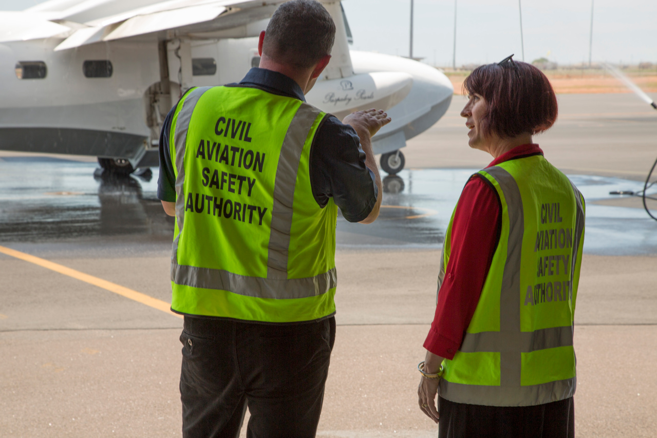 |
| Air Traffic Controllers | 4,000 | 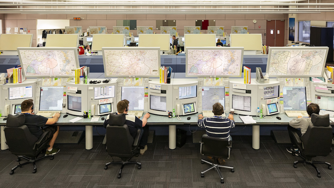 |
| Aviation Firefighters | 530 | 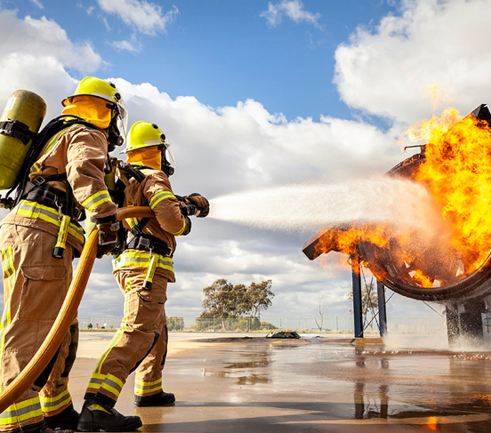 |
| Type: | Amount: | Image: |
|---|---|---|
| Rosenbauer Panther | 74 |  |
| Rescue Boat | 13 | 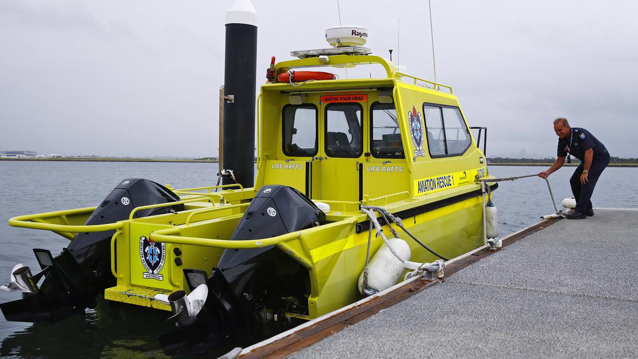 |
| Fokker F28 Fellowship | 2 |  |
| Section: | Size: | Base: |
|---|---|---|
| Airworthiness and Engineering Section | 75x Regular Personnel | Aviation House, Canberra |
| Air Navigation, Airspace and Aerodromes Section | 75x Regular Personnel, 2x Fokker F28 Fellowships | Essendon Airport |
| Flight Standards Section | 75x Regular Personnel | Aviation House, Canberra |
| Regulation Implementation Section | 75x Regular Personnel | Aviation House, Canberra |
| Region: | Jurisdiction | Size: | Base: |
|---|---|---|---|
| Western Region |
| 100x Regular Personnel | Perth |
| Southern Region |
| 100x Regular Personnel | Melbourne |
| Sydney Region |
| 100x Regular Personnel | Sydney |
| Eastern Region |
| 100x Regular Personnel | Canberra |
| Northern Region |
| 100x Regular Personnel | Brisbane |
 |
| Airport Fire Station: | Size: |
|---|---|
| Sydney-Kingsford Smith International Airport Station 1 (Domestic Terminal) | 20x Aviation Firefighters, 3x Rosenbauer Panthers, 1x Rescue Boat |
| Sydney-Kingsford Smith International Airport Station 2 (International Terminal) | 20x Aviation Firefighters, 3x Rosenbauer Panthers, 1x Rescue Boat |
| Melbourne-Tullamarine International Airport Station | 30x Aviation Firefighters, 4x Rosenbauer Panthers |
| Canberra International Airport Station | 20x Aviation Firefighters, 3x Rosenbauer Panthers |
| Hobart International Airport Station | 20x Aviation Firefighters, 3x Rosenbauer Panthers, 1x Rescue Boat |
| Melbourne-Avalon Airport Station | 20x Aviation Firefighters, 3x Rosenbauer Panthers |
| Launceston Airport Station | 15x Aviation Firefighters, 2x Rosenbauer Panthers |
| Coffs Harbour Airport Station | 15x Aviation Firefighters, 2x Rosenbauer Panthers |
| Ballina-Byron Gateway Airport Station | 15x Aviation Firefighters, 2x Rosenbauer Panthers |
| Norfolk Island International Airport Station | 15x Aviation Firefighters, 2x Rosenbauer Panthers |
| Airport Fire Station: | Size: |
|---|---|
| Perth International Airport Station | 30x Aviation Firefighters, 4x Rosenbauer Panthers |
| Adelaide International Airport Station | 20x Aviation Firefighters, 3x Rosenbauer Panthers, 1x Rescue Boat |
| Darwin International Airport Station | 20x Aviation Firefighters, 3x Rosenbauer Panthers |
| Broome International Airport Station | 15x Aviation Firefighters, 2x Rosenbauer Panthers, 1x Rescue Boat |
| Port Hedland International Airport Station | 15x Aviation Firefighters, 2x Rosenbauer Panthers |
| Alice Springs Airport Station | 15x Aviation Firefighters, 2x Rosenbauer Panthers |
| Ayers Rock-Connellan Airport Station | 15x Aviation Firefighters, 2x Rosenbauer Panthers |
| Karratha Airport Station | 15x Aviation Firefighters, 2x Rosenbauer Panthers |
| Newman Airport Station | 15x Aviation Firefighters, 2x Rosenbauer Panthers |
| Airport Fire Station: | Size: |
|---|---|
| Brisbane International Airport Station | 30x Aviation Firefighters, 4x Rosenbauer Panthers, 1x Rescue Boat |
| Cairns International Airport Station | 20x Aviation Firefighters, 3x Rosenbauer Panthers |
| Townsville International Airport Station | 20x Aviation Firefighters, 3x Rosenbauer Panthers, 1x Rescue Boat |
| Gold Coast-Coolangatta International Airport Station | 20x Aviation Firefighters, 3x Rosenbauer Panthers, 2x Rescue Boats |
| Sunshine Coast-Maroochydore Airport Station | 15x Aviation Firefighters, 2x Rosenbauer Panthers, 1x Rescue Boat |
| Hamilton Island-Great Barrier Reef Airport Station | 15x Aviation Firefighters, 2x Rosenbauer Panthers, 2x Rescue Boats |
| Mackay Airport Station | 15x Aviation Firefighters, 2x Rosenbauer Panthers, 1x Rescue Boat |
| Rockhampton Airport Station | 15x Aviation Firefighters, 2x Rosenbauer Panthers |
| Proserpine-Whitsunday Coast Airport Station | 15x Aviation Firefighters, 2x Rosenbauer Panthers |
| Gladstone Airport Station | 15x Aviation Firefighters, 2x Rosenbauer Panthers |
| Centre: | Jurisdiction: | Size: |
|---|---|---|
| Brisbane Centre |
| 400x Air Traffic Controllers |
| Melbourne Centre |
| 400x Air Traffic Controllers |
NOTE: |
Class E Airspace that is managed from airports that use RAAF Air Traffic Control and are apart of the Australian Defence Air Traffic System:
|
| Terminal Control Unit: | Jurisdiction: | Size: |
|---|---|---|
| Sydney Terminal Control Unit |
| 300x Air Traffic Controllers |
| Melbourne Terminal Control Unit |
| 300x Air Traffic Controllers |
| Brisbane Terminal Control Unit |
| 250x Air Traffic Controllers |
| Perth Terminal Control Unit |
| 200x Air Traffic Controllers |
| Adelaide Terminal Control Unit |
| 150x Air Traffic Controllers |
| Canberra Terminal Control Unit |
| 100x Air Traffic Controllers |
| Cairns Terminal Control Unit |
| 100x Air Traffic Controllers |
NOTE: |
Joint User Civilian Airports that use RAAF Air Traffic Control and are a part of the Australian Defence Air Traffic System:
|
| Tower: | Jurisdiction: | Size: |
|---|---|---|
| Sydney Tower | Sydney-Kingsford Smith International Airport | 250x Air Traffic Controllers |
| Melbourne Tower | Melbourne-Tullamarine International Airport | 250x Air Traffic Controllers |
| Brisbane Tower | Brisbane International Airport | 150x Air Traffic Controllers |
| Perth Tower | Perth International Airport | 100x Air Traffic Controllers |
| Adelaide Tower | Adelaide International Airport | 100x Air Traffic Controllers |
| Canberra Tower | Canberra International Airport | 100x Air Traffic Controllers |
| Cairns Tower | Cairns International Airport | 100x Air Traffic Controllers |
| Hobart Tower | Hobart International Airport | 100x Air Traffic Controllers |
| Gold Coast Tower | Gold Coast-Coolangatta International Airport | 100x Air Traffic Controllers |
| Bankstown Tower | Sydney-Bankstown Airport | 50x Air Traffic Controllers |
| Moorabbin Tower | Melbourne-Moorabbin Airport | 50x Air Traffic Controllers |
| Archerfield Tower | Brisbane-Archerfield Airport | 50x Air Traffic Controllers |
| Jandakot Tower | Perth-Jandakot Airport | 50x Air Traffic Controllers |
| Parafield Tower | Adelaide-Parafield Airport | 50x Air Traffic Controllers |
| Avalon Tower | Melbourne-Avalon Airport | 50x Air Traffic Controllers |
| Sunshine Coast Tower | Sunshine Coast-Maroochydore Airport | 50x Air Traffic Controllers |
| Alice Springs Tower | Alice Springs Airport | 50x Air Traffic Controllers |
| Port Hedland Tower | Port Hedland International Airport | 50x Air Traffic Controllers |
| Broome Tower | Broome International Airport | 50x Air Traffic Controllers |
| Camden Tower | Sydney-Camden Airport | 50x Air Traffic Controllers |
| Essendon Tower | Melbourne-Essendon Airport | 50x Air Traffic Controllers |
| Launceston Tower | Launceston Airport | 30x Air Traffic Controllers |
| Coffs Harbour Tower | Coffs Harbour Airport | 30x Air Traffic Controllers |
| Mackay Tower | Mackay Airport | 20x Air Traffic Controllers |
| Hamilton Island Tower | Hamilton Island-Great Barrier Reef Airport | 20x Air Traffic Controllers |
| Rockhampton Tower | Rockhampton Airport | 10x Air Traffic Controllers |
| Tamworth Tower | Tamworth Regional Airport | 10x Air Traffic Controllers |
| Wagga Wagga Tower | Wagga Wagga Airport | 10x Air Traffic Controllers |
| Albury Tower | Albury-Wodonga Airport | 10x Air Traffic Controllers |
| Karratha Tower | Karratha Airport | 10x Air Traffic Controllers |
Overview |
| The Australian Advanced Air Traffic System (TAAATS), is the hardware and software system used by the Civil Aviation Safety Authority for air traffic control services. It is a paperless, computer-based system, which serves as an aid to civilian air traffic controllers. It does not control aircraft, but gives the user a display of information about an aircraft's position and associated information. It also handles communications and other information exchanges. The Australian Advanced Air Traffic System, or TAAATS is one of two systems in Australia, the other being the Australian Defence Air Traffic System (ADATS), which is used by the military. TAAATS makes use of the Thales Eurocat system and is used in two Flight Information Regions (FIRs), Melbourne and Brisbane (traffic above 25,000 feet). It is also used in Terminal Control Units (TCUs) in Adelaide, Melbourne, Brisbane, Perth, Canberra, Cairns and Sydney (traffic below 25,000 feet). TAAATS incorporates ADS-B from more than 70 stations located at various sites across the country. The system introduced new features to air traffic control in Australia including conflict alerting and conformance monitoring. |
Consoles |
There are several facilities which use TAAATS in Australia. The two main area control centres in Brisbane and Melbourne both have roughly 42 operational consoles or "suites" and each suite has four computer screens:
|
 |  |
 |  |  |
Upper Murray River Flag | Combined Murray River Flag | Lower Murray River Flag |
Levies and Fees |
| Levy/Fee: | Rate: | Who pays: | When to pay: |
|---|---|---|---|
| Marine Navigation Levy | 1 - 5,000 Net Tonnage: 23.5 cents per net ton 5,001 - 20,000 Net Tonnage: $1,175 + 12 cents per ton over 20,001 - 50,000 Net Tonnage: $2,975 + 7 cents per ton over Over 50,000 Net Tonnage: $5,075 + 2.5 cents per ton over | Commercial shipping (except Fishing vessels or docking for replenishment), where the vessel is longer than 24 metres. | Upon arrival at an Australian port. |
| Regulatory Functions Levy | 1 - 5,000 Net Tonnage: 17 cents per net ton 5,001 - 20,000 Net Tonnage: $850 + 17 cents per ton over 20,001 - 50,000 Net Tonnage: $3,400 + 17 cents per ton over Over 50,000 Net Tonnage: $8,500 + 15.5 cents per ton over | Commercial shipping (except Fishing vessels or docking for replenishment), where the vessel is longer than 24 metres. | Upon arrival at an Australian port. |
| Protection of the Sea Levy | 0 - 89 Net Tonnage: $10 flat rate Over 90 Net Tonnage: $10 + 11.25 cents per ton over | If you are required to pay both Marine Navigation and Regulatory Functions levy or if you're a Fishing vessel that has more than 10 tonnes of oil onboard at anytime. | Upon arrival at an Australian port. |
| Shipping Registration Fees | Application for registration: $2,664 Application for registration (demise charter): $3,996 Application for transfer of ownership: $777 Application for transfer of ownership (demise charter): $1,332 Application for change of home port or name: $111 Application to fly Australian national flag or red ensign: $222 | Any vessel wishing to operate inside Australian waters or wishing to use Australian flags on their vessel. | Upon lodging application. |
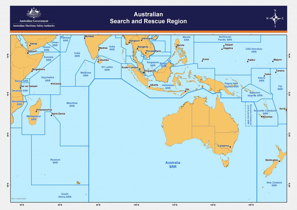
Australian Search and Rescue Region |
 |
| Type: | Amount: | Image: |
|---|---|---|
| Regular Personnel | 500 | 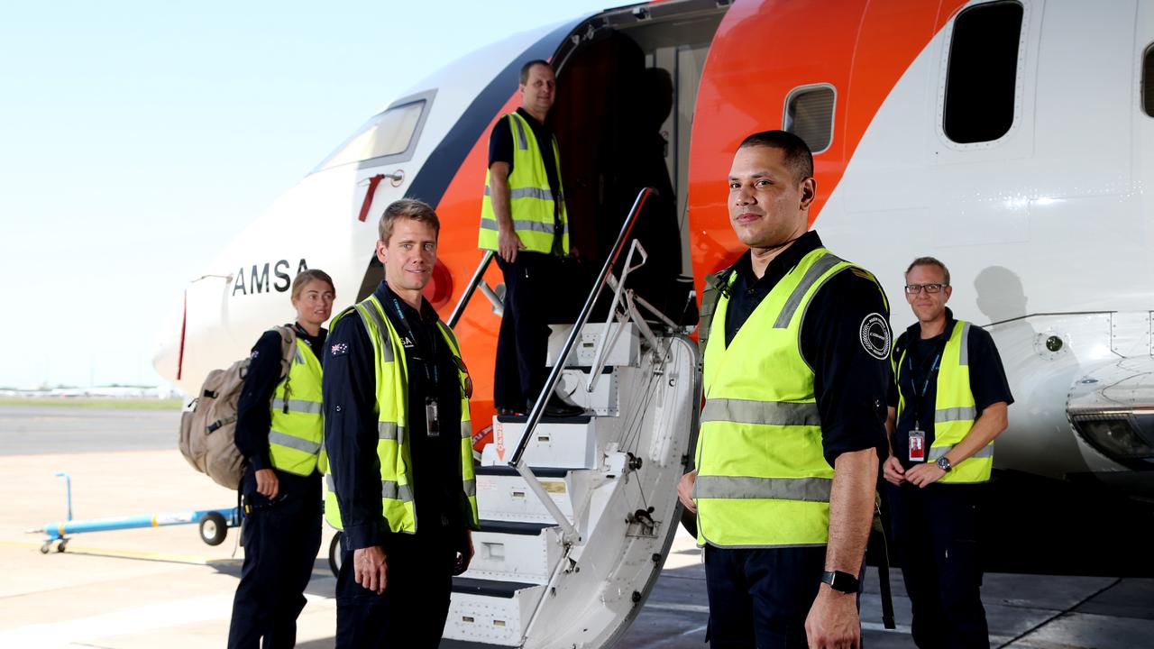 |
| Type: | Amount: | Names: | Image: |
|---|---|---|---|
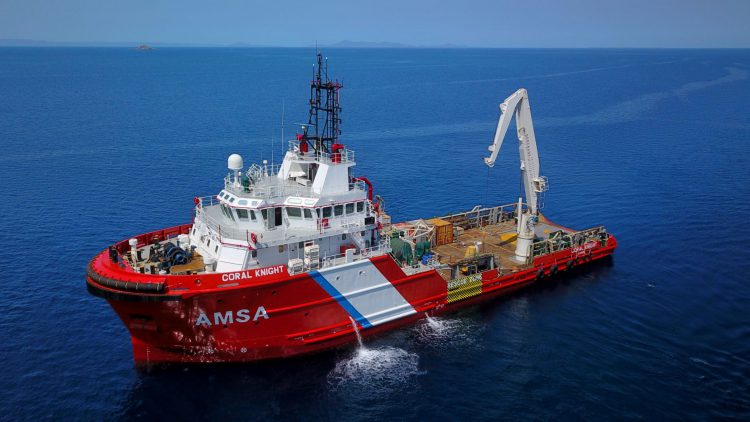
| Coral-class Emergency Towage Vessel | 1 |
|  |
| Reef-class Emergency Towage Vessel | 1 |
| |
| Lumen-class Lighthouse Tender | 1 |
|  |
| Carpentaria-class Lightship | 2 |
|  |
| Type: | Amount: | Image: |
|---|---|---|
| Bombardier Challenger CL-604 | 4 |  |
| Dornier 328 | 5 |  |
| Sikorsky S-76 | 6 |  |
| Unit: | Size: | Base: |
|---|---|---|
| New South Wales Port Operations Section | 40x Regular Personnel | Sydney |
| Victoria Port Operations Section | 30x Regular Personnel | Melbourne |
| South Queensland Port Operations Section | 30x Regular Personnel | Brisbane |
| Western Australia Port Operations Section | 30x Regular Personnel | Perth |
| North Queensland Port Operations Section | 20x Regular Personnel | Cairns |
| South Australia Port Operations Section | 20x Regular Personnel | Adelaide |
| Tasmania Port Operations Section | 10x Regular Personnel | Hobart |
| Northern Territory Port Operations Section | 10x Regular Personnel | Darwin |
| Torres Strait Marine Safety Program | 10x Regular Personnel | Thursday Island |
| Unit: | Size: | Base: |
|---|---|---|
| Crisis Preparedness and Response Centre | 40x Regular Personnel MV Coral Knight MV Reef Keeper | Cairns |
| Australian Marine Oil Spill Centre | 20x Regular Personnel | Geelong |
| Unit: | Size: | Base: |
|---|---|---|
| Joint Rescue Coordination Centre Australia | 60x Regular Personnel | Canberra |
| Cairns Airport Section | 20x Regular Personnel, 1x Bombardier Challenger CL-604s, 2x Dornier 328, 2x Sikorsky S-76s | Cairns |
| Essendon Airport Section | 20x Regular Personnel, 2x Bombardier Challenger CL-604, 1x Dornier 328s, 2x Sikorsky S-76s | Melbourne |
| Perth Airport Section | 20x Regular Personnel, 1x Bombardier Challenger CL-604, 2x Dornier 328s, 2x Sikorsky S-76s | Perth |
 |
| Unit: | Size: | Base: |
|---|---|---|
| Far North Queensland Navigational Aids Support Section | 20x Regular Personnel MV Lumen CLS2 Carpentaria CLS4 Carpentaria | Cairns |
| Lighthouse: | Size: | Location: |
|---|---|---|
| Fingal Head Light | Automatic | Fingal Head, New South Wales |
| Cape Byron Light | 2x Regular Personnel | Byron Bay, New South Wales |
| Richmond River Light | Automatic | Ballina, New South Wales |
| Clarence River Light | Automatic | Yamba, New South Wales |
| North Solitary Island Light | Automatic | North Solitary Island, New South Wales |
| South Solitary Island Light | Automatic | South Solitary Island, New South Wales |
| Smoky Cape Light | 2x Regular Personnel | Arakoon, New South Wales |
| Tacking Point Light | Automatic | Port Macquarie, New South Wales |
| Crowdy Head Light | Automatic | Crowdy Head, New South Wales |
| Sugarloaf Point Light | 2x Regular Personnel | Seal Rocks, New South Wales |
| Nelson Head Light | 2x Regular Personnel | Nelson Bay, New South Wales |
| Point Stephens Light | 2x Regular Personnel | Fingal Bay, New South Wales |
| Nobbys Head Light | Automatic | Newcastle, New South Wales |
| Norah Head Light | 2x Regular Personnel | Norah Head, New South Wales |
| Barrenjoey Head Light | Automatic | Sydney, New South Wales |
| Port Jackson Entrance Range Rear Light | Automatic | Sydney, New South Wales |
| Port Jackson Entrance Range Front Light | Automatic | Sydney, New South Wales |
| South Head Lower Light | Automatic | Sydney, New South Wales |
| Western Channel Pile Light | Automatic | Sydney, New South Wales |
| Eastern Channel Pile Light | Automatic | Sydney, New South Wales |
| Robertson Point Light | Automatic | Sydney, New South Wales |
| Vaucluse Bay Range Front Light | Automatic | Sydney, New South Wales |
| Bradleys Head Light | Automatic | Sydney, New South Wales |
| South Head Upper Light | Automatic | Sydney, New South Wales |
| Fort Denison Light | Automatic | Sydney, New South Wales |
| Shark Island Light | Automatic | Sydney, New South Wales |
| Vaucluse Bay Range Rear Light | Automatic | Sydney, New South Wales |
| Cape Bailey Light | Automatic | Sydney, New South Wales |
| Wollongong Breakwater Light | 2x Regular Personnel | Wollongong, New South Wales |
| Wollongong Head Light | Automatic | Wollongong, New South Wales |
| Kiama Light | Automatic | Kiama, New South Wales |
| Crookhaven Heads Light | Automatic | Culburra Beach, New South Wales |
| Point Perpendicular Light | 2x Regular Personnel | Beecroft Peninsula, New South Wales |
| Warden Head Light | Automatic | Ulladulla, New South Wales |
| Burrewarra Point Light | Automatic | Guerilla Bay, New South Wales |
| Montague Island Light | 2x Regular Personnel | Barunguba, New South Wales |
| Green Cape Light | 2x Regular Personnel | Green Cape, New South Wales |
| Mount Pitt Lightbeacon | Automatic | Norfolk Island National Park, Norfolk Island |
| Lighthouse: | Size: | Location: |
|---|---|---|
| Gabo Island Lighthouse | 2x Regular Personnel | Gabo Island, Victoria |
| Point Hicks Lighthouse | Automatic | Tamboon, Victoria |
| Cliffy Island Lighthouse | Automatic | Cliffy Island, Victoria |
| Wilsons Promontory Lighthouse | Automatic | Wilsons Promontory National Park, Victoria |
| Citadel Island Lighthouse | 2x Regular Personnel | Citadel Island, Victoria |
| Cape Liptrap Lighthouse | Automatic | Tarwin Lower, Victoria |
| Port Melbourne Rear Light | Automatic | Melbourne, Victoria |
| Port Melbourne Front Light | Automatic | Melbourne, Victoria |
| Eastern Lighthouse | Automatic | Melbourne, Victoria |
| Timeball Lighthouse | Automatic | Melbourne, Victoria |
| South Channel Pile Light | 2x Regular Personnel | Melbourne, Victoria |
| West Channel Pile Light | Automatic | Melbourne, Victoria |
| Cape Schanck Lighthouse | Automatic | Cape Schanck, Victoria |
| Queenscliff High Light | Automatic | Queenscliff, Victoria |
| Queenscliff Low Light | Automatic | Queenscliff, Victoria |
| Point Lonsdale Lighthouse | 2x Regular Personnel | Point Lonsdale, Victoria |
| Split Point Lighthouse | Automatic | Aireys Inlet, Victoria |
| Cape Otway Lighthouse | 2x Regular Personnel | Cape Otway, Victoria |
| Lady Bay Upper Lighthouse | Automatic | Warrnambool, Victoria |
| Lady Bay Lower Lighthouse | Automatic | Warrnambool, Victoria |
| Port Fairy Lighthouse | 2x Regular Personnel | Port Fairy, Victoria |
| Portland Lighthouse | Automatic | Portland, Victoria |
| Cape Nelson Lighthouse | 2x Regular Personnel | Portland West, Victoria |
| Lighthouse: | Size: | Location: |
|---|---|---|
| Goods Island Light | 2x Regular Personnel | Torres Strait Islands, Queensland |
| Booby Island Light | 2x Regular Personnel | Torres Strait Islands, Queensland |
| Eborac Island Light | Automatic | Torres Strait Islands, Queensland |
| Wyborn Reef Light | Automatic | Great Barrier Reef, Queensland |
| Grassy Hill Light | Automatic | Cooktown, Queensland |
| Archer Point Light | Automatic | Cooktown, Queensland |
| Low Island Light | 2x Regular Personnel | Great Barrier Reef, Queensland |
| Fitzroy Island Light | Automatic | Fitzroy Island, Queensland |
| Bay Rock Light | Automatic | Townsville, Queensland |
| Cape Cleveland Light | 2x Regular Personnel | Cape Cleveland, Queensland |
| Cape Bowling Green Light | Automatic | Alva, Queensland |
| Dent Island Light | 2x Regular Personnel | Whitsunday Islands, Queensland |
| Creal Reef Light | Automatic | Great Barrier Reef, Queensland |
| Flat Top Island Light | Automatic | Mackay, Queensland |
| Pine Islet Light | 2x Regular Personnel | The Percy Group, Queensland |
| North Reef Light | Automatic | Great Barrier Reef, Queensland |
| Cape Capricorn Light | Automatic | Curtis Island, Queensland |
| Sea Hill Light | Automatic | Curtis Island, Queensland |
| Bustard Head Light | 2x Regular Personnel | Eurimbula, Queensland |
| Lady Elliot Island Light | 2x Regular Personnel | Great Barrier Reef, Queensland |
| Sandy Cape Light | 2x Regular Personnel | Fraser Island, Queensland |
| New Burnett Heads Light | Automatic | Burnett Heads, Queensland |
| North Bluff Light | Automatic | Big Woody Island, Queensland |
| Middle Bluff Light | Automatic | Big Woody Island, Queensland |
| Double Island Point Light | 2x Regular Personnel | Cooloola, Queensland |
| Point Cartwright Light | Automatic | Sunshine Coast, Queensland |
| New Caloundra Light | Automatic | Sunshine Coast, Queensland |
| Cape Moreton Light | 2x Regular Personnel | Moreton Island, Queensland |
| Cowan Cowan Point Light | Automatic | Moreton Island, Queensland |
| Point Lookout Light | Automatic | North Stradbroke Island, Queensland |
| Bulwer Island Light | Automatic | Brisbane, Queensland |
| New Cleveland Point Light | Automatic | Brisbane, Queensland |
| Captain Cook Memorial Light | Automatic | Coolangatta, Queensland |
| Bougainville Reef Lighthouse | Automatic | Bougainville Reef, Coral Sea Islands |
| Willis Island Lighthouse | Automatic | Willis Island, Coral Sea Islands |
| Lihou Reef Lighthouse | Automatic | Lihou Reef and Cays, Coral Sea Islands |
| East Diamond Island Lighthouse | Automatic | East Diamond Islet, Coral Sea Islands |
| Frederick Reefs Lighthouse | Automatic | Frederick Reefs, Coral Sea Islands |
| Saumarez Reefs Lighthouse | Automatic | Saumarez Reefs, Coral Sea Islands |
| Lighthouse: | Size: | Location: |
|---|---|---|
| Adele Island Lighthouse | Automatic | Adele Island, Western Australia |
| Caffarelli Island Lighthouse | Automatic | Caffarelli Island, Western Australia |
| Cape Leveque Lighthouse | 2x Regular Personnel | Dampier Peninsula, Western Australia |
| East Island Lighthouse | Automatic | Lacepede Islands, Western Australia |
| Gantheaume Point Lighthouse | Automatic | Broome, Western Australia |
| Cape Bossut Lighthouse | Automatic | Lagrange, Western Australia |
| Jarman Island Lighthouse | Automatic | Cossack, Western Australia |
| Legendre Island Lighthouse | 2x Regular Personnel | Dampier Archipelago, Western Australia |
| Bessieres Island Lighthouse | Automatic | Bessieres Island, Western Australia |
| Vlamingh Head Lighthouse | Automatic | North West Cape, Western Australia |
| Quobba Point Lighthouse | Automatic | Macleod, Western Australia |
| Babbage Island Lighthouse | Automatic | Carnarvon, Western Australia |
| Cape Inscription Lighthouse | Automatic | Dirk Hartog Island, Western Australia |
| Moore Point Lighthouse | 2x Regular Personnel | Geraldton, Western Australia |
| Pelsart Island Lighthouse | Automatic | Houtman Abrolhos, Western Australia |
| Escape Island Lighthouse | Automatic | Jurien Bay, Western Australia |
| Guilderton Lighthouse | 2x Regular Personnel | Guilderton, Western Australia |
| Hillarys Lighthouse | Automatic | Perth, Western Australia |
| Buckland Hill Lighthouse | Automatic | Perth, Western Australia |
| North Mole Lighthouse | 2x Regular Personnel | Perth, Western Australia |
| South Mole Lighthouse | 2x Regular Personnel | Perth, Western Australia |
| Woodman Lighthouse | Automatic | Perth, Western Australia |
| Bathurst Lighthouse | 2x Regular Personnel | Rottnest Island, Western Australia |
| Wadjemup Lighthouse | 2x Regular Personnel | Rottnest Island, Western Australia |
| Casuarina Point Lighthouse | Automatic | Bunbury, Western Australia |
| Cape Naturaliste Lighthouse | Automatic | Naturaliste, Western Australia |
| Cape Leeuwin Lighthouse | 2x Regular Personnel | Leeuwin, Western Australia |
| Breaksea Island Lighthouse | Automatic | Breaksea Island, Western Australia |
| Eclipse Island Lighthouse | Automatic | Eclipse Island, Western Australia |
| Cave Point Lighthouse | Automatic | Hopetoun, Western Australia |
| Smith Point Lighthouse | Automatic | Flying Fish Cove, Christmas Island |
| Direction Island Lighthouse | Automatic | Home Island, Cocos (Keeling) Islands |
| Lighthouse: | Size: | Location: |
|---|---|---|
| South Neptune Island Lighthouse | Automatic | Neptune Islands, South Australia |
| Cape Donington Lighthouse | Automatic | Lincoln National Park, South Australia |
| Point Lowly Lighthouse | Automatic | Point Lowly, South Australia |
| Tiparra Reef Lighthouse | 2x Regular Personnel | Moonta, South Australia |
| Corny Point Lighthouse | Automatic | Corny Point, South Australia |
| West Cape Lighthouse | Automatic | Inneston, South Australia |
| Cape Spencer Lighthouse | Automatic | Inneston, South Australia |
| Althorpe Island Lighthouse | 2x Regular Personnel | Althorpe Island, South Australia |
| Troubridge Hill Lighthouse | Automatic | Honiton, South Australia |
| Troubridge Island Lighthouse | 2x Regular Personnel | Troubridge Island, South Australia |
| Port Adelaide Lighthouse | Automatic | Adelaide, South Australia |
| Marino Rocks Lighthouse | Automatic | Adelaide, South Australia |
| Cape Jervis Lighthouse | Automatic | Cape Jervis, South Australia |
| Cape Borda Lighthouse | 2x Regular Personnel | Cape Borda, South Australia |
| Cape du Couedic Lighthouse | Automatic | Flinders Chase, South Australia |
| Cape Willoughby Lighthouse | Automatic | Willoughby, South Australia |
| Cape St Albans Lighthouse | Automatic | Willoughby, South Australia |
| Point Malcolm Lighthouse | Automatic | Poltalloch, South Australia |
| Cape Jaffa Lighthouse | 2x Regular Personnel | Cape Jaffa, South Australia |
| Robe Lighthouse | Automatic | Robe, South Australia |
| Cape Martin Lighthouse | 2x Regular Personnel | Beachport, South Australia |
| Penguin Island Lighthouse | Automatic | Beachport, South Australia |
| Cape Banks Lighthouse | Automatic | Carpenter Rocks, South Australia |
| Cape Northumberland Lighthouse | 2x Regular Personnel | Port MacDonnell, South Australia |
| Lighthouse: | Size: | Location: |
|---|---|---|
| Bluff Hill Lighthouse | 2x Regular Personnel | Marrawah, Tasmania |
| Sandy Cape Lighthouse | Automatic | Arthur-Pieman Conservation Area, Tasmania |
| Cape Sorell Lighthouse | Automatic | Macquarie Heads, Tasmania |
| Entrance Island Lighthouse | Automatic | Macquarie Heads, Tasmania |
| Bonnet Island Lighthouse | Automatic | Macquarie Heads, Tasmania |
| Maatsuyker Island Lighthouse | 2x Regular Personnel | Maatsuyker Island, Tasmania |
| Cape Bruny Lighthouse | Automatic | South Bruny, Tasmania |
| Iron Pot Lighthouse | Automatic | Iron Pot, Tasmania |
| Tasman Island Lighthouse | Automatic | Tasman Island, Tasmania |
| Point Home Lookout Lighthouse | Automatic | Triabunna, Tasmania |
| Cape Tourville Lighthouse | Automatic | Coles Bay, Tasmania |
| Eddystone Point Lighthouse | Automatic | Eddystone, Tasmania |
| Swan Island Lighthouse | 2x Regular Personnel | Swan Island, Tasmania |
| Goose Island Lighthouse | Automatic | Goose Island, Tasmania |
| Deal Island Lighthouse | Automatic | Deal Island, Tasmania |
| Middle Channel Lighthouse | Automatic | Low Head, Tasmania |
| Shea Oak Lighthouse | Automatic | Low Head, Tasmania |
| Low Head Lighthouse | 2x Regular Personnel | Low Head, Tasmania |
| Mersey Bluff Lighthouse | Automatic | Devonport, Tasmania |
| Round Hill Point Lighthouse | 2x Regular Personnel | Burnie, Tasmania |
| Table Cape Lighthouse | Automatic | Table Cape, Tasmania |
| Rocky Cape Lighthouse | Automatic | Rocky Cape, Tasmania |
| Highland Bluff Lighthouse | Automatic | Stanley, Tasmania |
| Cape Wickham Lighthouse | Automatic | Wickham, Tasmania |
| Currie Lighthouse | Automatic | Currie, Tasmania |
| Lighthouse: | Size: | Location: |
|---|---|---|
| Cape Fourcroy Light | Automatic | Bathurst Island, Northern Territory |
| Point Charles Light | Automatic | Cox Peninsula, Northern Territory |
| Emery Point Light | Automatic | Darwin, Northern Territory |
| East Vernon Light | Automatic | Vernon Islands, Northern Territory |
| Cape Hotham Light | Automatic | Hotham, Northern Territory |
| Cape Don Light | 2x Regular Personnel | Cobourg Peninsula, Northern Territory |
| Ship Name: | Registration Number: | Length: | Type: | Year of Completion: | Home Port: | Owner: |
|---|---|---|---|---|---|---|
| Ship Name: | Registration Number: | Length: | Type: | Year of Completion: | Home Port: | Owner: |
|---|---|---|---|---|---|---|

|
 |
Overview |
| The Australian Transport Safety Bureau (ATSB) is Australia's national transport safety investigator. The ATSB is the federal government body responsible for investigating transport-related accidents and incidents within Australia. It covers air, sea and rail travel. The ATSB is an independent Commonwealth Government statutory agency, governed by a Commission and is separate from transport regulators, policy makers and service providers. The ATSB is responsible for investigating civil aircraft incidents and accidents within Australia and assisting in investigations of Australian registered aircraft overseas, accidents and serious incidents of Australian flagged ships worldwide, and of foreign flagged ships within Australian waters as well as rail accidents and incidents in conjunction with the National Rail Safety Regulator. Federal government initiatives dealing with road safety are also primarily within the ATSB's responsibilities in the Road Safety Branch. It is not a function of the ATSB to apportion blame or liability, instead, investigations are focused on learning from accidents and incidents and, encouraging safety action by government and industry. |
| Division (Aviation, Maritime, Rail): | Investigation Title: | Investigation Number: | Occurrence Date: | Report Status: | Report Outcome: |
|---|---|---|---|---|---|
 |
Overview |
The Federal Airports Corporation (FAC) is a business enterprise of the Government of Australia responsible for the operation of 21 airports in Australia located on Commonwealth land. It was established by the Federal Airports Corporation Act 1986 and commenced operations in January 1988. FAC's other functions include:
|
Commercial Airports |
| Airport: | Location: | Revenue Passengers: | Image: |
|---|---|---|---|
| Sydney-Kingsford Smith International Airport | Sydney, New South Wales | 39,021,357 | 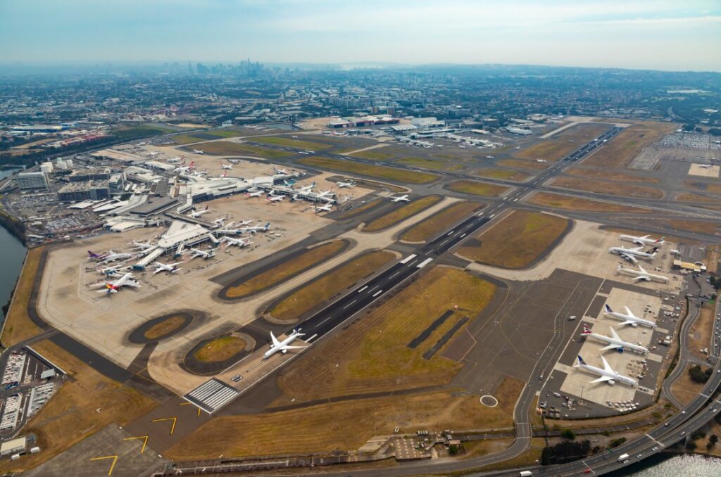 |
| Melbourne-Tullamarine International Airport | Melbourne, Victoria | 31,935,600 |  |
| Brisbane International Airport | Brisbane, Queensland | 21,918,357 | 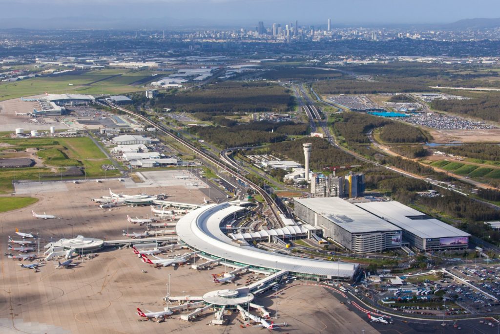 |
| Perth International Airport | Perth, Western Australia | 14,176,390 | 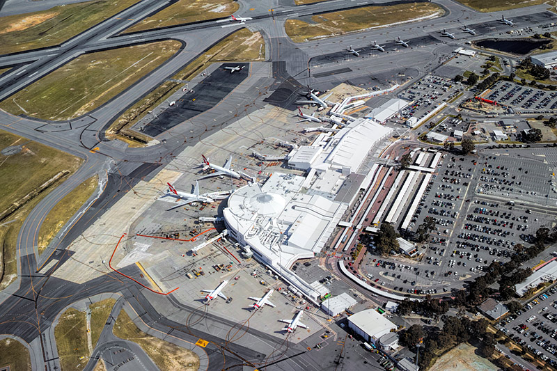 |
| Adelaide International Airport | Adelaide, South Australia | 8,066,632 | 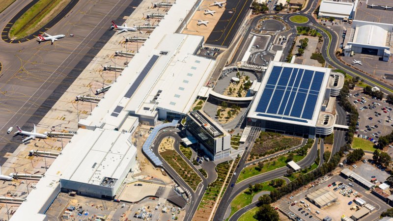 |
| Gold Coast-Coolangatta International Airport | Gold Coast, Queensland Tweed Heads, New South Wales | 5,867,294 |  |
| Canberra International Airport | Canberra, Australian Capital Territory | 2,803,989 | 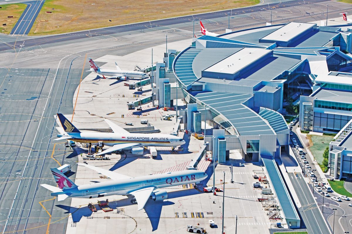 |
| Hobart International Airport | Hobart, Tasmania | 2,186,358 |  |
| Darwin International Airport | Darwin, Northern Territory | 2,057,307 | 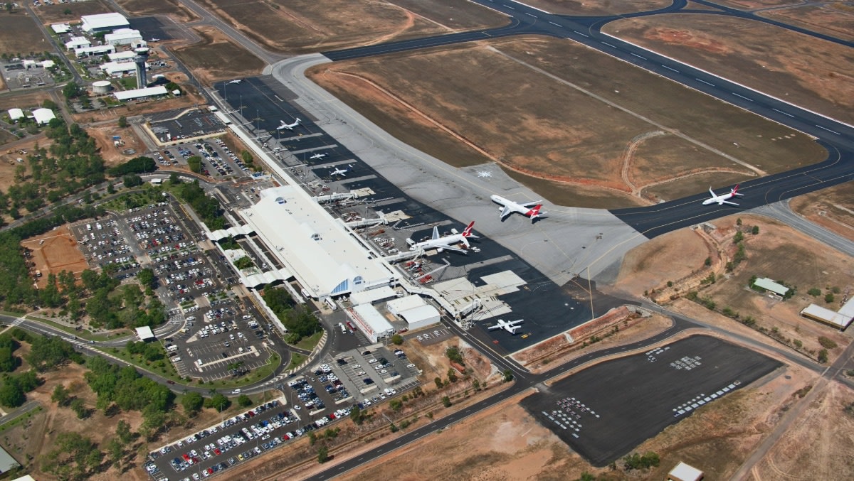 |
| Townsville International Airport | Townsville, Queensland | 1,497,946 | 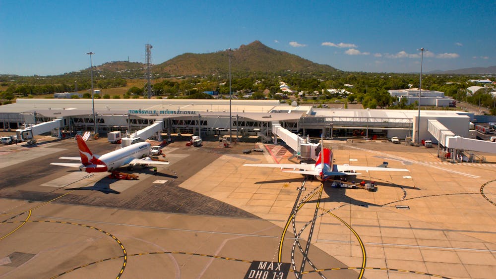 |
| Launceston Airport | Launceston, Tasmania | 1,272,198 | 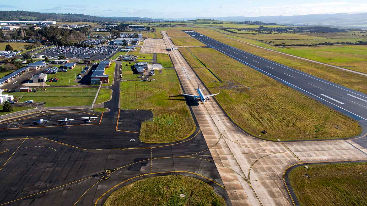 |
| Alice Springs Airport | Alice Springs, Northern Territory | 582,755 | 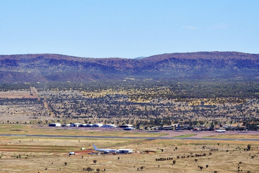 |
| Mount Isa Airport | Mount Isa, Queensland | 208,395 |  |
| Tennant Creek Airport | Tennant Creek, Northern Territory | <75,000 | 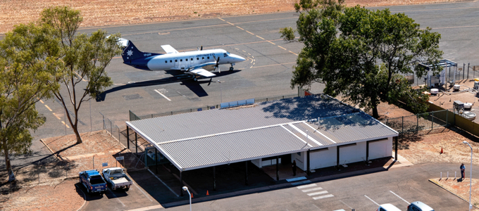 |
General Aviation Airports |
| Airport: | Location: | Aircraft Movements: | Image: |
|---|---|---|---|
| Moorabbin-Harry Hawker Airport | Melbourne, Victoria | 242,542 |  |
| Parafield Airport | Adelaide, South Australia | 235,384 |  |
| Jandakot Airport | Perth, Western Australia | 222,874 | 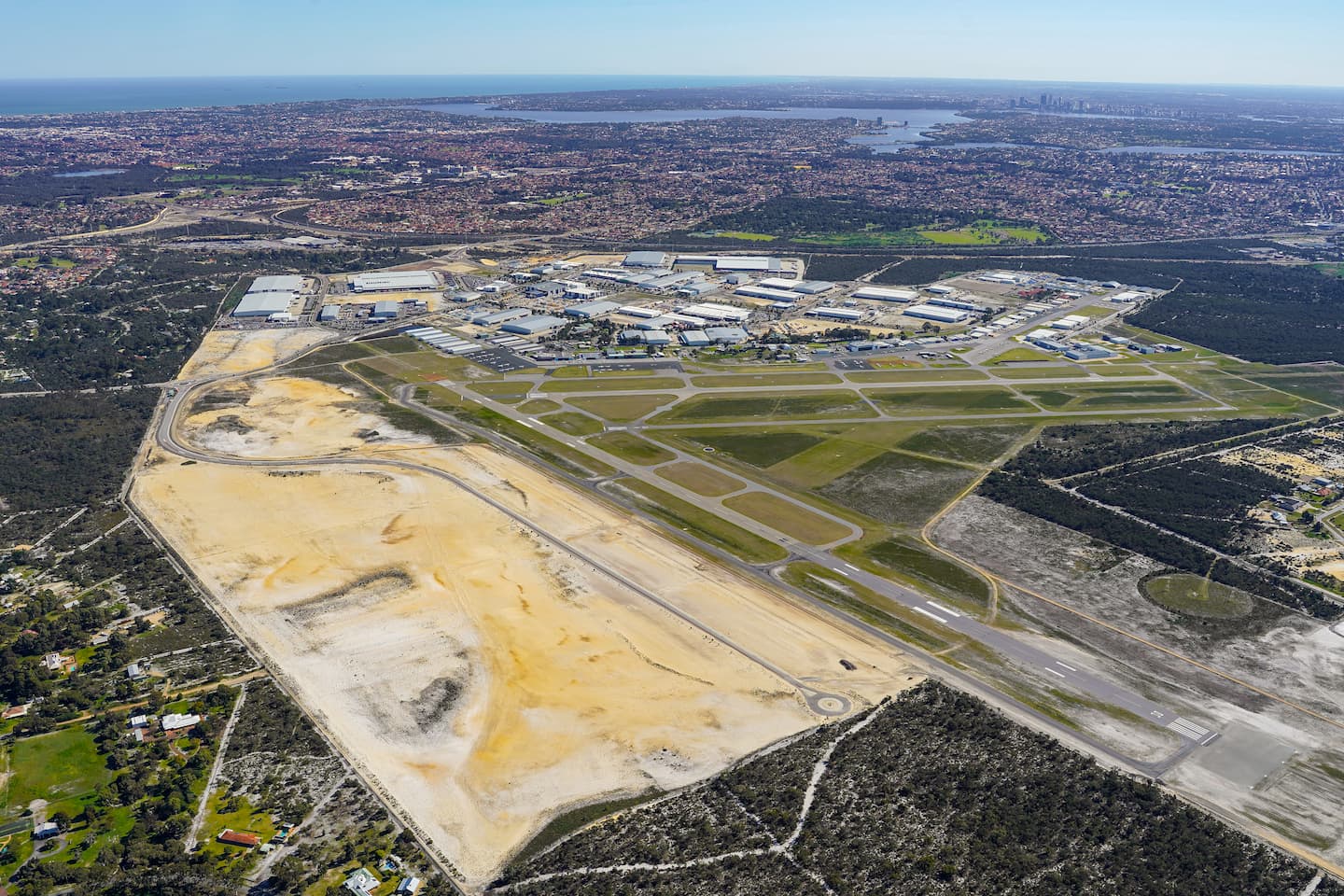 |
| Bankstown Airport | Sydney, New South Wales | 220,166 | 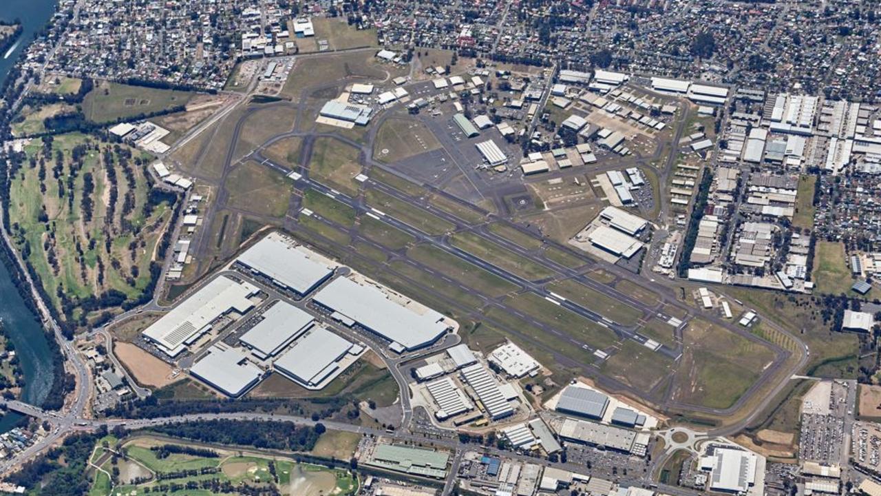 |
| Archerfield Airport | Brisbane, Queensland | 133,872 |  |
| Camden Airport | Sydney, New South Wales | 104,838 | 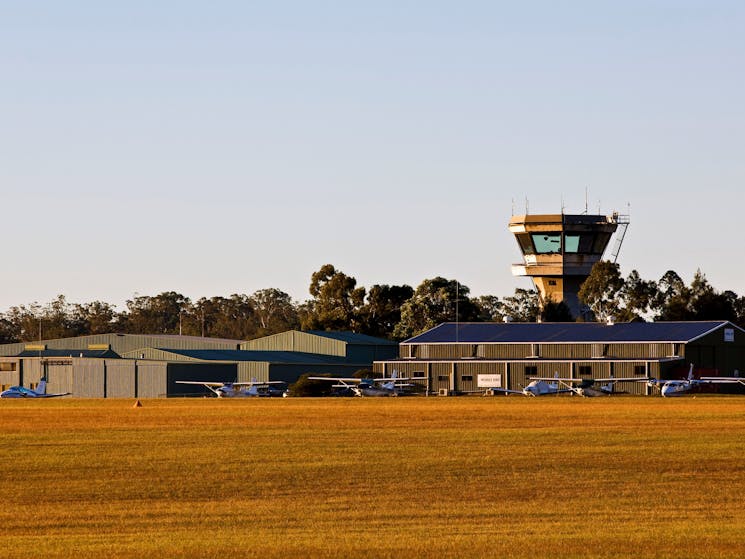 |
| Melbourne-Essendon Airport | Melbourne, Victoria | ~50,000 | .jpg) |
 | |||||||||||||||||||||||||||||||||||||||||||||||||||||||||||||||||||||||||||||||||||||||||||||||||||||||||||||||||||||||||||||||||||||||||||||||||||||||||||||||||||||||||||||||||||||||||||||||||||||||||||||||||||||||||||||||||||||||||||||||||||||||||||||||||||||||||||||||||||||||||||||||||||||||||||||||||||||||||||||||||||||||||||||||||||||||||||||||||||||||||||||||||||||||||||||||||||||||||||||||||||||||||||||||||||||||||||||||||||||||||||||||||||||||||||||||||||||||||||||||||||||||||||||||||||||||||||||||||||||||||||||||||||||||||||||||||||||||||||||||||||||||||||||||||||||||||||||||||||||||||||||||||||||||||||||||||||||||||||||||||||||||||||||||||||||||||||||||||||||||||||||||||||||||||||||||||||||||||||||||||||||||||||||||||||||||||||||||||||||||||||||||||||||||||||||||||||||||||||||||||||||||||||||||||||||||||||||||||||||||||||||||||||||||||||||||||||||||||||||||||||||||||||||||||||||||||||||||||||||||||||||||||||||||||||||||||||||||||||||||||||||||||||||||||||||||||||||||||||||||
Overview | |||||||||||||||||||||||||||||||||||||||||||||||||||||||||||||||||||||||||||||||||||||||||||||||||||||||||||||||||||||||||||||||||||||||||||||||||||||||||||||||||||||||||||||||||||||||||||||||||||||||||||||||||||||||||||||||||||||||||||||||||||||||||||||||||||||||||||||||||||||||||||||||||||||||||||||||||||||||||||||||||||||||||||||||||||||||||||||||||||||||||||||||||||||||||||||||||||||||||||||||||||||||||||||||||||||||||||||||||||||||||||||||||||||||||||||||||||||||||||||||||||||||||||||||||||||||||||||||||||||||||||||||||||||||||||||||||||||||||||||||||||||||||||||||||||||||||||||||||||||||||||||||||||||||||||||||||||||||||||||||||||||||||||||||||||||||||||||||||||||||||||||||||||||||||||||||||||||||||||||||||||||||||||||||||||||||||||||||||||||||||||||||||||||||||||||||||||||||||||||||||||||||||||||||||||||||||||||||||||||||||||||||||||||||||||||||||||||||||||||||||||||||||||||||||||||||||||||||||||||||||||||||||||||||||||||||||||||||||||||||||||||||||||||||||||||||||||||||||||||||
| The National Highway is a system of roads connecting all mainland states and territories of Australia, and is the major network of highways and motorways connecting Australia's capital cities and major regional centres. The National Highway became defined under the Australian Land Transport Development (ALTD) Act 1988. The act was largely concerned with funding road development in cooperation with the state governments. The federal transport minister defined the components of the National Highway, and also a category of "Road of National Importance" (RONI), with federal funding implications. Section 10.5 of the Act required the state road authorities to place frequent, prominent, signs on the National Highways and RONI projects funded by the federal government. | |||||||||||||||||||||||||||||||||||||||||||||||||||||||||||||||||||||||||||||||||||||||||||||||||||||||||||||||||||||||||||||||||||||||||||||||||||||||||||||||||||||||||||||||||||||||||||||||||||||||||||||||||||||||||||||||||||||||||||||||||||||||||||||||||||||||||||||||||||||||||||||||||||||||||||||||||||||||||||||||||||||||||||||||||||||||||||||||||||||||||||||||||||||||||||||||||||||||||||||||||||||||||||||||||||||||||||||||||||||||||||||||||||||||||||||||||||||||||||||||||||||||||||||||||||||||||||||||||||||||||||||||||||||||||||||||||||||||||||||||||||||||||||||||||||||||||||||||||||||||||||||||||||||||||||||||||||||||||||||||||||||||||||||||||||||||||||||||||||||||||||||||||||||||||||||||||||||||||||||||||||||||||||||||||||||||||||||||||||||||||||||||||||||||||||||||||||||||||||||||||||||||||||||||||||||||||||||||||||||||||||||||||||||||||||||||||||||||||||||||||||||||||||||||||||||||||||||||||||||||||||||||||||||||||||||||||||||||||||||||||||||||||||||||||||||||||||||||||||||||
National Highway Routes | |||||||||||||||||||||||||||||||||||||||||||||||||||||||||||||||||||||||||||||||||||||||||||||||||||||||||||||||||||||||||||||||||||||||||||||||||||||||||||||||||||||||||||||||||||||||||||||||||||||||||||||||||||||||||||||||||||||||||||||||||||||||||||||||||||||||||||||||||||||||||||||||||||||||||||||||||||||||||||||||||||||||||||||||||||||||||||||||||||||||||||||||||||||||||||||||||||||||||||||||||||||||||||||||||||||||||||||||||||||||||||||||||||||||||||||||||||||||||||||||||||||||||||||||||||||||||||||||||||||||||||||||||||||||||||||||||||||||||||||||||||||||||||||||||||||||||||||||||||||||||||||||||||||||||||||||||||||||||||||||||||||||||||||||||||||||||||||||||||||||||||||||||||||||||||||||||||||||||||||||||||||||||||||||||||||||||||||||||||||||||||||||||||||||||||||||||||||||||||||||||||||||||||||||||||||||||||||||||||||||||||||||||||||||||||||||||||||||||||||||||||||||||||||||||||||||||||||||||||||||||||||||||||||||||||||||||||||||||||||||||||||||||||||||||||||||||||||||||||||||
|


 |
Overview |
| The Office of the National Rail Safety Regulator (ONRSR) has responsibility for regulatory oversight of rail safety in every Australian state and territory, to promote and improve national rail safety and ensure the safety of the community. ONRSR is an independent body corporate established under the Rail Safety National Law (South Australia) Act. ONRSR independently administers the Rail Safety National Law and performs the functions and responsibilities, and exercises the powers conferred upon it by that law on behalf of all state, territory and federal Ministers for Transport and Infrastructure. Under Rail Safety National Law, “the ONRSR” comprises the National Rail Safety Regulator and two non-executive members. These appointments are made by the South Australian Transport Minister on the unanimous recommendation of the responsible ministers. |
| Investigation Title: | Investigation Number: | Occurrence Date: | Report Status: | Report Outcome: |
|---|---|---|---|---|
Overview |
| Infrastructure Australia is an independent statutory body providing independent research and advice to all levels of government and industry on projects and reforms relating to investment in Australian infrastructure. It advocates for reforms on issues including financing, delivering and operating infrastructure and how to better plan and use Australia's infrastructure networks. Infrastructure Australia also maintains the Infrastructure Priority List. This is a prioritisation process that is intended to ensure that there is a single pipeline for the evaluation and prioritisation of nationally-significant infrastructure projects. |
Infrastructure Priority List |
| Name: | Location: | Sector: | Proponent: | Overview of Problem and Proposal: | Project Stage: |
|---|---|---|---|---|---|
| 1. Early Stage Proposal 2. Potential Investment Options 3. Investment Ready Proposal 4. Project Delivery 5. Post Completion Review |
Overview |
| The International Air Services Commission (IASC) is an independent Australian Government statutory agency, responsible to the Minister for Infrastructure and Transport. The IASC's role is to determine the outcomes of applications by existing and prospective airlines for capacity and route entitlements available under air services arrangements. These determinations allocate the available capacity on a route to one or more carriers and set conditions, where these are considered appropriate. The IASC is composed of a Chairperson and two Members, appointed on a part-time basis. Its office in Canberra is assisted by a small Secretariat. The Commission was established under the International Air Services Commission Act 1992. The object of the Act is to enhance the welfare of Australians by promoting economic efficiency through competition in the provision of international air services, resulting in:
|
Current and Completed Cases |
| Destination Country: | Date of Application: | Airline: | Codeshares: | Frequency: | Seat Capacity: | Status: |
|---|---|---|---|---|---|---|
Overview |
| The Australian Rail Track Corporation (ARTC) is an Australian Government-owned statutory corporation. It operates one of the largest rail networks in the nation, spanning 8,500km across five states and 39 worksites. ARTC continues to expand the network through major infrastructure projects. ARTC does not operate any trains, but provides and maintains the infrastructure for train operators to run on. ARTC controls tracks in all mainland states. These were previously run by five separate state railways in an uncoordinated fashion that gave an advantage to road transport. By combining the infrastructure under one corporation it was expected that a more integrated and coordinated one-stop-shop would be created. It provides its own reporting numbers to trains that operate on its network. It also allows Commonwealth officers undercover privileges presenting as staff of ARTC. |
Owned Corridors |
| Corridor: | Line Name(s): | Start Point: | End Point: | Gauge: | Length: |
|---|---|---|---|---|---|
| Adelaide to Serviceton | Adelaide-Melbourne Line | Adelaide, South Australia | Serviceton, Victoria | 1435mm | 366km |
| Adelaide to Port Augusta | Adelaide-Port Augusta Line | Adelaide, South Australia | Port Augusta, South Australia | 1435mm | 315km |
| Port Augusta to Kalgoorlie | Trans-Australian Railway | Port Augusta, South Australia | Kalgoorlie, Western Australia | 1435mm | 1,691km |
| Port Augusta to Whyalla | Whyalla Line | Port Augusta, South Australia | Whyalla, South Australia | 1435mm | 74km |
| Crystal Brook to Broken Hill | Crystal Brook-Broken Hill Line | Crystal Brook, South Australia | Broken Hill, New South Wales | 1435mm | 371km |
| Tarcoola to Alice Springs | Adelaide-Darwin Rail Corridor | Tarcoola, South Australia | Alice Springs, Northern Territory | 1435mm | 828km |
| Dry Creek to Pelican Point | Dry Creek-Port Adelaide Line | Dry Creek, South Australia | Outer Harbor, South Australia | 1435mm | 8km |
| Sefton to Macarthur | Southern Sydney Freight Line | Sefton, New South Wales | Campbelltown, New South Wales | 1435mm | 36km |
Leased Corridors |
| Corridor: | Line Name(s): | Start Point: | End Point: | Gauge: | Length: |
|---|---|---|---|---|---|
| Melbourne to Albury | North East Line | Melbourne, Victoria | Albury, New South Wales | 1435mm | 307km |
| Melbourne to Serviceton | Western Line | Melbourne, Victoria | Serviceton, Victoria | 1435mm | 532km |
| Maroona to Portland | Portland Line | Maroona, Victoria | Portland, Victoria | 1435mm | 173km |
| Benalla to Oaklands | Oaklands Line | Benalla, Victoria | Oaklands, New South Wales | 1435mm | 125km |
| Port Botany to Sefton | Metropolitan Goods Line | Port Botany, New South Wales | Sefton, New South Wales | 1435mm | 21km |
| Macarthur to Albury | Main Southern Line | Campbelltown, New South Wales | Albury, New South Wales | 1435mm | 594km |
| Unanderra to Moss Vale | Unanderra-Moss Vale Line | Wollongong, New South Wales | Moss Vale, New South Wales | 1435mm | 57km |
| Cootamunda to Parkes | Stockinbingal-Parkes Line Lake Cargelligo Line | Stockinbingal, New South Wales | Parkes, New South Wales | 1435mm | 165km |
| Parkes to Broken Hill | Broken Hill Line | Parkes, New South Wales | Broken Hill, New South Wales | 1435mm | 678km |
| Parkes to Narromine | Parkes-Narromine Line | Parkes, New South Wales | Narromine, New South Wales | 1435mm | 106km |
| Dubbo to Werris Creek | Troy Junction-Merrygoen Line | Dubbo, New South Wales | Werris Creek, New South Wales | 1435mm | 119km |
| Maitland to Brisbane | North Coast Line | Maitland, New South Wales | Brisbane, Queensland | 1435mm | 795km |
| Maitland to North Star | Main North Line Mungindi Line Boggabilla Line | Maitland, New South Wales | North Star, New South Wales | 1435mm | 470km |
| Muswellbrook to Gulgong | Sandy Hollow-Gulgong Line | Muswellbrook, New South Wales | Gulgong, New South Wales | 1435mm | 125km |
Overview |
The High Speed Rail Authority (HSRA) is an Australian Government authority tasked with advising on, planning, developing and overseeing the construction and operation of an eventual high-speed rail network along Australia's eastern seaboard. The Authority is currently tasked with producing a number of business cases for higher-speed rail between capital cities and regional centres. The Government is to assess five fast rail corridors:
|
Overview |
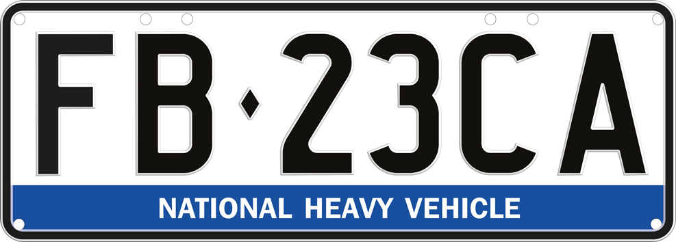
The National Heavy Vehicle Regulator (NHVR) is Australia’s regulator for heavy vehicles (over 4.5 tonnes Gross Vehicle Mass). They are headquartered in Brisbane and operate across the ACT, New South Wales, Queensland, South Australia, Tasmania and Victoria. They were established as a statutory authority to administer one set of laws, the Heavy Vehicle National Law (HVNL), which applies in all Australia's states and territories except the Northern Territory and Western Australia. In the 6 states and territories where the HVNL applies, there are more than:
|
National Heavy Vehicle Registration Scheme |
The National Heavy Vehicle Registration Scheme operates in the ACT, New South Wales, Queensland, South Australia, Tasmania, Victoria and the Northern Territory, where a national heavy vehicle plate will be issued with any transaction, such as when:
 |
| Type: | Amount: | Image: |
|---|---|---|
| Safety and Compliance Officers | 1,000 |  |
| Type: | Amount: | Image: |
|---|---|---|
| Patrol Cars | 200 |  |
| Unit: | Size: | Base: |
|---|---|---|
| Queensland Operations | 470x Safety and Compliance Officers, 94x Patrol Cars | Brisbane |
| New South Wales and Australian Capital Territory Operations | 380x Safety and Compliance Officers, 76x Patrol Cars | Sydney |
| Victoria Operations | 70x Safety and Compliance Officers, 14x Patrol Cars | Melbourne |
| South Australia Operations | 70x Safety and Compliance Officers, 14x Patrol Cars | Adelaide |
| Tasmania Operations | 10x Safety and Compliance Officers, 2x Patrol Cars | Hobart |
Overview |
The Office of Road Safety was established to coordinate and facilitate the national efforts to eliminate road trauma in Australia. It is a Branch within the Road and Vehicle Safety Division. The Office works with state, territory and local governments, police agencies, road safety organisations and other stakeholders to achieve our long-term aim that no one is killed or seriously injured on Australia's roads. To support effective national collaboration and coordination, our role involves:
|
 |
 |
Overview |
| The National Transport Commission (NTC), previously known as the National Road Transport Commission, is an Australian statutory body created to develop regulatory and operational reform for road, rail and intermodal transport. Under Australia's federal system, transport policy and regulatory responsibilities span across Commonwealth, state and territory, and local governments. Differences between these regulatory systems mean that national transport operators can face inconsistent regulations, creating unnecessary inefficiency and cost. The NTC is focused on reforms which improve the productivity, safety and environmental outcomes of the Australian transport system. Its work includes delivering a National Rail Action Plan to make rail more interoperable, developing an end-to-end regulatory framework for automated vehicles, improving the National Heavy Vehicle law, maintaining the Australian Dangerous Goods Code and maintaining national model laws, including the Australian Road Rules. The NTC also plays a role in implementation planning to ensure reform outcomes are relevant and effective. Recommendations and advice are presented to Australia's transport ministers through the Infrastructure and Transport Ministers' Meeting for approval by majority vote. Based in Melbourne, the NTC has six commissioners including a Chief Executive. |
Overview |
| The National Intermodal Corporation (NIC) develops infrastructure necessary to connect Australian exporters to the global market, and to deliver products to Australian businesses, homes and families. The NIC supports the Australian Government’s vision for an efficient and effective transport sector, as laid out in the National Freight and Supply Chain Strategy, and are a critical enabler for a modern, efficient supply chain. The NIC is wholly owned by the Commonwealth of Australia as a Government Business Enterprise, incorporated under the Corporations Act 2001 and operated in accordance with the Public Governance, Performance and Accountability Act. The strategic priorities of the National Intermodal Corporation are:
|
 |
Overview |
| The Centre for Population is the Australian Government body responsible for producing population projections, conducting demographic analysis, and providing data and insights to inform government policy and the wider community about Australia's changing population. It monitors migration, natural increase, and other demographic factors to support sustainable population growth and ensure equitable distribution of services across the nation. |
Last edited: