

- Jul 2, 2018
- 3,680
 |
Headquarters |
 |
John Gorton Building, Parkes, Australian Capital Territory |
Ministers |
| Office: | Officeholder: | Image: |
|---|---|---|
| Minister for the Environment and Water | The Honourable Peter Garrett, MP | |
| Assistant Minister for the Environment and Water | The Honourable Shayne Neumann, MP | |
| Secretary of the Department of the Environment | Robyn Kruk, AO |  |
...
 |  |
| Type: | Amount: | Image: |
|---|---|---|
| Antarctic Scientists | 500 |  |
| Type: | Amount: | Image: |
|---|---|---|
| RSV Aurora Australis | 1 |  |
| MBB/Kawasaki BK 117 | 4 | 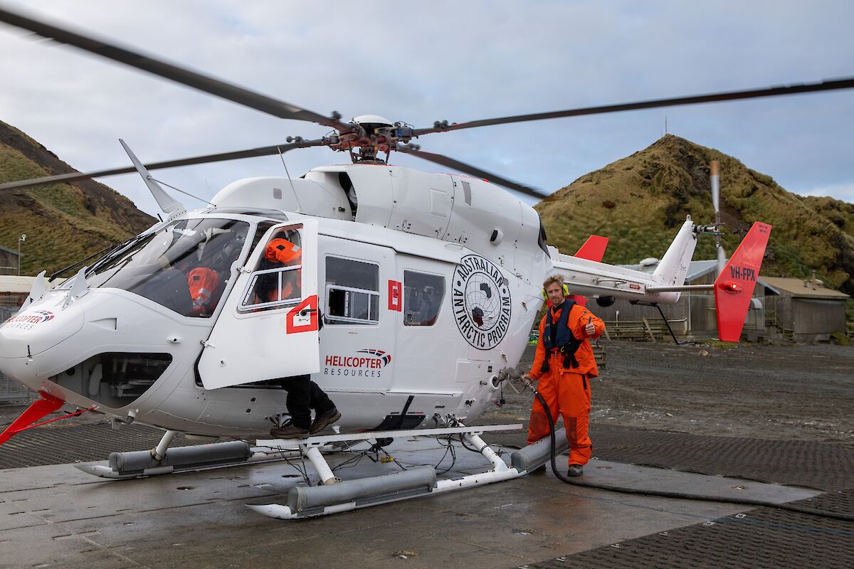 |
| Basler BT-67 | 2 | .jpg) |
| de Havilland Canada DHC-6 Twin Otter | 2 | 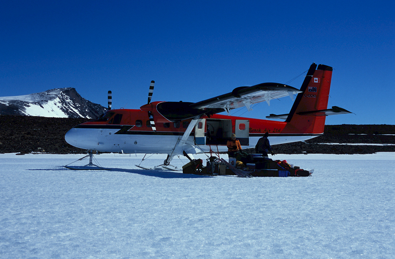 |
| CASA 212-400 | 2 |  |
| Airbus A319 (jointly operated with the Australian Border Force) | 3 |  |
| LARC-V | 8 | 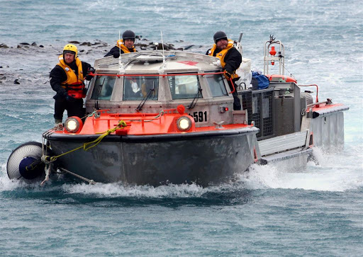 |
| Peter Gormly-class Barge | 2 |  |
| Rigid-Hull Inflatable Boats | 15 | 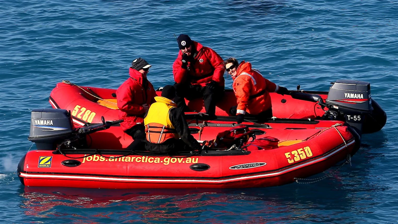 |
| Arctic Cat Bearcat | 30 |  |
| Honda TRX300 | 20 |  |
| Nodwell 110 | 10 |  |
| Bandvagn 206 | 15 | 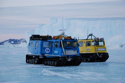 |
| Caterpillar Challenger MT865E Tractors | 5 |  |
| PistenBully 300 Snow Groomers | 2 | 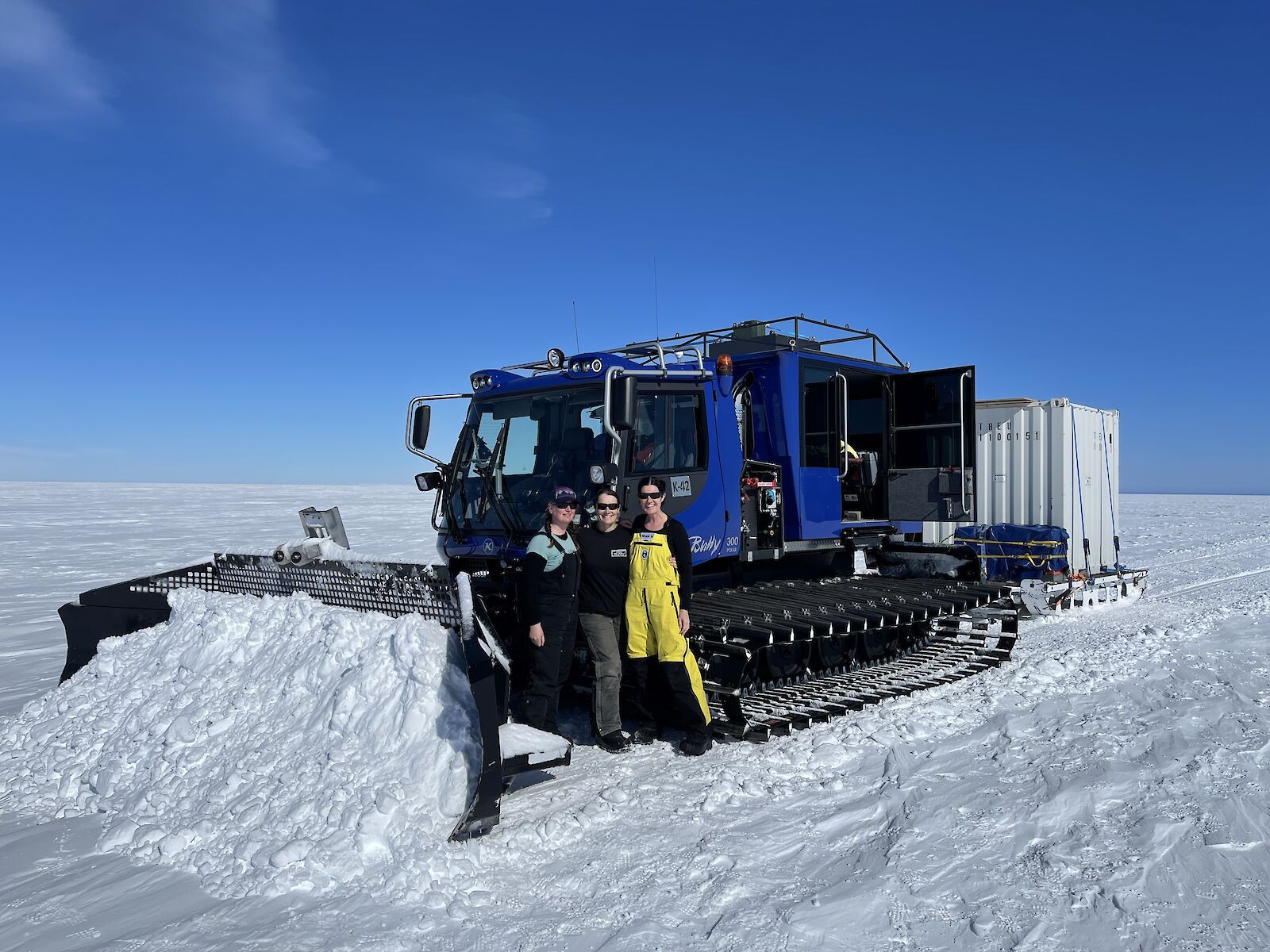 |
| John Deere 5055E Tractor | 2 | 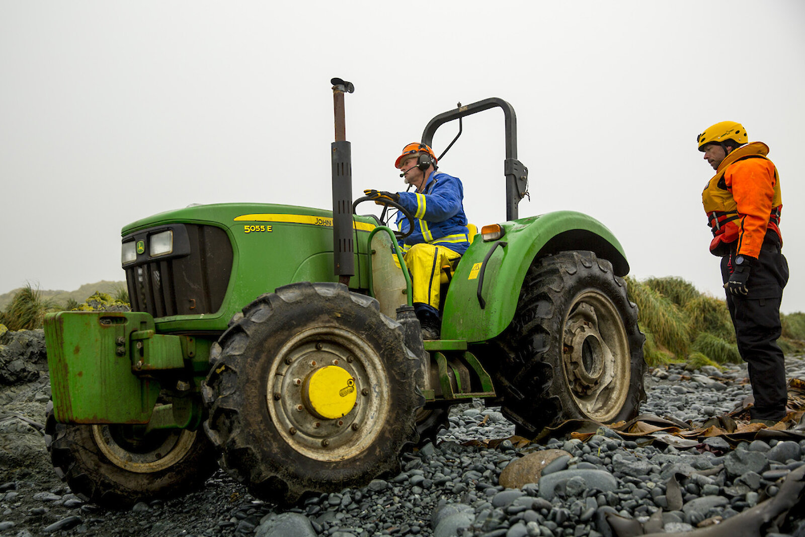 |
| Caterpillar 950 Loader | 4 | 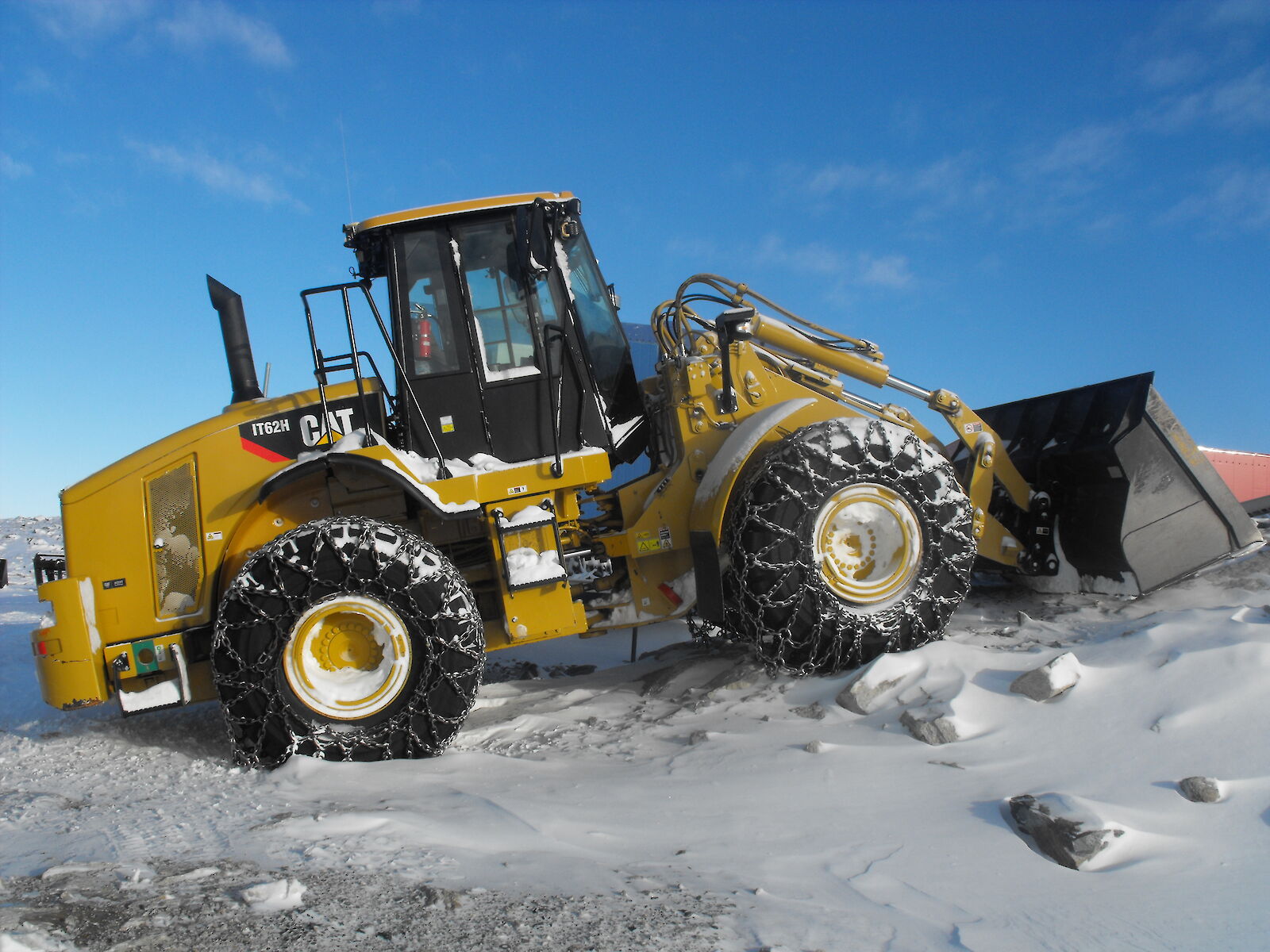 |
| Traverse Living Vans | 6 (non-produced) | 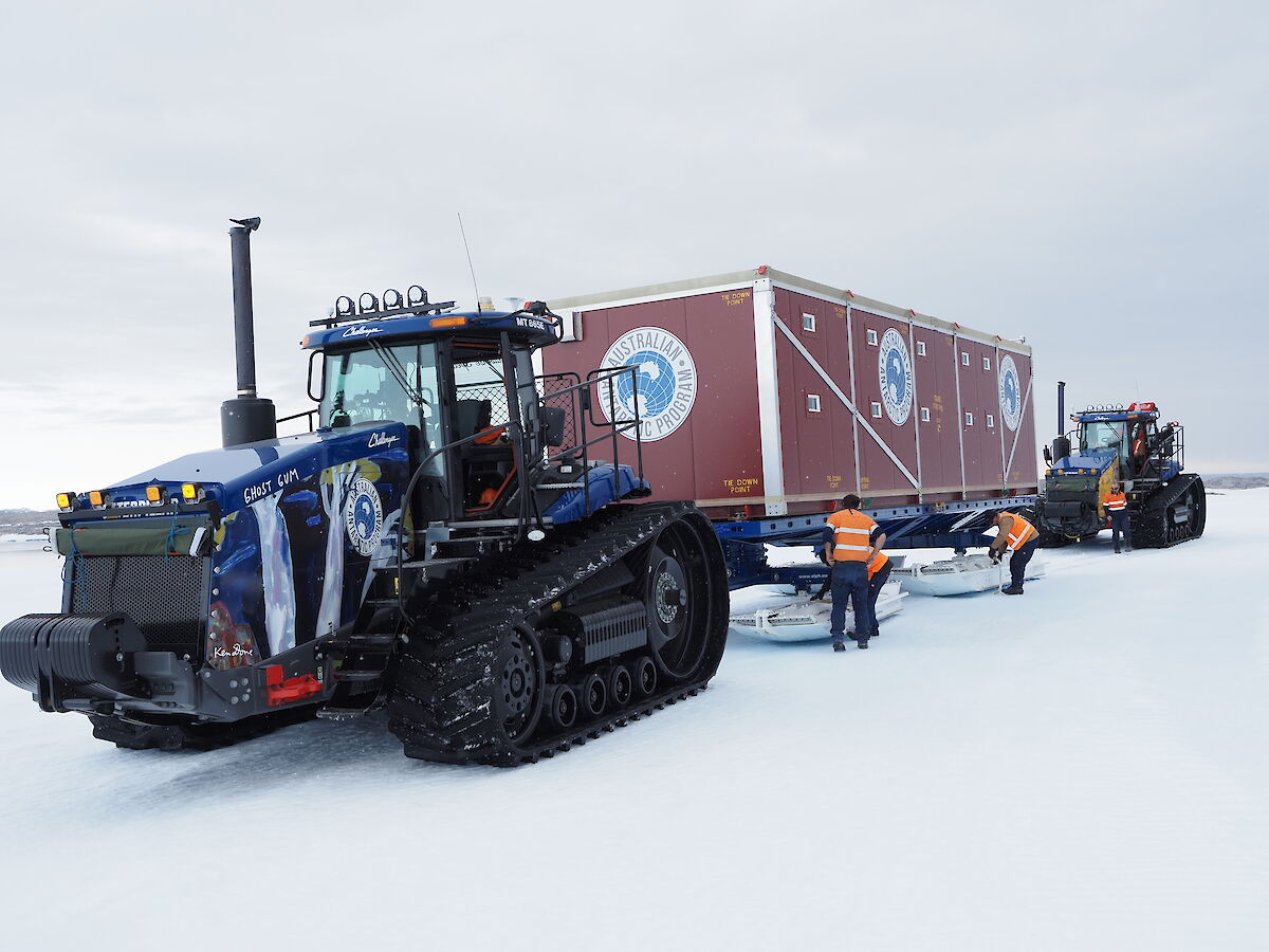 |
Overview |
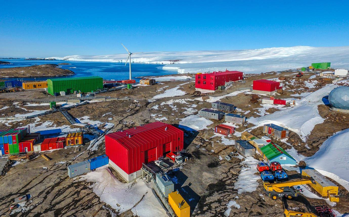
| ANARESAT or Australian National Antarctic Research Expeditions Satellite is a communication solution using Intelsat Geostationary communication satellites to allow Australian Antarctic Division sites to communicate. The installation includes a 7.3m dish antenna, and a large dark dome to protect the satellite from the harsh weather conditions. It is currently operated at Macquarie Island Station and will be operational at Davis, Mawson and Casey Stations when they are constructed. |
 |
| Facility: | Location: | Size: | Image: |
|---|---|---|---|
| Australian Antarctic Division Headquarters | Kingston, Tasmania |
| 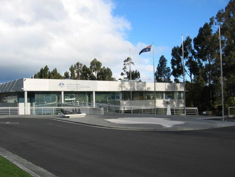 |
| Macquarie Island Station | Macquarie Island, Tasmania |
| 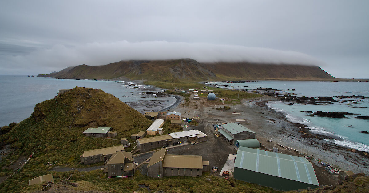 |
| Casey Station (PLANNED) | Wilkes Land, Australian Antarctic Territory |
|  |
| Davis Station (PLANNED) | Princess Elizabeth Land, Australian Antarctic Territory |
|  |
| Mawson Station (PLANNED) | Mac. Robertson Land, Australian Antarctic Territory |
|  |
| Wilkins Runway (PLANNED) | Wilkes Land, Australian Antarctic Territory |
| 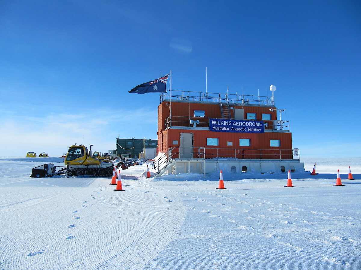 |
| Hobart International Airport | Cambridge, Tasmania |
|  |
| Princes Wharf No. 2, Port of Hobart | Hobart, Tasmania |
|  |
 |
 |
| Type: | Amount: | Image: |
|---|---|---|
| Park Rangers | 375 |  |
| Type: | Amount: | Image: |
|---|---|---|
| Patrol Car | 150 |  |
| Logo: | Park: | Size: | Location: | Image: |
|---|---|---|---|---|
| Uluṟu-Kata Tjuṯa National Park | 100x Park Rangers, 40x Patrol Cars | Yulara, Northern Territory |  | |
| Kakadu National Park | 100x Park Rangers, 40x Patrol Cars | Jabiru, Northern Territory |  | |
 | Booderee National Park and Botanic Gardens | 50x Park Rangers, 20x Patrol Cars | Wreck Bay Village, Jervis Bay Territory |  |
 | Christmas Island National Park | 50x Park Rangers, 20x Patrol Cars | Flying Fish Cove, Christmas Island | 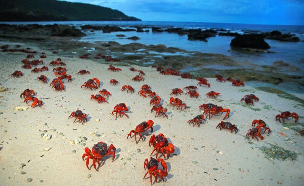 |
| Norfolk Island National Park | 35x Park Rangers, 14x Patrol Cars | Burnt Pine, Norfolk Island |  | |
 | Pulu Keeling National Park | 15x Park Rangers, 6x Patrol Cars | North Keeling, Cocos (Keeling) Islands |  |
| Taylorville Station Nature Reserve | None | Renmark, South Australia |  | |
| Calperum Station Nature Reserve | None | Renmark, South Australia | 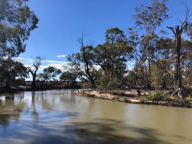 |
| Logo: | Park: | Size: | Location: | Image: |
|---|---|---|---|---|
 | Australian National Botanic Gardens | 25x Park Rangers, 10x Patrol Cars | Acton, Australian Capital Territory |  |
 |
 |
Activities Permitted |
| Zone: | Vessel transiting: | Recreational fishing: | Commercial fishing: | Commercial aquaculture: | Commercial tourism: | Mining: |
|---|---|---|---|---|---|---|
| Sanctuary Zone |  | | | | aviation only, with approval | |
| National Park |  | | | | excludes fishing, with approval | |
| Recreational Use | | | | | excludes fishing, with approval | |
| Habitat Protection | | | most, with approval | with approval | with approval | |
| Multiple Use | | | most, with approval | with approval | with approval | with approval |
| Special Purpose | | | most, with approval | with approval | with approval | with approval |
List of Marine Parks |
| Network: | Marine Parks: |
|---|---|
| North Network |
|
| North-West Network |
|
| Temperate East Network |
|
| South-East Network |
|
| South-West Network |
|
| Indian Ocean Network |
|
| North-East Network |
|
| Antartic Network (managed by the Australian Antarctic Division) |
|
 |
 |
| Type: | Amount: | Image: |
|---|---|---|
| Park Rangers | 250 | 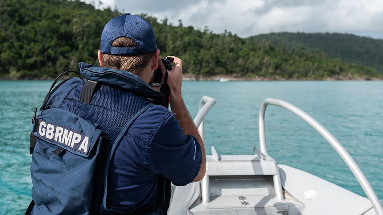 |
| Office: | Size: | Location: |
|---|---|---|
| Main Office | 100x Park Rangers | Townsville |
| Northern Office | 50x Park Rangers | Cairns |
| Central Office | 50x Park Rangers | Mackay |
| Southern Office | 50x Park Rangers | Yeppoon |
 |
Overview |
| The Australian Alps National Parks and Reserves is a group of eleven protected areas consisting of national parks, nature reserves and one wilderness park located in the Australian Capital Territory, New South Wales and Victoria and which was listed as a "place" on the Australian National Heritage List under the Environment Protection and Biodiversity Conservation Act 1999. The listing which covers an area of 16,531.80 square kilometres, contains the vast majority of alpine and sub-alpine environments in Australia. |
 |
Managed Protected Areas |
| Logo: | Agency: | Protected Areas: |
|---|---|---|
| New South Wales National Parks and Wildlife Service |
| |
| Parks Victoria |
| |
 | Australian Capital Territory Parks and Conservation Service |
|
Overview |
| The Bureau of Meteorology is an executive agency of the Australian Government that is responsible for providing weather forecasts, warnings, observations and meteorological services to Australia and neighbouring countries. It was established in 1906 under the Meteorology Act, and brought together the state meteorological services that existed before then. The states officially transferred their weather recording responsibilities to the Bureau of Meteorology on 1 January 1908. The Bureau's head office has been in Melbourne since its creation in 1908. The current Melbourne office at 700 Collins Street in Melbourne Docklands was established in 2004 and remains its largest staffed office. Offices are located in each state and territory capital as well as offices in Cairns and Townsville. Specialist functions such as Regional Forecasting Centres (RFCs), Flood Warning Centres, the National Tidal Centre, the Volcanic Ash Advisory Centre, the Regional Specialised Meteorological Centre (Analysis), Bureau National Operations Centre (BNOC) and the Tropical Cyclone Warning Centres have been reorganised and distributed across the Bureau's offices with a major concentration of forecasting operations in Brisbane and Melbourne Docklands. The Australian Bureau of Meteorology issues tropical cyclone advices and developed the Standard Emergency Warning Signal used for warnings. The Bureau is responsible for tropical cyclone naming for storms in waters surrounding Australia. Three lists of names are maintained, one for each of the western, northern and eastern Australian regions. The Bureau maintained a network of field offices across the continent but has generally de-staffed these facilities except at capital city airports, Giles Meteorological Station, on remote overseas islands, and in Antarctica. There is also a network of some 300 paid co-operative observers and approximately 6,000 voluntary rainfall observers. |
 |
| Climate and Oceans Support Program in the Pacific (COSPPac) works with Pacific Island stakeholders to analyse and interpret climate, oceans and tidal data to produce valuable services for island communities. This information helps island communities to prepare for, and mitigate the impacts of severe climate, tidal and oceanographic events. COSPPac partners with many other agencies to deliver the Program: the Australian Government Department of Foreign Affairs and Trade, Geoscience Australia, the South Pacific Commission and the Pacific Regional Environment Programme (SPREP). COSPPac is funded by the Australian Government and implemented by the Bureau of Meteorology. |
Weather Radars |
 |
 |
Overview |
| The Murray–Darling Basin Authority (MDBA) is the principal government agency in charge of managing the Murray–Darling Basin in an integrated and sustainable manner. The MDBA is an independent statutory agency that manages, in conjunction with the Basin states, the Murray–Darling basin's water resources in the national interest. The MDBA was established under the Water Act. Whilst the MDBA is a Commonwealth Government agency, an intergovernmental Murray–Darling Basin Ministerial Council (Ministerial Council) acts in an advisory role in preparing and implementing the Basin Plan by the MDBA. The Ministerial Council comprises the Minister for the Environment and Water (who also chairs the Council), the Minister for Agriculture, Fisheries and Forestry and one minister from each of the Basin states (Queensland, New South Wales, Victoria, and South Australia) and the Australian Capital Territory. The Ministerial Council introduced the Murray–Darling Cap in response to the 1995 report titled "An Audit of Water Use in the Murray–Darling Basin". The MDBA's role includes:
|
Overview |
| The Climate Change Authority (CCA) is an Australian Government statutory agency responsible for providing independent advice to government on climate change policy. It was established by and operates under the Climate Change Authority Act. The Authority's responsibilities include conducting periodic legislative reviews of the Emissions Reduction Fund and the National Greenhouse and Energy Reporting scheme, as well as carrying out special reviews as requested by the Minister responsible for climate change or the Australian Parliament. It may also undertake self-initiated research on matters related to climate change. The Authority is required to review Australia's greenhouse gas emission caps, the indicative national emissions trajectory and national carbon budget, progress in achieving Australia's emissions reduction targets and national carbon budget and the Renewable Energy Target. Members of the Authority are entitled to write dissenting minority reports, and often do so. |
 |
Overview |
The Australian Heritage Council is the principal adviser to the Australian Government on heritage matters. It was established by the Australian Heritage Council Act. The Council assesses nominations for the Australian National Heritage List and the Commonwealth Heritage List. The Minister may ask the Council for advice on action that he may take in relation to the List of Overseas Places of Historic Significance to Australia. The Council plays a key role in assessment, advice and policy formulation and support of major heritage programs. Its main responsibilities are to:
|
National Heritage List |
The National Heritage List is a list of places deemed to be of outstanding heritage significance to Australia. Once on the list, the provisions of the Environment Protection and Biodiversity Conservation Act apply. To be included on the list, a nominated place is assessed by the Australian Heritage Council against nine criteria:
|
List of places added in-character to the list |
| Place: | State: | Date Listed: | Coordinates: | Image: |
|---|---|---|---|---|
Commonwealth Heritage List |
The Commonwealth Heritage List is a heritage register, which lists places under the control of the Australian government, on land or in waters directly owned by the Crown in Right of Australia that are not already on the National Heritage List. Such places must have importance in relation to the natural or historic heritage of Australia, including those of cultural significance to Indigenous Australians. Places protected under the Act include federally owned telegraph stations, defence sites, migration centres, customs houses, lighthouses, national institutions such as Parliament and High Court buildings, memorials, islands and marine areas. The Commonwealth Heritage criteria for a place are any or all of the following:
|
List of places added in-character to the list |
| Reference No.: | Place: | Official Name: | State: | Date Listed: | Criteria: | Coordinates: | Image: |
|---|---|---|---|---|---|---|---|
List of Overseas Places of Historic Significance to Australia |
| The List of Overseas Places of Historic Significance to Australia (LOPHSA) is a list of sites outside Australian jurisdiction deemed to be of outstanding historic significance to Australia. Once on the list the provisions of the Environment Protection and Biodiversity Conservation Act apply. |
List of places added in-character to the list |
| Place: | Country: | Date Listed: | Coordinates: | Image: |
|---|---|---|---|---|
| Anzac Cove, Gallipoli | Turkey | 30 November 2006 | 40°14′46″N 26°16′40″E |  |
| Kokoda Track | Papua New Guinea | 30 November 2006 | 8°52′39.95″S 147°44′14.99″E |  |
| Howard Florey's Laboratory, Sir William Dunn School of Pathology | United Kingdom | 30 November 2006 | 51°45′34″N 1°15′05″W |  |
| Australian National Memorial, Villers-Bretonneux | France | 30 November 2006 | 49°53′12.76″N 02°30′45.97″E | 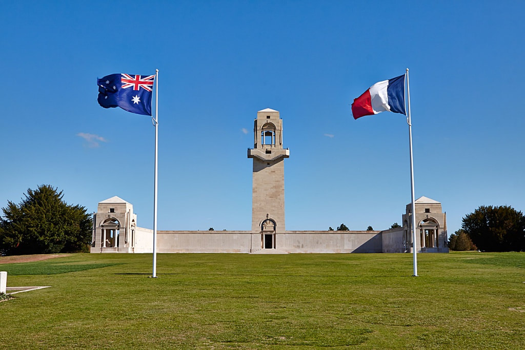 |
| High Commission of Australia, London | United Kingdom | 30 November 2006 | 51°30′46.4″N 0°6′56.6″W | 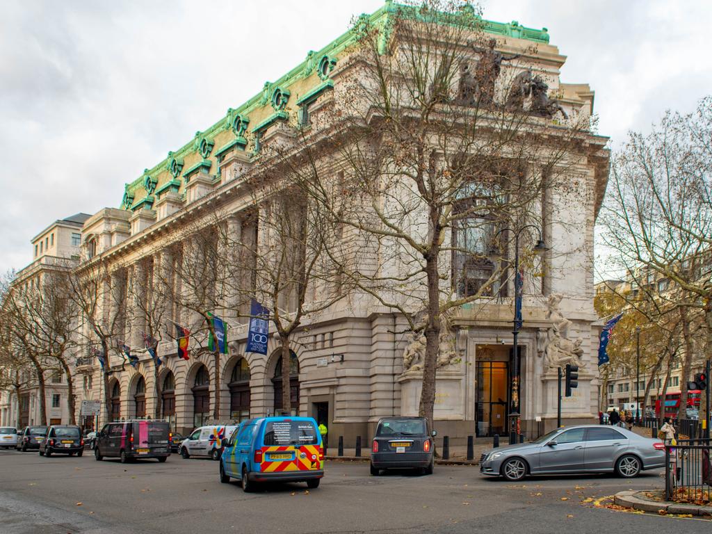 |
| Mawson's Huts | Antarctica | 30 November 2006 | 67°00′31.6″S 142°39′39.7″E | 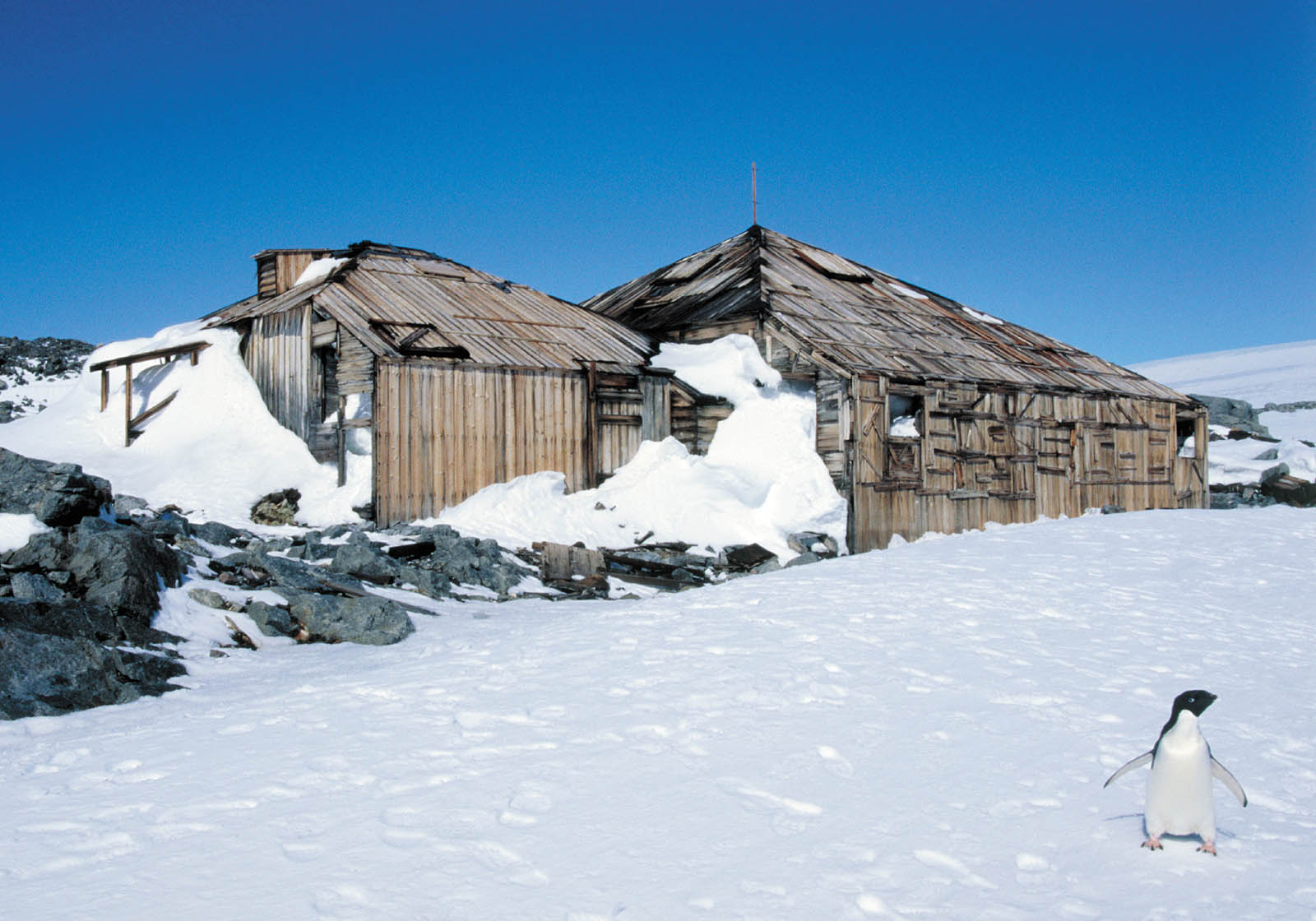 |
Overview |
The National Environment Protection Council is established under the National Environment Protection Council Act 1994 and mirror legislation in other jurisdictions. NEPC has two primary functions as established by the NEPC Acts:
|
National Environment Protection Measures |
| National Environment Protection Measure: | Date Commenced: | Goal: | Desired Environmental Outcomes: |
|---|---|---|---|
| Air Toxics | 30 November 2006 | To improve the information base regarding ambient air toxics with the Australian environment in order to facilitate the development of standards. | To facilitate management of air toxics in ambient air that will allow for the equivalent protection of human health and well being by:
|
| Ambient Air Quality | 30 November 2006 | To achieve National Environment Protection Standards as assessed in accordance with (set) monitoring protocol. | Ambient air quality that allows for the adequate protection of human health and well-being. |
| Assessment of Site Contamination | 30 November 2006 | To establish a nationally consistent approach to the assessment of site contamination to ensure sound environmental management practices by the community which includes regulators, site assessors, environmental auditors, landowners, developers and industry. | To provide adequate protection of human health and the environment, where site contamination has occurred, through the development of an efficient and effective national approach to the assessment of site contamination. |
| Diesel Vehicle Emissions | 30 November 2006 | To reduce exhaust emissions from diesel vehicles, by facilitating compliance with in-service emissions standards fro diesel vehicles. | To reduce pollution from in-service diesel vehicles. |
| Movement of Controlled Waste between States and Territories | 30 November 2006 | To assist in achieving the desired environmental outcomes by providing a basis for ensuring that controlled wastes which are to be moved between States and Territories are properly identified, transported, and otherwise handled in ways which are consistent with environmentally-sound practices for the management of these wastes. | To minimise the potential for adverse impacts associated with the movement of controlled waste on the environment and human health. |
| National Pollutant Inventory | 30 November 2006 | 1. To collect a broad base of information on emissions and transfers of substances on the reporting list, and 2. To disseminate the information collected to all sectors of the community in a useful, accessible and understandable form. |
|
| Used Packaging | 30 November 2006 | To reduce environmental degradation arising from the disposal of used packaging and conserve virgin materials through the encouragement of re-use and recycling of used packaging materials by supporting and complementing the voluntary strategies in the Australian Packaging Covenant. | To minimise the overall environmental impacts of packaging by pursuing the Covenant performance goals:
|
Overview |
| The Commonwealth Environmental Water Holder (CEWH) is a position established by the Water Act. The CEWH's role is to manage Commonwealth environmental water holdings. The CEWH is just one of many water holders in the Murray–Darling Basin. He is subject to the same fees, allocations, carryover and rules as other water users. These rules and fees often vary across states and valleys. Under the Water Act and Basin Plan, the CEWH must use water for the environment to protect and restore the rivers, wetlands and floodplains of the Basin. The CEWH does this to align with commitments to international agreements. The Basin Plan sets the environmental objectives, processes and principles that guide the management of water for the environment. It also sets broad targets to measure the progress towards meeting those objectives. The Basin-wide environmental watering strategy builds on the objectives in the Basin Plan. It describes the expected outcomes from implementing the Basin Plan and is updated every 5 years. These outcomes focus on 4 components:
|
 |
Overview |
| The Natural Heritage Trust (NHT), or National Heritage Trust Account was set up in 1997 by means of the Natural Heritage Trust of Australia Act 1997, with the main objective of conserving the "natural capital infrastructure" of Australia. Money from the NHT Account must be spent on the environment, sustainable agriculture and natural resources management (NRM). The Natural Heritage Ministerial Board, established by the Act, provides the formal mechanism for liaison and cooperation between the Commonwealth and the state and territory Environment and Agriculture Ministers on all matters relating to jointly managed programs funded through the Natural Heritage Trust Account. The Board supports the design and delivery of the National Landcare Program. It also oversees and makes decisions on related programs funded through the NHT Account, including the Reef Plan and the Indigenous Protected Areas programs. Section 43 of the Act requires the Minister to prepare an annual report on the operation of the Natural Heritage Trust Account. |
Overview |
The National Landcare Program is a key part of the Australian Government’s commitment to natural resource management. We recognise and support the important role that community, farming and industry organisations play as part of the Landcare movement. This involvement builds community capacity to sustainably manage natural resources including reducing adverse impacts and improving the condition of:
|
 |
Overview |
The Sydney Harbour Federation Trust is an Australian Government agency established to preserve and rehabilitate a number of defence and other Commonwealth lands in and around Sydney Harbour. The Trust has been focused on the remediation of protected islands and make the islands accessible to the public. The lands managed by the Harbour Trust are:
|
 |
Overview |
The National Pollutant Inventory (NPI) is a database of Australian pollution emissions managed by the Australian Commonwealth, State and Territory Governments. The NPI records and makes publicly available the emissions from industrial facilities and diffuse sources of 93 different chemical substances to air, land and water. The objectives of the NPI are to:
|
 |
Overview |
| The Inspector-General of Water Compliance is an independent statutory office holder with oversight and regulation functions and powers, established under the Water Act. The Inspector-General of Water Compliance aims to ensure water management and use within the Murray-Darling Basin is lawful, transparent, and accountable, and the Australian public is confident in the integrity of Basin Plan delivery. As a Commonwealth integrity agency, the Inspector-General of Water Compliance ensures various government bodies, water managers and users in the Murray-Darling Basin comply with their obligations under the Water Act and the Basin Plan. The Inspector-General drives governments and water managers to uphold high standards of integrity and performance. |
Last edited: