STATISTICS

Start Year: 1995
Current Year: 2009

Month: January

2 Weeks is 1 Month
Next Month: 28/06/2026

OUR STAFF

Administration Team

Administrators are in-charge of the forums overall, ensuring it remains updated, fresh and constantly growing.

Administrator: Jamie
Administrator: Hollie

Community Support

Moderators support the Administration Team, assisting with a variety of tasks whilst remaining a liason, a link between Roleplayers and the Staff Team.

Moderator: Connor
Moderator: Odinson
Moderator: ManBear


Have a Question?
Open a Support Ticket

AFFILIATIONS

RPG-D

Black Saturday

Owen

Commonwealth of Australia
GA Member
Jul 2, 2018
3,692
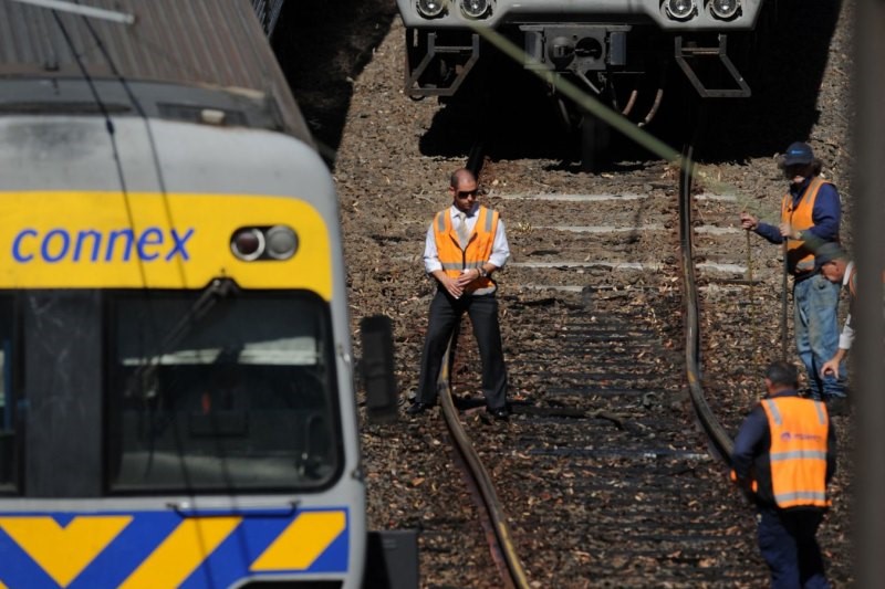
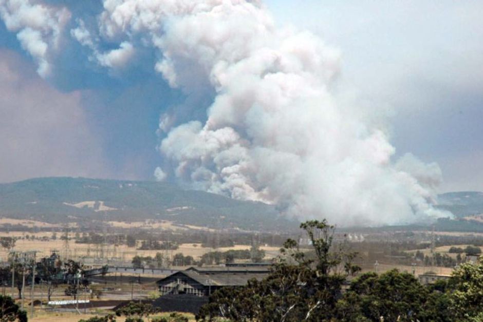
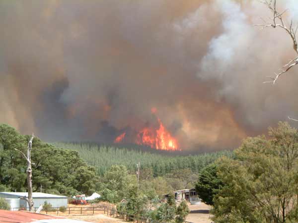
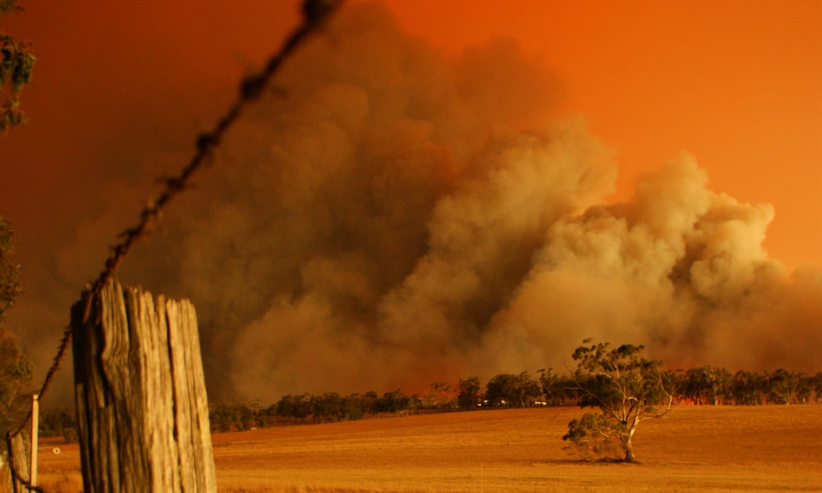
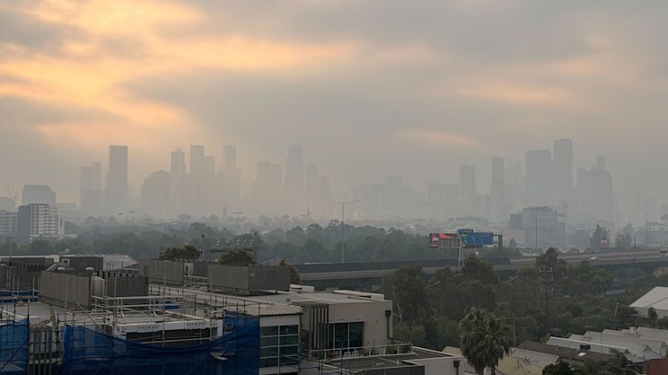
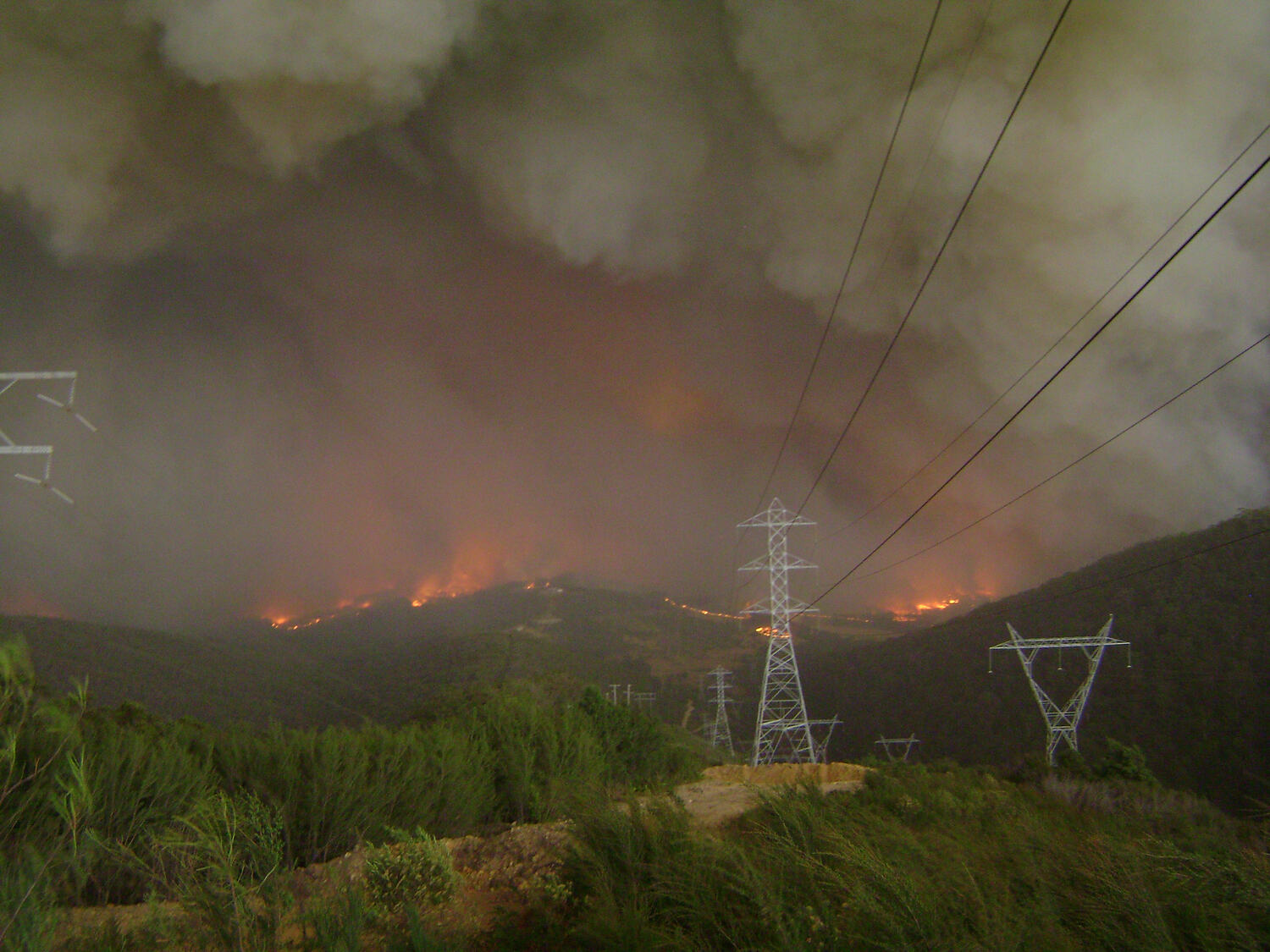
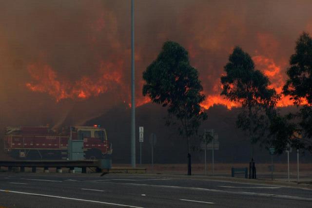
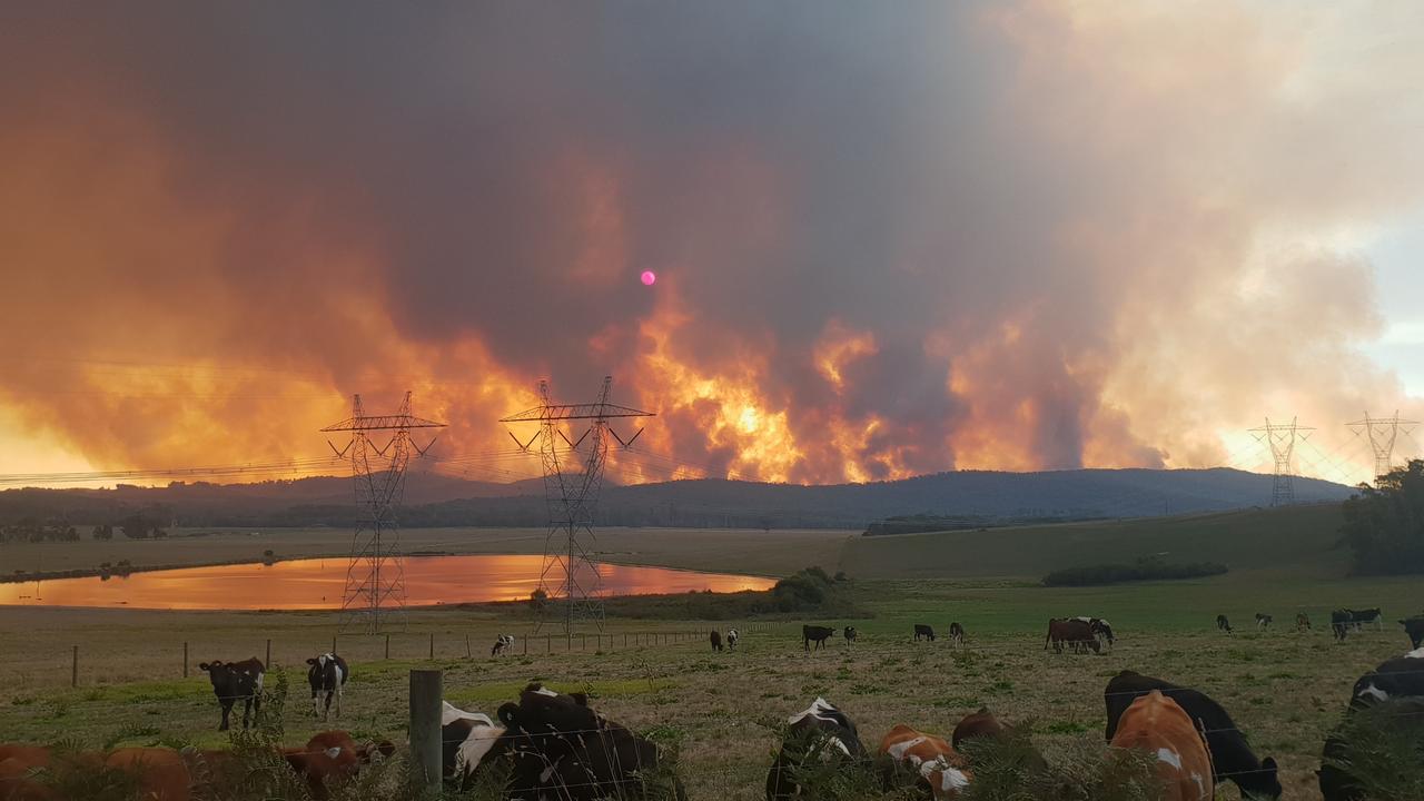
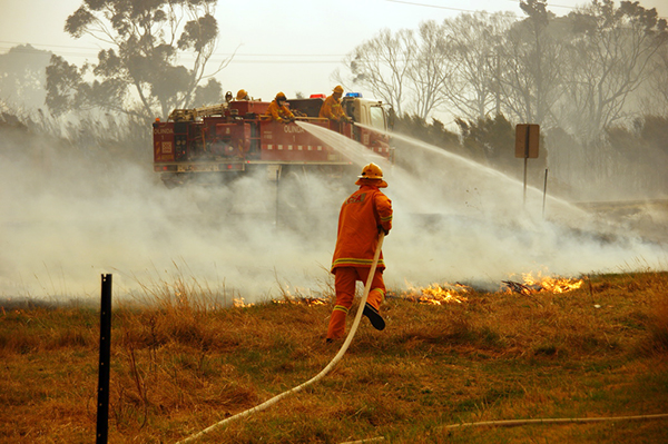
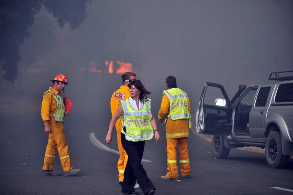
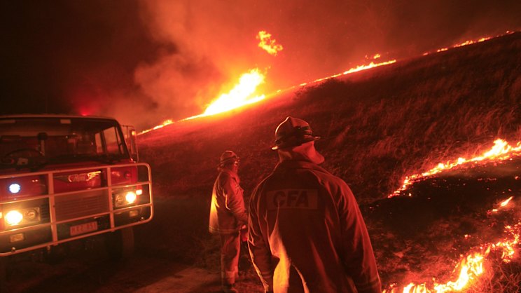
Late January 2009 would see an extreme weather pattern begin to form over the Australian continent. To the east, a slow moving high-pressure system was forming in the Tasman Sea. Over the northwest of the continent, a tropical low was forming and was directing hot, tropical air towards the southeast of Australia. The heat began building over western and northern parts of South Australia on Sunday the 25th of January, but was spreading eastwards and by January 27th would cover a vast area of southeast Australia. On the 25th, Woomera in outback South Australia would record 37.9 °C (100.2 °F), gradually increasing to 39.9 °C (103.8 °F) on the 26th and 43.8 °C (110.8 °F) on the 27th. Over on the west coast, Ceduna would record 44.8 °C (112.6 °F) on the 27th. In Adelaide, the capital of South Australia, the temperature was 36.6 °C (97.9 °F) on the 26th and 43.2 °C (109.8 °F) on the 27th. Other areas around the Riverland region of South Australia, Sunraysia region of Victoria and Riverina region of New South Wales would also record temperatures in the high 30s/low 40s from the 25th through to the 27th. Melbourne would record a high of 36.4 °C (97.5 °F) on the 27th. Heat was also beginning to build over northern and eastern parts of Tasmania.

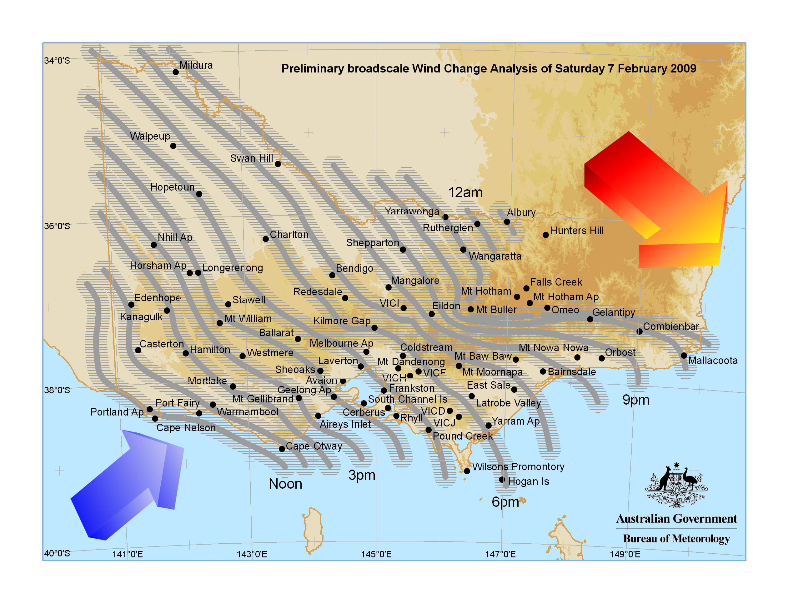
Whilst these temperatures were not unusual for southeast Australia during the summer, the forecast was showing that they would be persisting well into the weekend and for some parts, like South Australia, well into next week. A weak cold front was expected to bring some relief for Melbourne on the weekend, but beyond that was hard to predict. Australia was bracing itself for a heatwave. The slow moving nature of the high pressure system over the Tasman meant that the high temperatures were here to stay.

 
Last edited:

Owen

Commonwealth of Australia
GA Member
Jul 2, 2018
3,692
Date: 27th - 31st of January 2009
Location: Victoria, South Australia, Australian Capital Territory, Southern New South Wales, Northern and Eastern Tasmania


The heatwave would begin to settle in around southeast Australia. Temperatures would soar into the low 40s for most of the region and things would start becoming strained. Electricity demand would soar, putting strain on the grid and leading to rolling blackouts for many places. Train tracks would begin to buckle and bitumen roads would begin to melt. Things were struggling to cope. Over the course of the week, thousands of train and tram services were cancelled in both Melbourne and Adelaide, with more than 1,300 individual train services cancelled in Melbourne alone. The cancellations were due to buckling rail lines, air conditioner failures and power outages. On the 30th, all public transport in the city was free as the government admitted responsibility for failing to provide adequate infrastructure elements to cope with the heat, as well as long-standing issues with underfunding. On the 30th, 730 (40%) of rail services were cancelled, the worst day of rail operation in Melbourne's history.


Rail workers working to repair buckled train tracks


Passengers stranded at Flinders Street station in Melbourne

The State Emergency Service in each respective state would issue out heat advisories, urging elderly people to be looked after and for people to stay inside with air conditioning. Already the ambulance services were beginning to be stretched thin with many people taken to hospital with heat stroke. Ultimately, people would begin to die from the extreme heat, though the exact number was not very clear because determining if someone died of heat stroke or another underlying condition was hard. The temperatures recorded would be as follows:

Ceduna, South Australia:
  • 28th – 47.5 °C (117.5 °F)
  • 29th – 42.3 °C (108.1 °F)
  • 30th – 39.3 °C (102.7 °F)
  • 31st – 42.9 °C (109.2 °F)
Woomera, South Australia:
  • 28th – 44.6 °C (112.3 °F)
  • 29th – 42.3 °C (108.1 °F)
  • 30th – 42.4 °C (108.3 °F)
  • 31st – 41.9 °C (107.4 °F)
Adelaide, South Australia:
  • 28th – 45.7 °C (114.3 °F)
  • 29th – 43.4 °C (110.1 °F)
  • 30th – 43.1 °C (109.6 °F)
  • 31st – 41.1 °C (106.0 °F)
A record-high minimum temperature was recorded at around midnight on the 29th of January, when the temperature dropped to only 33.9 °C (93.0 °F) at the Bureau of Meteorology weather station in Kent Town, near the Adelaide city centre. Temperatures recorded in other parts of the city and other towns throughout South Australia were even higher.

Mildura, Victoria:
  • 28th – 43.7 °C (110.7 °F)
  • 29th – 42.8 °C (109.0 °F)
  • 30th – 43.3 °C (109.9 °F)
  • 31st – 44.1 °C (111.4 °F)
Swan Hill, Victoria:
  • 28th – 43.8 °C (110.8 °F)
  • 29th – 43.4 °C (110.1 °F)
  • 30th – 44.6 °C (112.3 °F)
  • 31st – 44.5 °C (112.1 °F)
Melbourne, Victoria:
  • 28th – 43.4 °C (110.1 °F)
  • 29th – 44.3 °C (111.7 °F)
  • 30th – 45.1 °C (113.2 °F) – third-hottest day ever recorded in Melbourne.
  • 31st – 30.5 °C (86.9 °F)
A weak cold front would make its way through southern parts of Victoria on the evening of the 30th of January, with temperatures dropping in Melbourne by more than 10 degrees. However the heat was still persistent in inland parts of Victoria and the cold front was not enough to completely flush the heat out from southeastern Australia.

Deniliquin, New South Wales:
  • 28th – 43.0 °C (109.4 °F)
  • 29th – 42.7 °C (108.9 °F)
  • 30th – 44.5 °C (112.1 °F)
  • 31st – 44.2 °C (111.6 °F)
Wagga Wagga, New South Wales:
  • 28th – 39.2 °C (102.6 °F)
  • 29th – 40.7 °C (105.3 °F)
  • 30th – 41.2 °C (106.2 °F)
  • 31st – 41.6 °C (106.9 °F)
On the 31st of January, Wagga Wagga broke the all-time January record for the most days above 40.0 °C (104.0 °F) with six days recorded (the record previously being five days, which was set in 1952 and equalled in 1979 and 2001).

Albury-Wodonga, New South Wales-Victoria:
  • 28th – 40.7 °C (105.3 °F)
  • 29th – 41.5 °C (106.7 °F)
  • 30th – 42.9 °C (109.2 °F)
  • 31st – 42.7 °C (108.9 °F)
Canberra, Australian Capital Territory:
  • 28th – 34.8 °C (94.6 °F)
  • 29th – 37.0 °C (98.6 °F)
  • 30th – 37.2 °C (99.0 °F)
  • 31st – 38.2 °C (100.8 °F)
Launceston, Tasmania:
  • 28th – 33.8 °C (92.8 °F)
  • 29th – 36.9 °C (98.4 °F)
  • 30th – 39.0 °C (102.2 °F) – hottest day recorded in Launceston since records began.
  • 31st – 38.2 °C (100.8 °F)
Several Tasmania-wide records would also be broken during this heatwave. Tasmania recorded its highest-ever temperature: 42.2 °C (108 °F) in Scamander on the 30th of January, and the long-standing Tasmanian record of 40.8 °C (105.4 °F) (recorded in Hobart on 4 January 1976) was broken five times within two days at Flinders Island, Fingal (twice), St Helens and Scamander. St Helens would record the second highest-ever Tasmanian temperature at 41.8 °C, also on the 30th of January. 7 of the 8 highest temperatures recorded in Tasmania occurred on the 30th of January.

It is estimated that over 500,000 residents in Melbourne were without power for the evening of the 30th of January. The outage affected much of central Melbourne with train and tram services cancelled, the evacuation of Crown Casino, traffic light failures, people being rescued from lifts and patrons of the Victorian Arts Centre evacuated and shows cancelled. The outage occurred only an hour after the National Electricity Market Operator issued a statement saying load shedding was ending and power had been restored. Blackouts also occurred in the city's west, caused by the three-day heat wave. It is believed an explosion at South Morang contributed to the power problems along three transmission lines supplying Victoria's west and Victorian power supplier SP AusNet shed 1,000 megawatts. On the 30th, Victorian Energy Minister Peter Batchelor announced consumers who lose power for more than 20 hours would be eligible for compensation. Areas that did not experience blackouts still had problems with abnormally low voltage (due to increased air-conditioner usage).

Several outdoor matches during the 2009 Australian Open on the 29th and the 30th were cancelled due to the heat. A number of players, including number 3 seed Novak Djokovic, cited the temperature as reason for withdrawing from matches. Serena Williams was quoted as saying it was so hot on court she felt like she was having an "out-of-body experience". After these retirements and an intensification in the heat, the organisers responded by closing the roof and allowing players longer breaks and icepacks.

Whilst Canberra didn't experience temperatures in the low 40s, the high 30s temperatures were not normal for Canberra, which was located in the higher elevations. The ACT State Emergency Service's Woden Unit would make courtesy calls to all embassies in Canberra to check on the welfare of those working there.

Date: 28th of January 2009
Location: Delburn, Victoria


On Wednesday the 28th and Thursday the 29th of January, there were six deliberately lit blazes south of Morwell near the townships of Yinnar, Mirboo North and Boolarra. While three of these fires were quickly extinguished by the Country Fire Authority, the other three at Ashfords Road, Creamery Road and Lyrebird Walk developed, and ultimately merged to become the Delburn Complex. Victoria Police would quickly apprehend the suspected arsonist. Timber plantations operated by Hancock Victorian Plantations would come under immediate threat. CFA firefighters would be joined by Forest Fire Management Victoria and firefighters from Hancock Victorian Plantations to bring the fire complex under control. A Level 3 Incident Control Centre was set up in the town of Traralgon.


The Delburn fire seen from the town of Churchill

The main fire activity increased during Friday the 30th of January when the temperature reached 42 degrees with low humidity and moderate winds. The Forest Fire Danger Index reached 52 (extreme). The fire area nearly tripled from 2,150 hectares just before dawn, to approximately 5,750 hectares close to midnight. However with the cool change moving through on the evening of the 30th of January, the fire was able to be brought under control. The final fire area was 6,350 hectares with approximately 60% in HVP plantations, and 44 houses were lost. There was no reports of injuries or death.


Approximate extent of the Delburn fire


Satellite image of the Delburn fire on the 30th of January


Forest Fire Management Victoria working to mop up the blaze on the morning of the 31st of January
 
Last edited:

Owen

Commonwealth of Australia
GA Member
Jul 2, 2018
3,692
Date: 1st - 6th of February 2009
Location: Victoria, South Australia, Australian Capital Territory, Southern New South Wales, Northern and Eastern Tasmania


Ceduna, South Australia:
  • 1st – 41.1 °C (106.0 °F)
  • 2nd – 34.1 °C (93.4 °F)
  • 3rd – 32.1 °C (89.8 °F)
  • 4th – 41.5 °C (106.7 °F)
  • 5th – 31.7 °C (89.1 °F)
  • 6th – 46.4 °C (115.5 °F)
Woomera, South Australia:
  • 1st – 41.7 °C (107.1 °F)
  • 2nd – 43.5 °C (110.3 °F)
  • 3rd – 43.7 °C (110.7 °F)
  • 4th – 42.5 °C (108.5 °F)
  • 5th – 42.8 °C (109.0 °F)
  • 6th – 45.6 °C (114.1 °F)
Adelaide, South Australia:
  • 1st – 40.6 °C (105.1 °F)
  • 2nd – 38.8 °C (101.8 °F)
  • 3rd – 36.3 °C (97.3 °F)
  • 4th – 33.0 °C (91.4 °F)
  • 5th – 35.6 °C (96.1 °F)
  • 6th – 43.9 °C (111.0 °F)
Mildura, Victoria:
  • 1st – 42.9 °C (109.2 °F)
  • 2nd – 42.6 °C (108.7 °F)
  • 3rd – 40.1 °C (104.2 °F)
  • 4th – 40.9 °C (105.6 °F)
  • 5th – 41.1 °C (106.0 °F)
  • 6th – 43.1 °C (109.6 °F)
Swan Hill, Victoria:
  • 1st – 43.0 °C (109.4 °F)
  • 2nd – 40.8 °C (105.4 °F)
  • 3rd – 38.3 °C (100.9 °F)
  • 4th – 40.0 °C (104.0 °F)
  • 5th – 42.5 °C (108.5 °F)
  • 6th – 42.6 °C (108.7 °F)
Melbourne, Victoria:
  • 1st – 33.8 °C (92.8 °F)
  • 2nd – 28.5 °C (83.3 °F)
  • 3rd – 30.2 °C (86.4 °F)
  • 4th – 30.2 °C (86.4 °F)
  • 5th – 29.2 °C (84.6 °F)
  • 6th – 33.1 °C (91.6 °F)
Wagga Wagga, New South Wales:
  • 1st – 41.6 °C (106.9 °F)
  • 2nd – 39.0 °C (102.2 °F)
  • 3rd – 39.4 °C (102.9 °F)
  • 4th – 38.1 °C (100.6 °F)
  • 5th – 41.7 °C (107.1 °F)
  • 6th – 42.8 °C (109.0 °F)
Deniliquin, New South Wales:
  • 1st – 43.0 °C (109.4 °F)
  • 2nd – 38.3 °C (100.9 °F)
  • 3rd – 38.2 °C (100.8 °F)
  • 4th – 39.2 °C (102.6 °F)
  • 5th – 42.1 °C (107.8 °F)
  • 6th – 41.5 °C (106.7 °F)
Albury-Wodonga, New South Wales-Victoria:
  • 1st – 43.1 °C (109.6 °F)
  • 2nd – 38.3 °C (100.9 °F)
  • 3rd – 37.7 °C (99.9 °F)
  • 4th – 36.9 °C (98.4 °F)
  • 5th – 41.2 °C (106.2 °F)
  • 6th – 42.2 °C (108.0 °F)
Canberra, Australian Capital Territory:
  • 1st – 31.9 °C (89.4 °F)
  • 2nd – 34.7 °C (94.5 °F)
  • 3rd – 31.0 °C (87.8 °F)
  • 4th – 33.8 °C (92.8 °F)
  • 5th – 37.4 °C (99.3 °F)
  • 6th – 39.6 °C (103.3 °F)
Whilst temperatures remained cooler in Melbourne, temperatures elsewhere in the region remained elevated, particularly in northern Victoria, southern New South Wales and in Adelaide and South Australia. It was estimated that there were over 200 excess deaths as a result of heat stroke from the initial heatwave in Melbourne and then persistent one in Adelaide and other regional areas. On the 6th, Ceduna and Woomera were recording high temperatures in the second half of the 40s, a clear indication of what was to come further east. As temperatures usually move west to east, Adelaide, Melbourne and the rest of Victoria were bracing themselves for a massive increase in temperatures on Saturday the 7th. Melbourne was forecasted to reach 46 degrees celsius, which would break their all time record. A frontal system was forecasted to move through Adelaide on the morning of the 7th, dropping temperatures there before moving across Melbourne later in the day. With the strong northerly winds ahead of the front, this was to bring extreme temperatures across Victoria before dropping behind the front.

High winds and high temperatures was a recipe for disaster though. The Forest Fire Danger Index would measure the intensity of bushfire conditions on a scale of 0 to 100. On February the 7th it was peaking more towards 200, higher than both Black Friday in 1939 and Ash Wednesday in 1983. The Premier of Victoria, Jacinta Allan, would assemble all emergency services leaders and the Emergency Management Commissioner in Victoria to Emergency Management Victoria's State Control Centre with herself. They would make a press conference on the evening of the 6th of February (in media).

More than 19,000 firefighting personnel, mainly from the Country Fire Authority (CFA) and Forest Fire Management Victoria (FFMV), were deployed across the state on Friday evening (6th of February) in anticipation of the extreme conditions the following day. Captains of all CFA brigades across Victoria would be required to be on shift from the early morning of the 7th and to prepare their stations to respond to fires immediately. Aircraft from across the country would be moved to Victoria as part of the National Aerial Firefighting Centre, including a 737 tanker and two C-130 Hercules from New South Wales.


Representatives of Country Fire Authority, Forest Fire Management Victoria, Fire Rescue Victoria, Victoria Police, Victoria State Emergency Service and the State Aircraft Unit would gather at the State Control Centre in Melbourne


The National Situation Room operated by the National Emergency Management Agency would also be stood up in Canberra with relevant federal government Ministers being briefed on the situation in Victoria

Date: 4th - 6th of February 2009
Location: Bunyip State Park, near Gembrook, Victoria


On the 4th of February, 17 fires would commence within the Bunyip State Park, outside of Melbourne near the satellite town of Gembrook. The cause of these fires was determined to be lightning. One of those fires would get out of control, the "Bunyip Ridge Track fire". This fire would burn across the park from a west to east direction. It was entirely contained within the park and would be managed by Forest Fire Management Victoria and Parks Victoria as a regulation fire within a national or state park or forest. By the evening of the 5h of February, all fires within the Bunyip State Park had been declared contained and within containment lines.

Date: 4th - 6th of February 2009
Location: Alpine National Park, near Dargo, Victoria


In a sparsely populated area of the Alpine area of Victoria, a small fire would commence in the Alpine National Park north of Dargo due to lightning. The fire would not move very fast and was burning in rugged isolated terrain. Forest Fire Management Victoria would work on the fire, but no significant resources would be required.


Fire activity on the evening of the 6th of February, showing the Bunyip State Park fire on the left and the Dargo fire in the middle.
 

Owen

Commonwealth of Australia
GA Member
Jul 2, 2018
3,692
Date: 7th of February 2009 (Black Saturday), morning
Location: Victoria


The sun would begin to rise over Victoria and the state would hold its breath. By 9am, the temperature in Melbourne would already reach 35 degrees celsius. 19,000 volunteer firefighters would be on standby across the state. Humidity would drop to near 0%, the air was incredibly dry, the temperatures were hot and by mid-morning hot northwesterly winds would start impacting the state, some in excess of 100 kilometres per hour. The State Control Centre would be abuzz, commanders and incident controllers would gather. The Chief Officer of the CFA would say to his colleagues, "This is not going to be an ordinary day, it's going to be an absolute horrible day. But we've faced days like this before." As the morning progressed, phones would be going off the hook from fire captains and Triple Zero Victoria reporting fires from the front lines. By mid morning many fires had begun to sprung up, some more severe than others. Most however, would not be major and would be extinguished fairly quickly. The CFA Chief Officer almost thought for a minute that through providence, nothing was going to happen. Others however, would keep going...

Bunyip State Park Fire
At 5am, the fire which had been contained within the Bunyip State Park would immediately jump its containment lines, fanned by the fresh winds. The weather conditions deteriorated much more quickly than predicted, with conditions overnight and in the early hours usually being mild. Firefighters reported strong winds and flame heights of five to 10 metres. Ground-based fire crews had to retreat from the fire front as the escalating conditions made firefighting in the bushland terrain impossible. The fire continued to burn out of control through the morning inside the State Park but had not left the park.

Kilmore East Fire

Time: 11:47am

Just before midday, a single-wire earth return mains power cable a Kilmore East was torn down in the strong winds. It would ignite the vegetation below it, near Nannys Creek Road. Winds would be peaking at 125km/h. It took approximately 20 minutes for the Kilmore CFA Brigade to become aware of the fire and to begin responding to it with their heavy tankers. However by this time it was already burning in a neighbouring pine plantation, which provided the perfect amount of fuel for it to grow intensely. It would make its way through to the State Control Centre and the captain of the Kilmore Brigade would keep them updated.


Kilmore East fire burning within the Hancock Victorian Plantations - Midways Plantation

"It's out of control but it's heading towards the Hume at the moment, so we're expecting to hold it there."

The Hume Freeway was the major road link between Melbourne and Sydney. It was 100 metres wide and provided a man-made barrier to stop a bushfire. Victoria Police would rush to the Hume Freeway to stop traffic from continuing on the road. They would block it at Broadford on the northern end and Wallan on the southern end and divert traffic through Kilmore. CFA trucks from Kilmore and from other surrounding CFA brigades would make their way onto the Hume Freeway to put out the fire as it approached. However, within the hour, the fire would jump across the road, with burning bark and embers being pushed across by 125km/h winds. It provided no resistance and there was nothing firefighters could do.

"Jesus Christ, where's the road gone mate?" One of the tanker drivers would mention, with fire burning on both sides of the freeway and smoke covering the entire road. The tanker would drive straight through the firestorm. "Watch it on the right mate. Keep going. Keep going." The firefighter in the passenger seat would mention to the driver.

The Kilmore CFA Captain would radio through to the State Control Centre.

"We couldn't hold it back, it just jumped straight across the Hume. The fire is heading straight for Wandong and Heathcote Junction, we need to get them evacuated ASAP. She's heading straight into the Mount Disappointment State Forest."

The State Control Centre would send out an AusAlert to the towns of Wandong and Heathcote Junction to evacuate immediately and head south.

Horsham Fire
Time: 12:30pm

In Western Victoria, near the city of Horsham, another fire would be ignited from a fallen single-wire earth return. Strong winds initiated the failure of a 40-year-old tie wire, felling a power line at Remlaw, west of the city. It would start on the Petersons' farm and they would immediately call 000. The Horsham CFA brigade would be the first on scene and would immediately request six additional tankers. Immediately it would cross the Wimmera Highway. Police would scramble to get road closures in place, including the Western Highway. This would be quickly upgraded to 20 tankers from across the region. Eventually it would be boosted to 30. They would be joined by Forest Fire Management Victoria who would work on the head of the fire. The State Control Centre would be alerted to the fire and immediately issue an evacuation order for areas south of Horsham including Haven, McKenzie Creek and communities through to Wonwondah.


The fire burning on the outskirts of Horsham through grassland
 

Owen

Commonwealth of Australia
GA Member
Jul 2, 2018
3,692
Date: 7th of February 2009 (Black Saturday), afternoon
Location: Victoria


The Melbourne CBD would record a high temperature fo 46.4 degrees celsius at 3:04pm, breaking its all time record. The city of Melbourne was sweltering, but on the outskirts of the city a more sinister picture was being painted. The amount of fires springing up around metropolitan Melbourne would cause a strong smoke haze to envelop the city. Air quality advisories were issue and people were urged to stay indoors with their windows closed.


Smoke blanketing the city of Melbourne by mid-afternoon.

Kilmore East Fire
The Kilmore East fire would make its way in a southeasterly direction. The front of the fire was narrow though and luckily for the residents of Wandong and Heathcote Junction, it skirted past the towns. It would quickly start burning through the Mount Disappointment State Forest and through the Clobinane area. This would take it through the summit of Mount Disappointment. The fire was burning fast though and flying embers were causing fires to begin well ahead of the front. Aircraft would begin arriving on scene to begin waterbombing operations, this included fixed-wing and rotary-wing aircraft from the State Aircraft Unit. Spot fires would begin springing up in the Whittlesea and Humevale areas around 3pm. A divisional command was set up the Whittlsea CFA Brigade. By this time over 1,000 firefighters would be responding to the fire from CFA, Forest Fire Management Victoria and Fire Rescue Victoria from metropolitan Melbourne. Over 100 appliances and 11 aircraft were working on the fire. The fire would brush past Humevale at 3:30pm and would head straight for the town of Strathewen. There was chaos on the fire ground and Strathewen was unaware they were under direct threat, the speed of the fire was unheard of and there was no time to exact. About 4 minutes after the fire impacted the Humevale area, it would quickly make its way over Mount Sugarloaf and slam into Strathewen like a freight train. Controllers at Whittlesea would attempt to get hold of an update.

"Do we have an update on Strathewen? Anybody on the fire ground?"

A tanker from the Hurstbridge Brigade would respond.

"We're just coming up the road now from Arthurs Creek. Will update you as soon as we get there. Over."


The Kilmore East fire making its way through the Strathewen area

Little did they know, the few houses and buildings, including the primary school in Strathewen were completely alight, the fire front would already have passed through the town but had ignited everything in its trail. The fire front was now making its way through the St Andrews, Steels Creek and Dixons Creek area. By 4pm it was on the outskirts of Healesville and Yarra Glen, sizeable towns on the outskirts of Melbourne. The vegetation would be less dense in this area and CFA brigades from the region would begin to put a hold to the fire front before it could reach Healesville and Yarra Glen. The operational mandate at the time was to save life and property. However, the fire would leave everything between Kilmore and Healesville alight and it would still be burning in other directions from the fire ground.

By 5pm, power had been cut to the towns of Kinglake and Kinglake West. By 5:30pm, the cool change would begin sweeping through the region. A wind change had come in. The 3km fire front would now become a 50km fire front. Kinglake would also come under a heavy ember attack by 5:45pm. At this point the fire had completely cut off the town of Kinglake in all directions. People in the town had no way of escaping. Kinglake could only hold its breath with the wind change now sweeping through.


An aerial firefighting helicopter working to contain the Kilmore East fire

Churchill Fire
At around 1:30pm, a fire would begin in a pine plantation about 1km southeast of the town of Churchill in the Central Gippsland region of Victoria. Within 30 minutes it would begin threatening the towns of Hazelwood South, Jeeralang and Budgeree East. It would start burning through a sparsely populated area of Central Gippsland and would not pose a threat to anymore towns through the afternoon. By the late afternoon, the fire was approaching the Gippsland coastline and the towns of Yarram and Woodside. About 500 evacuees from the area sheltered at an emergency centre established in a theatre in Traralgon. The cool change was expected to pass through the Gippsland area around 6pm, which would change the dynamic of the fire and where it would impact.


The Churchill fire 10 minutes after it started

Murrundindi Mill Fire
The Murrindindi Mill fire would commence at about 2:55pm in the settlement of Murrindindi to the north of a sawmill on Wilhelmina Falls Road. The fire would burn through the Murrindindi River area, which was a nature reserve owned by Parks Victoria. Forest Fire Management Victoria employees would be the first on scene and would work on the first as it burned through the Murrindindi River scenic reserve. It burned across the Black Range and was running nearly parallel to the Kilmore East fire. The Toolangi Forest Fire Management Victoria crew independently responded to the fire at 3pm, with Mike Lauder, a senior ranger for Parks Victoria, as crew leader. Under Mike’s direction, the crew travelled in convoy from the fire’s point of origin to Murrindindi scenic reserve. He knew people were camping there. Not long after arriving, Mike realised that the crew and the 19 campers were cut off to the north by the fire and were trapped. He directed crew and campers into the river, about 150 metres away. The children sheltered in the FFMV vehicles in the river. The crew protected the campers for the next hour-and-a-half. The pumps on the slip-on units were used to spray water on both the vehicles and the surrounding vegetation.

An incident control centre was set up in the town of Alexandra. By 4pm, water bombers would begin drops on the fire as it approached the town of Narbethong. Spot fires were starting ahead of the fire at Granton, St Fillans, Mount Ground and the Maroondah Highway. By 4:30pm the fire was impacting the town of Narbethong. At 5pm, the Victoria State Emergency Service would begin evacuating the town of Marysville. However, the cool change was fast approaching.


CFA trucks responding to the fire as it approached Narbethong

Bendigo Fire
At 4:30pm, a fire would break out on the outskirts of Bendigo in the Maiden Gully area, about 8km northwest of the CBD of Bendigo. It was believed it was started by a discarded cigarette butt that had been discarded by a passing motorist along Bracewell Street in Maiden Gully. The fire would burn on the western suburbs of Bendigo, in an area filled with old gold mines and suburban blocks. The Eaglehawk CFA Brigade would immediately respond to the fire, as would other CFA brigades in the Bendigo area and professional Fire Rescue Victoria crews from the Bendigo Fire Station. At 4:50pm, Victoria Police would begin directing traffic away from the area and evacuating areas of the western suburbs. A relief centre was set up at Kangaroo Flat Senior Citizens Centre. During the fire, residents from Long Gully, Eaglehawk, Maiden Gully, California Gully and West Bendigo were evacuated and advised to assemble at the centre.

At 5:30pm the fire would cross Maiden Gully Road to the south. Spot fires were being extinguished several kilometres south of the fire in the Bendigo West area. Residents of Lilac Street in the suburb of Ironbark, only 1km from the CBD of Bendigo, would be extinguishing spot fires. The fire was now well and truly burning through the city of Bendigo.


The fire approaching houses on the outskirts of Bendigo


Image from a reconnaissance helicopter over the Long Gully area


Residents watching their houses be destroyed in the California Gully area


Bunyip State Park Fire
At 1pm, the fire was begin to break out of the Bunyip State Park, spotting into private property in Tonimbuk. The towns of Garfield North, Tonimbuk, Labertouche, Robin Hood, Drouin West, Buln Buln, Tarago, Jindivick, Jindivick North, Longwarry, Longwarry North, Drouin and Bunyip were experiencing ember attacks from the fire. A decision was made at 1pm to evacuate the towns of Neerim South, Neerim and Neerim Junction. At 1:30pm, V/Line services on the Gippsland line were suspended and the Princes Freeway was closed. Ambulances were called in to evaucate patients from the Neerim Hospital. 11 strike teams were deployed to the Tonimbuk Airport area at 1:25pm. An additional 7 strike teams were later requested.


The Bunyip State Park fire breaking out of the park and burning in the Tonimbuk area

Major spot fires affecting Longwarry North, Robin Hood and Drouin were reported at 2pm, and by 2:30pm waves of spot fires were occurring up to 16 kilometres ahead of the fire front. At 3pm, fire spotting was reported at Warragul (20 kilometres ahead of the fire front), Buln Buln and Nilma. Two of the helicoptes which had been water bombing the fire throughout the day, were redeployed at 4:30 to help deal with the emerging fire threat in Upper Ferntree Gully.


CFA tanker narrowly escaping the fire in the Labertouche area

Horsham Fire
The Horsham Fire would continue to burn on the southwestern edge of the town. Firefighters managed to save the general store, town hall and school at Haven, though flames came within metres of those buildings. Winds of up to 90km/h changed direction three times throughout the day. To the southwest of Horsham an 82-year-old woman in a wheelchair and her daughter were collected from her house by a taxi when the fire was no more than 100 metres away; the house was alight as the taxi drove off, and burned down within minutes. At 2:45pm a Dimboola CFA Brigade forward command vehicle had been involved in a burnover, however the two firefighters inside the vehicle narrowly escaped without injury.

At 3pm more than 400 personnel were engaged in fighting the fire, as well as two water-bombing aircraft, 54 CFA tankers, and 35 FFMV units. The fire then burnt into the back of the Horsham Golf Club and towards Golf Course Road. Once it had entered the golf course, the fairways funnelled it towards the clubhouse, which was destroyed. By 4:30pm the front had moved east, and a wind change then pushed it northeast across the Western Highway to Drung, east of Horsham. By 6pm the fire was stopped east of Horsham.


The remains of the Horsham Golf Club clubhouse

Coleraine Fire
Shortly before 12:30pm a fire started on farmland, 5km northwest of Coleraine in western Victoria. In gusting winds, a corroded tie wire holding a 48-year-old single wire earth return conductor to an insulator failed due to metal fatigue. The galvanised steel conductor swung free in the wind. It is not believed to have touched the ground, but was pushed into a nearby eucalyptus tree by the strong prevailing wind. Burning gumleaves fell to the ground and ignited grass, from which the fire grew extremely rapidly in the hot, dry and windy conditions. Over 230 firefighters, with 43 appliances and two water bombing aircraft, worked to contain the fire which burnt 770 hectares.

The fire threatened to burn through the township, but a wind change around 2pm pushed the fire to the northeast instead. A local man was badly burned while helping a farmer move livestock out of harm's way; the man was caught when the same wind change that saved the town pushed the fire in his direction, and he suffered burns to 50% of his body. At about 6pm the fire was controlled.

The fire destroyed one house, two haysheds, three tractors, the Coleraine Avenue of Honour, and 200km of fences, as well as injuring livestock, but firefighters were able to save six other homes, including that of the parents of former Victorian Premier John Brumby.


CFA firefighters working to contain the Coleraine fire

Weerite Fire
At Weerite, east of Camperdown, a fire started by sparking from felled power lines along the Princes Highway at 1:15pm. Immediately it would damage the rail line between Geelong and Warrnambool. Approximately 3,000 sleepers were burnt across a 4km section of track. V/Line would immediatley suspend services from Geelong to Warrnambool. At 2:50pm the fire would cross the Princes Highway and head towards Pomberneit North. The fire was short lived though and by 4:35pm it had been stopped and by 5:50pm it had been declared contained. The fire caused unquantified losses of stock, and destroyed several outbuildings, but all houses under threat were saved by CFA firefighters.


Firefighters working on the Weerite-Pomberneit fire

Redesdale Fire
In Redesdale, southeast of Bendigo, a fire started 9km west of the town at 3pm. It would immediately cross the Redesdale-Metcalfe Road and by 3:45pm, 40 CFA trucks were responding to the fire. The Heathcote-Kyneton Road was subsequently closed. An incident control centre would be set up in Redesdale and by 5:40pm a reconnaissance aircraft would take off from Bendigo to assess the fire as it burnt towards the Sidonia area. It would not impact any major settlements.
 

Owen

Commonwealth of Australia
GA Member
Jul 2, 2018
3,692
Date: 7th of February 2009 (Black Saturday), evening
Location: Victoria


By 5pm the wind change was beginning to sweep through Melbourne. Earlier it had swept through Western Victoria and caused the fires at Horsham, Coleraine and Weerite to shift direction. Now it was threatening the larger and more ominous fires to the east and north of Melbourne. By 5:15pm the temperature in Melbourne had dropped from 46.4 degrees celsius to 30 degrees celsius in the span of 15 minutes. By 8pm the Victorian Health Emergency Coordination Centre would issue a directive to all Melbourne hospitals to prepare for an influx of bushfire victims, particularly the Northern Hospital in Epping which was closest to the Kilmore East and Murrundindi Mill fires. By 9pm, Victoria Police would be first notified of casualties.


Kilmore East Fire
With the wind change now sweeping through the Kilmore East fire ground, the 60km path that was left behind the narrow 3km fire front had now become a 60km fire front. Kinglake and Kinglake West came under intense ember attack and by 6pm, the sky had become dark and a massive smoke cloud hung over the town. The fire front was now directly impacting on the towns of Kinglake and Kinglake West. Other localities impacted included Steels Creek, Clonbinane and Pheasant Creek. With the fire front now pushing away from the initial impact zone, CFA crews were able to start entering some of the impacted areas, including the town of Strathewen. Arthurs Creek CFA Brigade would be the first to enter at 7pm and would come across a completely destroyed town, with burnt out cars on the roads and worst of all, bodies.


"Arthurs Creek 3.4, we're passing through Strathewen. There's nothing left. There might be casualties needing transport to hospital but I'm not confident anyone is left alive." The crew would radio back to the incident control centre.

By 7:40pm on the northern side of the fire, the town of Flowerdale and Strath Creek would come under direct attack from the fire front now. By 8pm, the localities of Reedy Creek, Castella and Toolangi would also come under direct attack. The cloud from the Kilmore East Fire now towered 15km high and caused its own pyrocumulus cloud. By now multiple towns were being impacted by fire and all roads in and out were blocked, essentially trapping people inside their towns. The only fire brigades defending the towns were the ones located inside the towns. The Kinglake CFA Captain was furiously trying to get people to stay on the main street of the town, as driving away from the town could mean certain death. Communications were cut to the incident control centre. Incident controllers were eager to get into the town of Kinglake and at 10:20pm a strike team was able to make their way into Kinglake, having cut through Kinglake West. They would arrive at the Kinglake CFA Station and would see most of the town had been destroyed. The fire station was still standing and so was the pub. They would radio back to incident control.

"We've reached Kinglake, we have about 150 to 200 people gathered at the fire station, many seriously burnt. Once we get the road to become passable we will need ambulances here ASAP."

The strike team would attempt to take the eight most seriously injured people in their trucks back towards Melbourne and to the Northern Hospital at Epping. By 10pm, Victoria Police would confirm 14 fatalities in the Kilmore East fire: 6 in Kinglake, 4 at Wandong, 3 at Strathewen and 1 at Clonbinane. They would estimate however that the figure could be much higher.

Murrundindi Mill Fire
Almost in unison with the Kilmore East fire, the Murrundindi Mill fire would now begin to shift direction and create a new 60km fire front with the wind change at 5:30pm. By 5pm, power to Marysville had been cut. It would continue sweeping through the town of Narbethong and would make its way towards Marysville, sweeping up Mount Gordon and back down towards the town. The crew of the Yarck CFA Tanker 2 were caught outside of their vehicle working on the fire when the wind changed swept through. Yarck Tanker 1 would quickly pick up the crew of Tanker 2 and take them to safety, Tanker 2 would be completely destroyed by fire. By 6:45pm, the fire front would arrive at Marysville. Most of the town would gather on the Gallipoli Park Oval. With smoke and fire now surrounding the town, Senior Constables Kenneth Dwight, Peter Collyer and Ian Hamill would make the decision to lead a convoy of cars out of Gallipoli Park Oval and head north towards the town of Alexandra.


Residents gathering on Gallipoli Park Oval
At 7pm, the police would lead the convoy of about 60 vehicles out of Gallipoli Park Oval, they would drive north to the town of Alexandra and would set up refuge at the Alexandra Secondary College. As they drove through the towns of Buxton and Taggerty they were able to alert people there as well. Other people would evacuate Marysville as the fire approached, with the Victoria State Emergency Service driving two vehicles around town to warn residents to leave. About 65 people besides from firefighters would choose to remain in Marysville. Senior Constable Ian Thompson would remain and would attend to people using the first aid kit in his car. After a couple of hours he was able to leave the oval to search for survivors and offer assistance.

At 8:30pm, ABC Local Radio would issue an emergency warning:

"The Murrindindi Mill fire in the Mount Despair State Forest is burning in a north easterly direction and is spotting well ahead of the fire. The fire has directly impacted on Narbethong and Marysville. Marysville residents are encouraged to assemble at a muster point at the town oval. The community of Buxton can expect to come under direct attack from this fire. Healesville residents are advised to remain on high alert for the prospect of ember attack."
However, this message was far too late for the community of Buxton on the northern edge of the fire, where the fire front had already moved through at 7:30pm. At this time it would also move through the town of Taggerty about 10km to the north. The convoy leaving Marysville had narrowly escaped the fire front burning to the north of Marysville. The Alexandra CFA Brigade and Forest Fire Management Victoria would fall back from Buxton to Alexandra in order to protect the town.

Bendigo Fire
By 6:30pm the fire was 5.5 kilometres long and had almost reached the Calder Highway, between Happy Valley Road and Dare Street. The head of the fire was only 2 kilometres from Bendigo’s central business district, and there was a spot fire three blocks from the Bendigo police station. The wind change would extend the fire to the northeast and would threaten Eaglehawk again. It made major runs into the back areas of homes along Eaglehawk Road and threatened others along Upper California Gully Road. Spot fires occurred on the eastern side of these roads and north of the Eaglehawk rubbish tip. By 7:22pm, the winds had subsided it was now possible to use air support. A helicopter was directed to provide fire-bombing support on the running edge of the fire, where there were no tankers. Once ground crews arrived, the fire-bomber moved to the western side of the fire to protect some of the more remote dwellings.


Residents working to extinguish the fire with buckets of water in the Eaglehawk area

By 9:52pm, the fire was declared contained. Police searching burnt out homes would discover the body of one man on Daniel Street in Long Gully. Neighbours told police that they tried to rescue the man but were unsuccessful as he was ill and confined to his house and police estimate he died at about 5:30pm. 41 injuries were reported and 58 houses were destroyed along the fringe of Bendigo, covering 341 hectares. A total of 47 tankers responded during the course of the fire.

Churchill Fire
By 6pm the Churchill fire would reach Mount Tassie and the locality of Balook in the Tarra-Bulga National Park. Major spot fires were occurring well ahead of the front near the town of Yarram, including one on its eastern, northern and western flanks. The wind change would turn the fire into a 13km wide fire front. Heavy fuel loads, steep terrain and the extreme weather caused the fire to produce huge pieces of airborne burning debris. The fire was now affecting properties in Koornalla, Callignee North, Hazelwood South, Hazelwood North and Traralgon South. The fire progressively burned through Hazelwood North, Hazelwood South, Koornalla, Traralgon South, Callignee, Callignee South, Callignee North, Jeeralang, Jeeralang North, Devon, Yarram and Carrajung South and on to Won Wron State Forest.


The Churchill fire approaching Callignee

The fire threatened the Loy Yang Power Station, particularly the station's open-cut coal mine. The fire approached the mine's overburden dump, but did not damage any infrastructure, nor did it affect the station's operations. Several small fires broke out in the bunker storing raw coal from the mine, but were contained with no damage.

During the course of the fire three CFA tankers were involved in burnovers. All the burnovers occurred during suppression activities on Glendonald Road shortly after 6pm, when the wind change arrived. By 7pm, the fire had reached Gormandale and by 8pm the progression of the fire significantly slowed moving to the northeast.


Bunyip State Park Fire
When the southwesterly change arrived at 5:45pm, the northeastern flank of the fire became the head of the fire and the fire started running towards Neerim South, threatening the townships of Jindivick, Jindivick West, Rokeby and Crossover. CFA crews protected assets in these areas well into the night. Spot fires were now occurring in Drouin, Warragul, Longwarry, Longwarry North and Labertouche. There was no continuous line of firefront, but numerous tongues had developed out of the spot fires.

At 6:45pm, 90 people were reported trapped at a forest camp in Neerim East, and local police were given the task of managing the situation. The western flank of the fire began to die away after the wind change, although the fire did continue to creep out of Bunyip State Park. 14 Forest Fire Management Victoria light units and 1 tanker were left in Tonimbuk to protect the area, including houses under threat. At 7pm the first urgent threat message was issued for Warragul, the largest settlement in the path of the fire, with a population of over 10,000. Strike teams that had been working in and around Labertouche to protect assets, including the town hall, where people where sheltering, were operating in very difficult conditions. They continued working until 9pm, by which time they had been firefighting for over 10 hours without the opportunity to eat or rest and were exhausted. The fire destroyed approximately a dozen houses at Labertouche, Tonimbuk, and Drouin West, in addition to various outbuildings and a factory.

Beechworth Fire
In the north-east of Victoria, a new fire would begin at 6pm. This time it was 3km south of the town of Beechworth. A tree had fallen on a power line on Buckland Gap Road, pulling the conductor furthest from the road off the supporting insulators. This caused power to be cut to the town of Beechworth. Most of the CFA resources in the area had already been sent south to the Kilmore East and Murrundindi Mill fires. Firefighters from the Beechworth CFA began arriving on scene at 6:15pm and would begin attacking the fire, with not much luck. A strike team from the Rural Fire Service across the border in New South Wales would arrive at 8:40pm. By 9:30pm the fire would develop a large crown and would begin spotting fires to the southeast and would reach the Myrtleford-Yackandandah Road. The fire would burn through the town of Mudgegonga. The fire destroyed an unknown number of buildings at Mudgegonga. The fire would continue burning through the night to the southeast and eventually reach the locality of Havilah by 2:30am before the wind change eventually reach that part of Victoria and pushed the first towards the northeast.


Firefighters working through the night to contain the Beechworth-Mudgegonga fire

Redesdale Fire
By 6:35pm the wind change would begin moving through the Redesdale fire pushing the eastern flank of the fire towards the communities of Redesdale, Mia Mia and Heathcote. This fire was burning through primarily grassland and was not moving as fast as others, only between 6 and 12 kilometres an hour. The firefighters’ efforts to secure the north-eastern flank of the fire during the afternoon proved effective, and the fire did not reach these communities. Once the wind change had passed, weather conditions eased and firefighters were able to attack the fire directly on all flanks. The fire burnt 10,000 hectares and destroyed fourteen houses and more than 50 sheds and outbuildings, as were the Baynton church, a bridge, two olive plantations and a vineyard. Two CFA forward control vehicles were damaged.
 

Forum statistics

Threads
24,348
Messages
118,479
Members
423
Latest member
Szalakota
Top